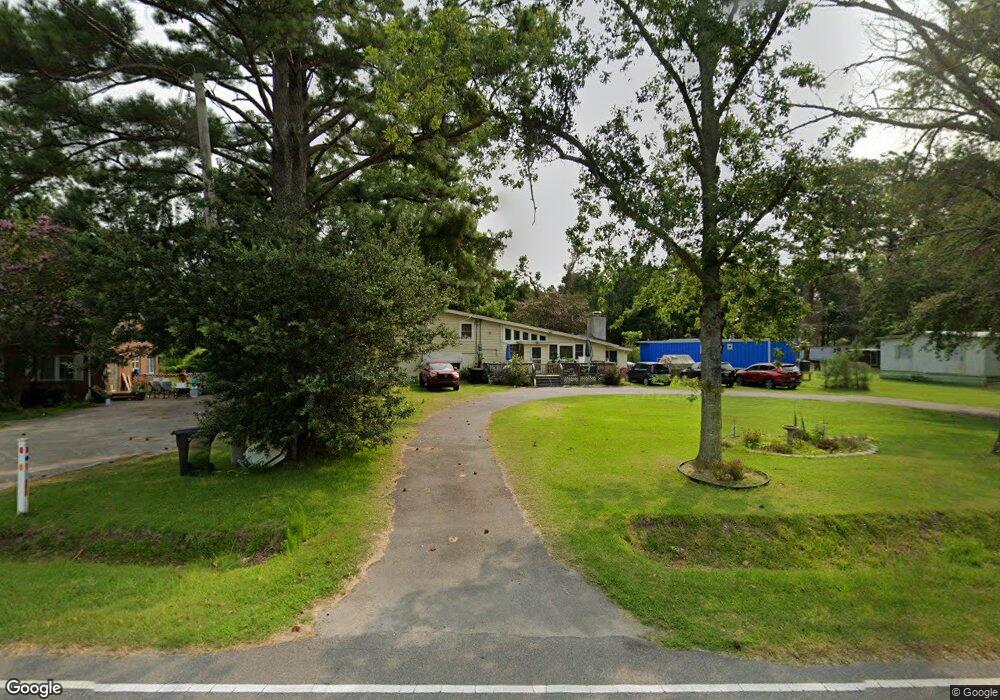
6505 Us Highway 64 Unit 264 Manns Harbor, NC 27953
Manns Harbor NeighborhoodEstimated Value: $344,610 - $520,000
4
Beds
2
Baths
2,352
Sq Ft
$185/Sq Ft
Est. Value
About This Home
This home is located at 6505 Us Highway 64 Unit 264, Manns Harbor, NC 27953 and is currently estimated at $434,153, approximately $184 per square foot. 6505 Us Highway 64 Unit 264 is a home located in Dare County with nearby schools including Manteo Elementary School, Manteo Middle School, and Manteo High School.
Ownership History
Date
Name
Owned For
Owner Type
Purchase Details
Closed on
Apr 20, 2018
Sold by
Price Wayne L and Price Amber M
Bought by
Mccormick Rebecca and Mccormick Jonathan
Current Estimated Value
Home Financials for this Owner
Home Financials are based on the most recent Mortgage that was taken out on this home.
Original Mortgage
$209,407
Outstanding Balance
$180,087
Interest Rate
4.44%
Mortgage Type
VA
Estimated Equity
$254,067
Create a Home Valuation Report for This Property
The Home Valuation Report is an in-depth analysis detailing your home's value as well as a comparison with similar homes in the area
Home Values in the Area
Average Home Value in this Area
Purchase History
| Date | Buyer | Sale Price | Title Company |
|---|---|---|---|
| Mccormick Rebecca | $2,050 | -- |
Source: Public Records
Mortgage History
| Date | Status | Borrower | Loan Amount |
|---|---|---|---|
| Open | Mccormick Rebecca | $209,407 |
Source: Public Records
Tax History Compared to Growth
Tax History
| Year | Tax Paid | Tax Assessment Tax Assessment Total Assessment is a certain percentage of the fair market value that is determined by local assessors to be the total taxable value of land and additions on the property. | Land | Improvement |
|---|---|---|---|---|
| 2024 | $1,310 | $230,500 | $50,700 | $179,800 |
| 2023 | $1,310 | $230,500 | $50,700 | $179,800 |
| 2022 | $1,287 | $230,500 | $50,700 | $179,800 |
| 2021 | $1,264 | $230,500 | $50,700 | $179,800 |
| 2020 | $1,261 | $230,500 | $50,700 | $179,800 |
| 2019 | $667 | $103,700 | $37,000 | $66,700 |
| 2018 | $667 | $103,700 | $37,000 | $66,700 |
| 2017 | $667 | $103,700 | $37,000 | $66,700 |
| 2016 | $626 | $103,700 | $37,000 | $66,700 |
| 2014 | $626 | $103,700 | $37,000 | $66,700 |
Source: Public Records
Map
Nearby Homes
- 5689 Old Ferry Dock Rd
- 0 Docks Unit slip R14 130572
- 0 Docks Unit Lot 15 125645
- 141 Tuscarora Ct
- 141 Tuscarora Ct Unit Lot 25
- 140 Fort Hugar Way Unit Lot 102
- 121 Fort Hugar Way Unit Lot 42
- 158 Fort Hugar Way Unit Lot 87
- 111 Fort Hugar Way Unit 37
- 148 Sunnyside Dr Unit Lot 2
- 128 Daphne Ln Unit Lot 17
- 274 Airport Rd Unit lot 50
- 118 Bradford Ln Unit 34
- 165 Shady Pines Ln Unit Lot 12
- 1095 Burnside Rd Unit Lot B3
- 0 Holly Ridge Rd Unit Lot Parcel B 128689
- 106 Fearing Place Unit Lot 2
- 1285 Burnside Rd Unit Lot 1
- 1285 Burnside Rd Unit Lot 2
- 1285 Burnside Rd Unit Lot 3
- 6505 Us Highway 64
- 6505 Hwy 64/264
- 6579 Hwy 64/264
- 6579 Us Highway 64 Unit 264
- 6529 Coastal Ln
- 6529 Coastal Ln
- 6441 Us Highway 64 Unit 264
- 6478 Azalea Ln
- 6595 Us Highway 64 Unit 264
- 6450 Us Highway 64 Unit 264
- 6434 Hooper Ln
- 6413 Us Highway 64 Unit s - 3
- 6413 Us Highway 64 Unit 264
- 6025 Richard Dr
- 6548 Us Highway 64 Unit 264
- 6393 U S 64
- 6393 Us Highway 64 Unit 5
- 6393 Us Highway 64 Unit 1
- 6442 Azalea Ln
- 6440 Azalea Ln
