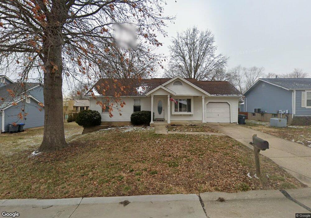
6507 Star Buck Dr O Fallon, MO 63368
Estimated Value: $263,000 - $282,000
3
Beds
1
Bath
970
Sq Ft
$281/Sq Ft
Est. Value
About This Home
This home is located at 6507 Star Buck Dr, O Fallon, MO 63368 and is currently estimated at $272,348, approximately $280 per square foot. 6507 Star Buck Dr is a home located in St. Charles County with nearby schools including Pheasant Point Elementary School, Fort Zumwalt South Middle School, and Fort Zumwalt South High School.
Ownership History
Date
Name
Owned For
Owner Type
Purchase Details
Closed on
Jun 14, 2024
Sold by
Halbruegge Melissa A
Bought by
Halbruegge Zachary D
Current Estimated Value
Home Financials for this Owner
Home Financials are based on the most recent Mortgage that was taken out on this home.
Original Mortgage
$175,000
Outstanding Balance
$172,797
Interest Rate
7.09%
Mortgage Type
New Conventional
Estimated Equity
$99,551
Purchase Details
Closed on
Feb 2, 2013
Sold by
Geno Lisa A
Bought by
Halbruegge Zachary D and Halbruegge Melissa A
Purchase Details
Closed on
Aug 20, 2012
Sold by
Geno Lisa Ann and Geno Edward G
Bought by
Geno Lisa A and Hagan Lisa A
Purchase Details
Closed on
Jan 21, 2005
Sold by
Geno Edward G
Bought by
Geno Edward G
Create a Home Valuation Report for This Property
The Home Valuation Report is an in-depth analysis detailing your home's value as well as a comparison with similar homes in the area
Home Values in the Area
Average Home Value in this Area
Purchase History
We collect this data history from publicly available records. To have your information removed, we recommend requesting removal directly through your county’s website.
| Date | Buyer | Sale Price | Title Company |
|---|---|---|---|
| Halbruegge Zachary D | -- | None Listed On Document | |
| Halbruegge Zachary D | -- | None Available | |
| Geno Lisa A | -- | None Available | |
| Geno Edward G | -- | -- |
Source: Public Records
Mortgage History
We collect this data history from publicly available records. To have your information removed, we recommend requesting removal directly through your county’s website.
| Date | Status | Borrower | Loan Amount |
|---|---|---|---|
| Open | Halbruegge Zachary D | $175,000 |
Source: Public Records
Tax History
| Year | Tax Paid | Tax Assessment Tax Assessment Total Assessment is a certain percentage of the fair market value that is determined by local assessors to be the total taxable value of land and additions on the property. | Land | Improvement |
|---|---|---|---|---|
| 2025 | $2,636 | $42,701 | -- | -- |
| 2023 | $2,638 | $39,822 | $0 | $0 |
| 2022 | $2,243 | $31,509 | $0 | $0 |
| 2021 | $2,249 | $31,509 | $0 | $0 |
| 2020 | $2,054 | $27,711 | $0 | $0 |
| 2019 | $2,059 | $27,711 | $0 | $0 |
| 2018 | $2,039 | $26,252 | $0 | $0 |
| 2017 | $2,000 | $26,252 | $0 | $0 |
| 2016 | $1,735 | $21,863 | $0 | $0 |
| 2015 | $1,617 | $21,863 | $0 | $0 |
| 2014 | $1,727 | $23,045 | $0 | $0 |
Source: Public Records
Map
Nearby Homes
- 6519 Star Buck Dr
- 6512 Sprucefield Dr
- 815 Brimley Dr
- 703 Tinsley Ct
- 711 Tinsley Ct
- 78 Lower Dardenne Farms Dr
- 1343 Avondale Spring Dr
- 37 Jacqueline Cir
- 79 Harrisburg Ct
- 6 Tailor Square
- 1001 Summersweet Dr
- 213 Dardenne Farms Dr
- 71 Harrisburg Ct
- 531 John Pitman Dr
- 2849 Royallvalley Way
- 2753 Red Cedar Parc Dr S
- 2218 Quaint Cottage Dr
- 148 Jacobs Way
- 204 Jacobs Way
- 112 Auburn Trace Pointe Ct
- 6523 Star Buck Dr
- 6515 Star Buck Dr
- 6508 Sprucefield Dr
- 1014 Golden Orchard Dr
- 1016 Golden Orchard Dr
- 6511 Star Buck Dr
- 6517 Sprucefield Dr
- 1012 Golden Orchard Dr
- 6522 Star Buck Dr
- 1018 Golden Orchard Dr
- 6518 Star Buck Dr
- 6514 Star Buck Dr
- 6504 Sprucefield Dr
- 1010 Golden Orchard Dr
- 1020 Golden Orchard Dr
- 6510 Star Buck Dr
- 1008 Golden Orchard Dr
- 6509 Sprucefield Dr
- 1022 Golden Orchard Dr
- 6517 Long Timber Dr
Your Personal Tour Guide
Ask me questions while you tour the home.