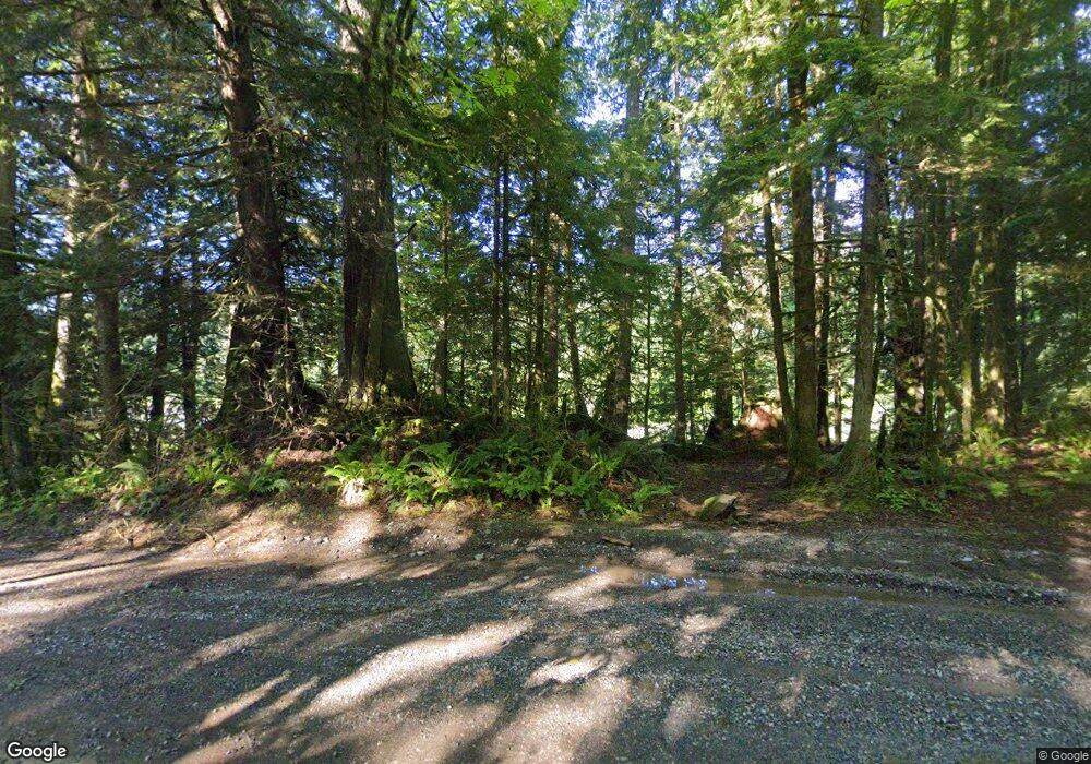
6509 N Fork Rd Deming, WA 98244
Estimated Value: $381,000 - $615,000
2
Beds
1
Bath
1,256
Sq Ft
$395/Sq Ft
Est. Value
About This Home
This home is located at 6509 N Fork Rd, Deming, WA 98244 and is currently estimated at $495,805, approximately $394 per square foot. 6509 N Fork Rd is a home located in Whatcom County with nearby schools including Mount Baker Senior High School.
Ownership History
Date
Name
Owned For
Owner Type
Purchase Details
Closed on
Jan 31, 2014
Sold by
Rodriguez Juan
Bought by
Sekulich Bradley J and Sekulich Michelle L
Current Estimated Value
Purchase Details
Closed on
Jul 14, 2003
Sold by
Bradley Carolyn D
Bought by
Bradley Victor
Home Financials for this Owner
Home Financials are based on the most recent Mortgage that was taken out on this home.
Original Mortgage
$135,000
Interest Rate
5.15%
Mortgage Type
New Conventional
Create a Home Valuation Report for This Property
The Home Valuation Report is an in-depth analysis detailing your home's value as well as a comparison with similar homes in the area
Home Values in the Area
Average Home Value in this Area
Purchase History
| Date | Buyer | Sale Price | Title Company |
|---|---|---|---|
| Sekulich Bradley J | -- | None Available | |
| Bradley Victor | -- | Chicago Title Insurance |
Source: Public Records
Mortgage History
| Date | Status | Borrower | Loan Amount |
|---|---|---|---|
| Previous Owner | Bradley Victor | $135,000 |
Source: Public Records
Tax History Compared to Growth
Tax History
| Year | Tax Paid | Tax Assessment Tax Assessment Total Assessment is a certain percentage of the fair market value that is determined by local assessors to be the total taxable value of land and additions on the property. | Land | Improvement |
|---|---|---|---|---|
| 2024 | $2,588 | $378,450 | $267,290 | $111,160 |
| 2023 | $2,588 | $348,969 | $258,064 | $90,905 |
| 2022 | $2,119 | $286,033 | $211,523 | $74,510 |
| 2021 | $2,003 | $230,669 | $170,581 | $60,088 |
| 2020 | $1,844 | $195,482 | $144,560 | $50,922 |
| 2019 | $1,650 | $172,234 | $127,368 | $44,866 |
| 2018 | $2,044 | $166,057 | $122,800 | $43,257 |
| 2017 | $1,848 | $161,908 | $119,808 | $42,100 |
| 2016 | $1,778 | $156,286 | $115,648 | $40,638 |
| 2015 | $1,667 | $149,259 | $110,448 | $38,811 |
| 2014 | -- | $140,545 | $104,000 | $36,545 |
| 2013 | -- | $140,545 | $104,000 | $36,545 |
Source: Public Records
Map
Nearby Homes
- 6373 Eastwood Rd
- 6483 Mt Baker Hwy
- 118 5 Big River Blvd W
- 134 5 W Big River Blvd
- 11 5 Big River Blvd SW
- 169 1 Fireside Lodge Cir
- 5888 Mount Baker Hwy
- 190 1 Fireside Lodge Cir
- 6479 Little Big Horn Rd
- 187 Fireside Lodge Cir
- 116-6 Riverside Dr
- 27 Riverside Dr
- 82 Riverside Dr
- 175 6 Chanterelle Dr
- 189 6 Chanterelle Dr
- 201 Chanterelle Dr
- 205 6 Chanterelle Dr
- 147 6 Chanterelle Dr
- 42 6 Riverside Dr
- 164 6 Chanterelle Dr
- 6513 N Fork Rd
- 6501 N Fork Rd
- 6511 N Fork Rd
- 6517 N Fork Rd
- 6281 Mt Baker Hwy
- 7067 Hatchery Rd
- 6269 Mt Baker Hwy
- 7051 Hatchery Rd
- 6267 Mt Baker Hwy
- 7059 Hatchery Rd
- 6195 Mt Baker Hwy
- 6200 Mt Baker Hwy
- 6289 Mt Baker Hwy
- 6235 Mt Baker Hwy
- 6225 Mt Baker Hwy
- 6272 Mt Baker Hwy
- 6288 Mt Baker Hwy
- 6226 Mt Baker Hwy
- 6222 Mt Baker Hwy
- 6800 Mount Baker Hwy
