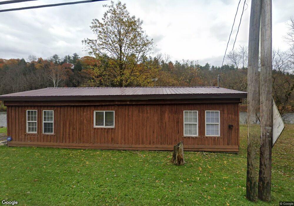
6509 State Route 79 Chenango Forks, NY 13746
Estimated Value: $65,000 - $125,000
1
Bed
1
Bath
1,226
Sq Ft
$83/Sq Ft
Est. Value
About This Home
This home is located at 6509 State Route 79, Chenango Forks, NY 13746 and is currently estimated at $101,361, approximately $82 per square foot. 6509 State Route 79 is a home located in Broome County with nearby schools including Chenango Forks Elementary School, Chenango Forks Middle School, and Chenango Forks High School.
Ownership History
Date
Name
Owned For
Owner Type
Purchase Details
Closed on
Mar 19, 2012
Sold by
Knowle Edward and Knowles Edward
Bought by
Meyers Frank and Meyers Constance R
Current Estimated Value
Purchase Details
Closed on
Jun 23, 2003
Sold by
Cynthia Quinn
Bought by
Hendrickson Beverly A
Purchase Details
Closed on
Jun 9, 2003
Sold by
Hendrickson Vernetta V
Bought by
Hendrickson Beverly A
Create a Home Valuation Report for This Property
The Home Valuation Report is an in-depth analysis detailing your home's value as well as a comparison with similar homes in the area
Home Values in the Area
Average Home Value in this Area
Purchase History
| Date | Buyer | Sale Price | Title Company |
|---|---|---|---|
| Meyers Frank | $2,500 | None Available | |
| Hendrickson Beverly A | -- | Edward Rantanen | |
| Hendrickson Beverly A | $12,000 | Edward A Rantanen |
Source: Public Records
Tax History Compared to Growth
Tax History
| Year | Tax Paid | Tax Assessment Tax Assessment Total Assessment is a certain percentage of the fair market value that is determined by local assessors to be the total taxable value of land and additions on the property. | Land | Improvement |
|---|---|---|---|---|
| 2024 | $1,475 | $43,000 | $17,630 | $25,370 |
| 2023 | $1,483 | $43,000 | $17,630 | $25,370 |
| 2022 | $1,446 | $43,000 | $17,630 | $25,370 |
| 2021 | $1,391 | $43,000 | $17,630 | $25,370 |
| 2020 | $1,410 | $43,000 | $17,630 | $25,370 |
| 2019 | -- | $40,000 | $17,630 | $22,370 |
| 2018 | $1,514 | $45,000 | $17,630 | $27,370 |
| 2017 | $1,501 | $45,000 | $17,630 | $27,370 |
| 2016 | $1,505 | $45,000 | $17,630 | $27,370 |
| 2015 | -- | $45,000 | $12,000 | $33,000 |
| 2014 | -- | $45,000 | $12,000 | $33,000 |
Source: Public Records
Map
Nearby Homes
- 15 River Ln
- 6633 State Route 79
- 13 Parsons Rd
- 6667 State Route 79
- 68 Marshman Rd
- 120 Steed Rd
- 226 Knapp Hill Rd
- 309 Parsons Rd
- 198 Conklin Hill Rd
- 248 County Road 1
- 4 Beartown Rd
- 446 Conklin Hill Rd
- 434 Cloverdale Rd
- 13 Warner Rd
- 159 Beartown Rd
- 1979 State Route 12
- 87 Pamela Dr
- 101 Palmer Hill Rd
- 197 Port Rd
- 115 Iona Ln
- 6510 State Route 79
- 6502 State Route 79
- 6500 State Route 79
- 6496 State Route 79
- 6492 State Route 79
- 6488 State Route 79
- 433 Pigeon Hill Rd
- 2645 State Route 12 Unit NYS
- 6478 State Route 79
- 6476 State Route 79
- 6468 State Route 79
- 465 Pigeon Hill Rd
- 2625 State Highway 12
- 1 River Ln
- 5 River Ln
- 9 River Ln
- 13 River Ln
- 16 River Ln
- 19 River Ln
- 2735 State Highway 12