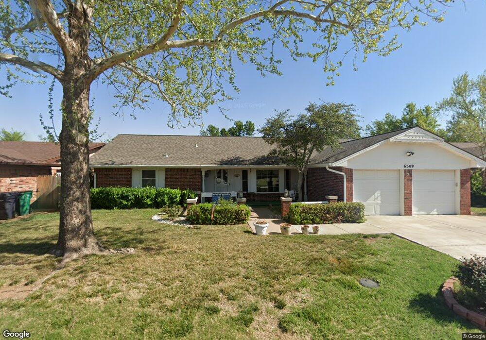
6509 Westrock Dr Oklahoma City, OK 73132
Rock Knoll-Lansbrook NeighborhoodEstimated Value: $212,000 - $230,000
4
Beds
2
Baths
1,978
Sq Ft
$112/Sq Ft
Est. Value
About This Home
This home is located at 6509 Westrock Dr, Oklahoma City, OK 73132 and is currently estimated at $220,914, approximately $111 per square foot. 6509 Westrock Dr is a home located in Oklahoma County with nearby schools including Wiley Post Elementary School, Hefner Middle School, and Putnam City North High School.
Ownership History
Date
Name
Owned For
Owner Type
Purchase Details
Closed on
Oct 2, 2019
Sold by
Millager Richard D and Millager Janine E
Bought by
Millager Richard D and Millager Janine E
Current Estimated Value
Purchase Details
Closed on
Jan 17, 2015
Sold by
Millager Janine E and Millager Richard
Bought by
Millager Richard and Millager Janine E
Purchase Details
Closed on
Sep 13, 1999
Sold by
Speicher Clark Franklin and Speicher Merry
Bought by
Millager Janine E and Millager Niki J
Create a Home Valuation Report for This Property
The Home Valuation Report is an in-depth analysis detailing your home's value as well as a comparison with similar homes in the area
Home Values in the Area
Average Home Value in this Area
Purchase History
| Date | Buyer | Sale Price | Title Company |
|---|---|---|---|
| Millager Richard D | -- | None Available | |
| Millager Richard | -- | Oklahoma Land Title Service | |
| Millager Janine E | $87,500 | -- |
Source: Public Records
Tax History Compared to Growth
Tax History
| Year | Tax Paid | Tax Assessment Tax Assessment Total Assessment is a certain percentage of the fair market value that is determined by local assessors to be the total taxable value of land and additions on the property. | Land | Improvement |
|---|---|---|---|---|
| 2024 | $1,768 | $15,970 | $2,730 | $13,240 |
| 2023 | $1,768 | $15,505 | $2,851 | $12,654 |
| 2022 | $1,734 | $15,053 | $2,712 | $12,341 |
| 2021 | $1,664 | $14,615 | $2,950 | $11,665 |
| 2020 | $1,605 | $14,190 | $3,042 | $11,148 |
| 2019 | $1,571 | $14,105 | $2,978 | $11,127 |
| 2018 | $1,524 | $13,695 | $0 | $0 |
| 2017 | $1,505 | $13,513 | $2,451 | $11,062 |
| 2016 | $1,455 | $13,119 | $2,438 | $10,681 |
| 2015 | $1,425 | $12,737 | $2,474 | $10,263 |
| 2014 | $1,382 | $12,824 | $3,041 | $9,783 |
Source: Public Records
Map
Nearby Homes
- 9220 Sutton Place
- 6405 Urschel Ct
- 6404 Brentford Terrace
- 6401 Urschel Ct
- 8816 Rolling Green Ave
- 6317 Overcourt Manor
- 6636 Whitehall Dr
- 9209 Knightsbridge Rd
- 6701 W Britton Rd
- 6309 Overcourt Manor
- 8713 Rolling Green Ave
- 6312 Connaught Ct
- 6416 W Kensington Rd
- 8800 Stoneleigh Ct
- 9304 Broughton Ct
- 8808 N Rockwell Dr
- 8500 Candlewood Dr
- 6112 Shaftsbury Rd
- 8806 N Rockwell Dr
- 8517 Brookridge Dr
- 6513 Westrock Dr
- 6505 Westrock Dr
- 6508 Eastbourne Ln
- 6508 Westrock Dr
- 6517 Westrock Dr
- 6501 Westrock Dr
- 6517 Westrock Dr
- 6512 Westrock Dr
- 6512 Eastbourne Ln
- 6504 Eastbourne Ln
- 6504 Westrock Dr
- 6516 Eastbourne Ln
- 6516 Westrock Dr
- 6500 Eastbourne Ln
- 6500 Westrock Dr
- 6521 Westrock Dr
- 6520 Eastbourne Ln
- 9005 Candlewood Dr
- 6520 Westrock Dr
- 6509 Eastbourne Ln