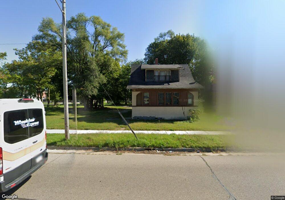
651 Broadway Benton Harbor, MI 49022
Estimated Value: $51,000 - $104,000
3
Beds
1
Bath
690
Sq Ft
$104/Sq Ft
Est. Value
About This Home
This home is located at 651 Broadway, Benton Harbor, MI 49022 and is currently estimated at $71,939, approximately $104 per square foot. 651 Broadway is a home located in Berrien County with nearby schools including Fair Plain Middle School, Benton Harbor High School, and Benton Harbor Charter School Academy.
Ownership History
Date
Name
Owned For
Owner Type
Purchase Details
Closed on
Jun 17, 2024
Sold by
Antonio Kellie
Bought by
Berrien County Treasurer
Current Estimated Value
Purchase Details
Closed on
Jun 13, 2023
Sold by
Antonio Kellie
Bought by
Berrien County Treasurer
Purchase Details
Closed on
Apr 26, 2019
Sold by
Towns Kwame
Bought by
Kellie Antonio
Purchase Details
Closed on
Jul 17, 2007
Sold by
Witkowski Bret
Bought by
Towns Kwame
Purchase Details
Closed on
May 20, 1997
Purchase Details
Closed on
Jan 24, 1994
Purchase Details
Closed on
Dec 28, 1990
Purchase Details
Closed on
Apr 26, 1990
Purchase Details
Closed on
Nov 15, 1977
Create a Home Valuation Report for This Property
The Home Valuation Report is an in-depth analysis detailing your home's value as well as a comparison with similar homes in the area
Home Values in the Area
Average Home Value in this Area
Purchase History
| Date | Buyer | Sale Price | Title Company |
|---|---|---|---|
| Berrien County Treasurer | -- | -- | |
| Berrien County Treasurer | -- | -- | |
| Kellie Antonio | $10,000 | None Available | |
| Towns Kwame | $4,000 | None Available | |
| -- | $23,000 | -- | |
| -- | $6,200 | -- | |
| -- | $23,000 | -- | |
| -- | $6,200 | -- | |
| -- | $5,500 | -- | |
| -- | $3,000 | -- |
Source: Public Records
Tax History Compared to Growth
Tax History
| Year | Tax Paid | Tax Assessment Tax Assessment Total Assessment is a certain percentage of the fair market value that is determined by local assessors to be the total taxable value of land and additions on the property. | Land | Improvement |
|---|---|---|---|---|
| 2025 | $1,251 | $23,800 | $0 | $0 |
| 2024 | $685 | $20,600 | $0 | $0 |
| 2023 | $548 | $14,300 | $0 | $0 |
| 2022 | $622 | $10,300 | $0 | $0 |
| 2021 | $689 | $10,100 | $500 | $9,600 |
| 2020 | $748 | $11,900 | $0 | $0 |
| 2019 | $1,203 | $10,300 | $0 | $0 |
| 2018 | $688 | $11,400 | $0 | $0 |
| 2017 | $674 | $10,900 | $0 | $0 |
| 2016 | $1,126 | $11,000 | $0 | $0 |
| 2015 | $917 | $10,600 | $0 | $0 |
| 2014 | $719 | $12,900 | $0 | $0 |
Source: Public Records
Map
Nearby Homes
- 614 Pavone St
- 161 Kline Ave
- 1045 Broadway
- 730 Superior St
- 833 Pearl St
- 416 E Britain Ave
- 694 Colfax Ave
- 131 Clay St
- 576 Colfax Ave
- 349 E Empire Ave
- 872 Mcalister Ave
- 378 Pipestone St
- 171 E Empire Ave
- 391 Pipestone St
- 460 Colfax Ave
- 972 Pearl St
- 941 Colfax Ave
- 979 Lavette Ave
- 960 Jennings Ave
- 309 High St