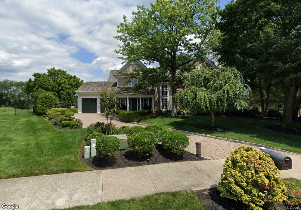
651 Centerton Rd Moorestown, NJ 08057
Estimated Value: $1,691,037 - $2,561,000
--
Bed
--
Bath
7,546
Sq Ft
$258/Sq Ft
Est. Value
About This Home
This home is located at 651 Centerton Rd, Moorestown, NJ 08057 and is currently estimated at $1,949,509, approximately $258 per square foot. 651 Centerton Rd is a home located in Burlington County with nearby schools including South Valley Elementary School, Moorestown Upper Elementary School, and William Allen Middle School.
Ownership History
Date
Name
Owned For
Owner Type
Purchase Details
Closed on
Dec 19, 2013
Sold by
Laurel Creek Lp
Bought by
The New Laurel Creek Country Club Inc
Current Estimated Value
Purchase Details
Closed on
Mar 11, 2003
Sold by
Laurel Homes Llc
Bought by
Nachmias Mark D and Nachmias Carolyn S
Home Financials for this Owner
Home Financials are based on the most recent Mortgage that was taken out on this home.
Original Mortgage
$700,000
Interest Rate
5.3%
Mortgage Type
Purchase Money Mortgage
Purchase Details
Closed on
Oct 31, 2002
Sold by
Parkinson Thomas H
Bought by
Laurel Homes Llc
Purchase Details
Closed on
Jan 4, 2002
Sold by
Laurel Creek Lp
Bought by
Parkinson Thomas H
Create a Home Valuation Report for This Property
The Home Valuation Report is an in-depth analysis detailing your home's value as well as a comparison with similar homes in the area
Home Values in the Area
Average Home Value in this Area
Purchase History
| Date | Buyer | Sale Price | Title Company |
|---|---|---|---|
| The New Laurel Creek Country Club Inc | $1,803,585 | Chicago Title Company | |
| Nachmias Mark D | $1,645,000 | Congress Title Corp | |
| Laurel Homes Llc | -- | -- | |
| Parkinson Thomas H | $300,000 | -- |
Source: Public Records
Mortgage History
| Date | Status | Borrower | Loan Amount |
|---|---|---|---|
| Previous Owner | Nachmias Mark D | $700,000 |
Source: Public Records
Tax History Compared to Growth
Tax History
| Year | Tax Paid | Tax Assessment Tax Assessment Total Assessment is a certain percentage of the fair market value that is determined by local assessors to be the total taxable value of land and additions on the property. | Land | Improvement |
|---|---|---|---|---|
| 2025 | $30,753 | $1,084,000 | $387,400 | $696,600 |
| 2024 | $29,821 | $1,084,000 | $387,400 | $696,600 |
| 2023 | $29,821 | $1,084,000 | $387,400 | $696,600 |
| 2022 | $29,517 | $1,084,000 | $387,400 | $696,600 |
| 2021 | $29,127 | $1,084,000 | $387,400 | $696,600 |
| 2020 | $28,943 | $1,084,000 | $387,400 | $696,600 |
| 2019 | $28,433 | $1,084,000 | $387,400 | $696,600 |
| 2018 | $27,664 | $1,084,000 | $387,400 | $696,600 |
| 2017 | $27,902 | $1,084,000 | $387,400 | $696,600 |
| 2016 | $27,805 | $1,084,000 | $387,400 | $696,600 |
| 2015 | $27,469 | $1,084,000 | $387,400 | $696,600 |
| 2014 | $26,081 | $1,084,000 | $387,400 | $696,600 |
Source: Public Records
Map
Nearby Homes
- 14 Baltusrol Terrace
- 29 Starboard Way
- 127 Oakmont Dr
- 40 Palmer Dr Unit 110
- 482 Monte Farm Rd
- 6 Buoy Dr
- 6 Lilac Cir
- 5 Birch Dr
- 163 Memorial Ln
- 861 Centerton Rd
- 64 Stratford Ln
- 9 Sister's Farmstead Rd
- 10 Crows Nest Ct
- 512 Garden Way
- 35 Stratford Ln
- 42 Landing Ct
- 8006 Normandy Dr Unit 8006
- 12 Cove Rd
- 3807A Chadbury Rd Unit 3807
- 6206B Normandy Dr
- 255 Country Club Dr
- 250 Country Club Dr
- 253 Country Club Dr
- 251 Country Club Dr
- 246 Country Club Dr
- 244 Country Club Dr
- 249 Country Club Dr
- 101 Sarazen Dr
- 103 Sarazen Dr
- 105 Sarazen Dr
- 107 Sarazen Dr
- 109 Sarazen Dr
- 242 Country Club Dr
- 247 Country Club Dr
- 113 Sarazen Dr
- 201 Eagle Ct
- 202 Eagle Ct
- 111 Sarazen Dr
- 203 Eagle Ct
- 204 Eagle Ct