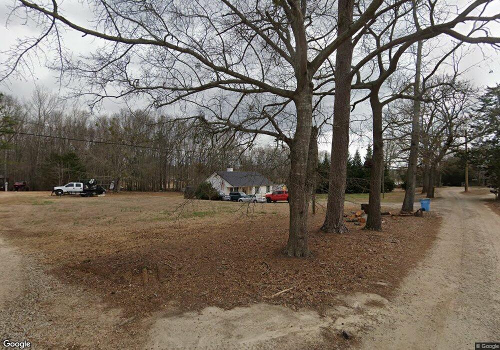
651 Garland Rd Locust Grove, GA 30248
Estimated Value: $233,000 - $254,000
3
Beds
2
Baths
1,191
Sq Ft
$207/Sq Ft
Est. Value
About This Home
This home is located at 651 Garland Rd, Locust Grove, GA 30248 and is currently estimated at $246,461, approximately $206 per square foot. 651 Garland Rd is a home located in Henry County with nearby schools including Unity Grove Elementary School, Locust Grove Middle School, and Locust Grove High School.
Ownership History
Date
Name
Owned For
Owner Type
Purchase Details
Closed on
Oct 26, 2009
Sold by
Lunsford Robert and Lunsford Debbie
Bought by
Rdl Rental Properties Llc
Current Estimated Value
Purchase Details
Closed on
Aug 11, 2004
Sold by
Green Tree Svc Llc
Bought by
Lunsford Debbie and Lunsford Robert
Purchase Details
Closed on
Jun 1, 2004
Sold by
Wright Huvey R and Wright Laura
Bought by
Green Tree Svcg Llc
Purchase Details
Closed on
Mar 23, 2001
Sold by
Wright Huvey R
Bought by
Wright Huevy R and Wright Laura
Purchase Details
Closed on
Jan 29, 1998
Sold by
J D J Inc
Bought by
Wright Huvey Ross
Home Financials for this Owner
Home Financials are based on the most recent Mortgage that was taken out on this home.
Original Mortgage
$63,900
Interest Rate
6.89%
Mortgage Type
New Conventional
Create a Home Valuation Report for This Property
The Home Valuation Report is an in-depth analysis detailing your home's value as well as a comparison with similar homes in the area
Home Values in the Area
Average Home Value in this Area
Purchase History
| Date | Buyer | Sale Price | Title Company |
|---|---|---|---|
| Rdl Rental Properties Llc | -- | -- | |
| Lunsford Debbie | $100,000 | -- | |
| Green Tree Svcg Llc | $107,370 | -- | |
| Wright Huevy R | -- | -- | |
| Wright Huvey Ross | $73,900 | -- |
Source: Public Records
Mortgage History
| Date | Status | Borrower | Loan Amount |
|---|---|---|---|
| Previous Owner | Wright Huvey Ross | $63,900 |
Source: Public Records
Tax History Compared to Growth
Tax History
| Year | Tax Paid | Tax Assessment Tax Assessment Total Assessment is a certain percentage of the fair market value that is determined by local assessors to be the total taxable value of land and additions on the property. | Land | Improvement |
|---|---|---|---|---|
| 2025 | $3,599 | $90,040 | $15,320 | $74,720 |
| 2024 | $3,599 | $87,440 | $14,240 | $73,200 |
| 2023 | $3,367 | $86,720 | $13,720 | $73,000 |
| 2022 | $2,739 | $70,360 | $12,640 | $57,720 |
| 2021 | $2,170 | $55,520 | $10,880 | $44,640 |
| 2020 | $1,939 | $49,520 | $10,240 | $39,280 |
| 2019 | $1,719 | $43,760 | $9,720 | $34,040 |
| 2018 | $0 | $39,400 | $8,960 | $30,440 |
| 2016 | $1,338 | $33,840 | $6,640 | $27,200 |
| 2015 | $1,165 | $28,440 | $7,520 | $20,920 |
| 2014 | $1,154 | $27,840 | $7,520 | $20,320 |
Source: Public Records
Map
Nearby Homes
- 111 Cardell Farms Rd
- 191 Old Stonewall Dr
- 1430 Cleveland Farms Rd
- 6.47 ACRES Peeksville Rd
- 1680 Leguin Mill Rd
- 1433 Cleveland Farm Rd
- 1430 Cleveland Farm Rd
- 108 Caraway Rd
- 1627 Leguin Mill Rd
- 724 Sunset Dr
- 744 Sunset Dr
- 230 Leguin Mill Rd
- 655 Sunset Dr
- 1409 Sodbuster Dr
- 105 Meadow Springs Ct
- Burton III Plan at Bunn Farms
- Jackson III Plan at Bunn Farms
- Hartwell III Plan at Bunn Farms
- Dockery III Plan at Bunn Farms
- 1417 Sodbuster Dr
- 641 Garland Rd
- 698 Garland Rd
- 724 Garland Rd
- 631 Garland Rd
- 80 Cleveland Rd
- 72 Cleveland Rd
- 50 Cleveland Rd
- 2539 S Ola Rd
- 2545 S Ola Rd
- 621 Garland Rd
- 100 Cleveland Rd
- 628 Garland Rd
- 620 Garland Rd
- 680 Garland Rd
- 611 Garland Rd
- 97 Cleveland Rd
- 2541 S Ola Rd
- 51 Cleveland Rd
- 102 Cleveland Rd
- 2537 S Ola Rd