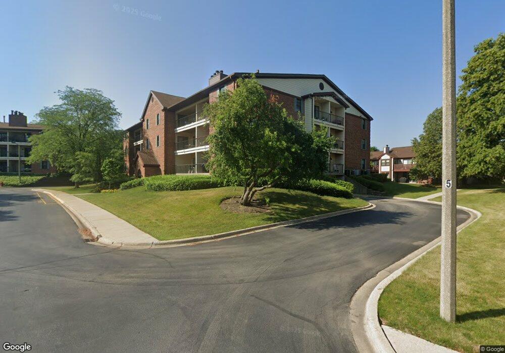
651 Hapsfield Ln Unit 651305 Buffalo Grove, IL 60089
South Buffalo Grove NeighborhoodEstimated Value: $237,000 - $264,000
2
Beds
--
Bath
1,112
Sq Ft
$221/Sq Ft
Est. Value
About This Home
This home is located at 651 Hapsfield Ln Unit 651305, Buffalo Grove, IL 60089 and is currently estimated at $245,605, approximately $220 per square foot. 651 Hapsfield Ln Unit 651305 is a home located in Cook County with nearby schools including Henry W Longfellow Elementary School, Cooper Middle School, and Buffalo Grove High School.
Ownership History
Date
Name
Owned For
Owner Type
Purchase Details
Closed on
Apr 20, 2018
Sold by
Okulik Michael
Bought by
Sadkowski Adrian
Current Estimated Value
Home Financials for this Owner
Home Financials are based on the most recent Mortgage that was taken out on this home.
Original Mortgage
$120,000
Outstanding Balance
$103,626
Interest Rate
4.62%
Mortgage Type
New Conventional
Estimated Equity
$141,979
Purchase Details
Closed on
Aug 16, 2004
Sold by
Cole Taylor Bank
Bought by
Okulik Michael
Home Financials for this Owner
Home Financials are based on the most recent Mortgage that was taken out on this home.
Original Mortgage
$141,000
Interest Rate
5.25%
Mortgage Type
Purchase Money Mortgage
Create a Home Valuation Report for This Property
The Home Valuation Report is an in-depth analysis detailing your home's value as well as a comparison with similar homes in the area
Home Values in the Area
Average Home Value in this Area
Purchase History
| Date | Buyer | Sale Price | Title Company |
|---|---|---|---|
| Sadkowski Adrian | $150,000 | Chicago Title | |
| Okulik Michael | $180,000 | Classic Title |
Source: Public Records
Mortgage History
| Date | Status | Borrower | Loan Amount |
|---|---|---|---|
| Open | Sadkowski Adrian | $120,000 | |
| Previous Owner | Okulik Michael | $141,000 | |
| Closed | Okulik Michael | $21,000 |
Source: Public Records
Tax History Compared to Growth
Tax History
| Year | Tax Paid | Tax Assessment Tax Assessment Total Assessment is a certain percentage of the fair market value that is determined by local assessors to be the total taxable value of land and additions on the property. | Land | Improvement |
|---|---|---|---|---|
| 2024 | $3,922 | $15,570 | $517 | $15,053 |
| 2023 | $3,741 | $15,570 | $517 | $15,053 |
| 2022 | $3,741 | $15,570 | $517 | $15,053 |
| 2021 | $3,671 | $13,720 | $114 | $13,606 |
| 2020 | $3,650 | $13,720 | $114 | $13,606 |
| 2019 | $4,707 | $15,203 | $114 | $15,089 |
| 2018 | $3,411 | $9,904 | $100 | $9,804 |
| 2017 | $3,348 | $9,904 | $100 | $9,804 |
| 2016 | $3,111 | $9,904 | $100 | $9,804 |
| 2015 | $2,918 | $8,590 | $244 | $8,346 |
| 2014 | $2,870 | $8,590 | $244 | $8,346 |
| 2013 | $2,653 | $8,590 | $244 | $8,346 |
Source: Public Records
Map
Nearby Homes
- 820 Weidner Rd Unit 4013
- 820 Weidner Rd Unit 409
- 813 Stradford Cir Unit 21B2
- 665 Thornwood Dr
- 859 Beechwood Rd
- 3300 N Carriageway Dr Unit 317
- 535 Estate Dr
- 561 Park View Terrace Unit 153
- 1127 Miller Ln Unit 107
- 1115 Miller Ln Unit 104
- 972 Thornton Ln Unit 102
- 18 E Heritage Ct
- 3157 N Daniels Ct Unit 1502
- 410 Chatham Cir
- 455 Mayfair Ln
- 3227 N Heritage Ln
- 1225 Radcliffe Rd Unit 2
- 3222 N Heritage Ln
- 408 Indian Hill Dr
- 476 Raupp Blvd
- 651 Hapsfield Ln Unit 201
- 651 Hapsfield Ln Unit 305
- 651 Hapsfield Ln Unit 306
- 651 Hapsfield Ln Unit 202
- 651 Hapsfield Ln Unit 651107
- 651 Hapsfield Ln Unit 651200
- 651 Hapsfield Ln Unit 651206
- 651 Hapsfield Ln Unit 651102
- 651 Hapsfield Ln Unit 651205
- 651 Hapsfield Ln Unit 651302
- 651 Hapsfield Ln Unit 651303
- 651 Hapsfield Ln Unit 651203
- 651 Hapsfield Ln Unit 651301
- 651 Hapsfield Ln Unit 651202
- 651 Hapsfield Ln Unit 651306
- 651 Hapsfield Ln Unit 651106
- 651 Hapsfield Ln Unit 651104
- 651 Hapsfield Ln Unit 651207
- 651 Hapsfield Ln Unit 651105
- 651 Hapsfield Ln Unit 651201