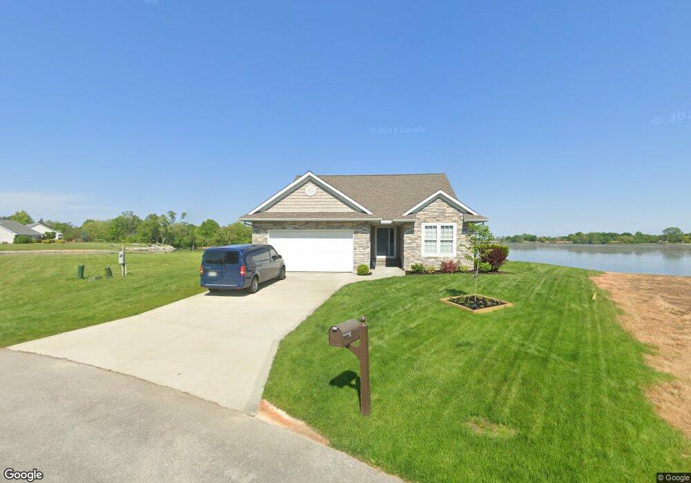
651 N Harbor Pointe Dr Port Clinton, OH 43452
Estimated Value: $575,000 - $651,000
3
Beds
2
Baths
2,032
Sq Ft
$305/Sq Ft
Est. Value
About This Home
This home is located at 651 N Harbor Pointe Dr, Port Clinton, OH 43452 and is currently estimated at $620,530, approximately $305 per square foot. 651 N Harbor Pointe Dr is a home located in Ottawa County with nearby schools including Bataan Memorial Primary School, Bataan Memorial Intermediate School, and Port Clinton Middle School.
Ownership History
Date
Name
Owned For
Owner Type
Purchase Details
Closed on
Sep 29, 2020
Sold by
Davenport Real Estate Development Llc
Bought by
Young Michael J and Mulvaney Kelly L
Current Estimated Value
Purchase Details
Closed on
Jun 18, 2015
Sold by
Rusk Gerald W and Rusk Kathy J
Bought by
Davenport Real Estate Development Llc
Purchase Details
Closed on
Oct 21, 2009
Sold by
Davenport Real Estate Development Llc
Bought by
Rusk Gerald W and Rusk Kathy J
Create a Home Valuation Report for This Property
The Home Valuation Report is an in-depth analysis detailing your home's value as well as a comparison with similar homes in the area
Home Values in the Area
Average Home Value in this Area
Purchase History
| Date | Buyer | Sale Price | Title Company |
|---|---|---|---|
| Young Michael J | $145,000 | Hartung Title Order | |
| Davenport Real Estate Development Llc | $88,000 | Attorney | |
| Rusk Gerald W | $175,000 | Attorney |
Source: Public Records
Tax History Compared to Growth
Tax History
| Year | Tax Paid | Tax Assessment Tax Assessment Total Assessment is a certain percentage of the fair market value that is determined by local assessors to be the total taxable value of land and additions on the property. | Land | Improvement |
|---|---|---|---|---|
| 2024 | $6,566 | $202,521 | $90,556 | $111,965 |
| 2023 | $6,566 | $123,327 | $47,660 | $75,667 |
| 2022 | $4,393 | $123,327 | $47,660 | $75,667 |
| 2021 | $1,695 | $47,660 | $47,660 | $0 |
| 2020 | $1,433 | $38,750 | $38,750 | $0 |
| 2019 | $1,419 | $38,750 | $38,750 | $0 |
| 2018 | $1,416 | $38,750 | $38,750 | $0 |
| 2017 | $1,294 | $34,910 | $34,910 | $0 |
| 2016 | $1,298 | $34,910 | $34,910 | $0 |
| 2015 | $1,303 | $34,910 | $34,910 | $0 |
| 2014 | $1,277 | $34,910 | $34,910 | $0 |
| 2013 | $1,277 | $34,910 | $34,910 | $0 |
Source: Public Records
Map
Nearby Homes
- 1217 NE Catawba Rd Unit 13
- 1217 NE Catawba Rd Unit 14
- 1217 NE Catawba Rd Unit 15
- 1217 NE Catawba Rd Unit 16
- 1217 NE Catawba Rd
- 3776 E Pine Dr
- 4881 E Wood Duck Ct
- 4075 E Christopher Dr
- 3571 E Eagle Beach Cir
- 146 N Harbors End Dr Unit 21A
- 891 Lost Lake Rd
- 61 N Harbors End Dr
- 1229 Catawba Bay Dr
- 1876 N Lakewood Ave
- 0 N Windward Dr Unit 5144701
- Kimberly Plan at Catawba Meadows
- 641 N Harbor Pointe Dr
- 661 N Harbor Pointe Dr
- 631 N Harbor Pointe Dr
- 671 Harbor Point Dr
- 671 N Harbor Pointe Dr
- 681 N Harbor Point Dr
- 621 N Harbor Pointe Dr
- 691 N Harbor Pointe Dr
- 611 N Harbor Pointe Dr
- 611 Harbor Point Dr
- 701 N Harbor Pointe Dr
- 601 N Harbor Pointe Dr
- 759 N Harbor Pointe Dr
- 769 N Harbor Pointe Dr
- 749 N Harbor Pointe Dr
- 739 N Harbor Pointe Dr
- 729 N Harbor Pointe Dr
- 591 N Harbor Pointe Dr
- 779 N Harbor Pointe Dr
- 719 N Harbor Pointe Dr