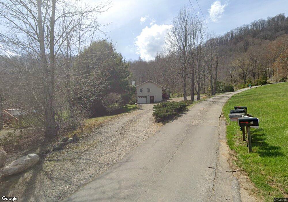
651 Red Maple Dr Waynesville, NC 28785
Estimated Value: $359,000 - $418,000
2
Beds
3
Baths
1,176
Sq Ft
$336/Sq Ft
Est. Value
About This Home
This home is located at 651 Red Maple Dr, Waynesville, NC 28785 and is currently estimated at $395,337, approximately $336 per square foot. 651 Red Maple Dr is a home located in Haywood County with nearby schools including Jonathan Valley Elementary School, Waynesville Middle, and Tuscola High.
Ownership History
Date
Name
Owned For
Owner Type
Purchase Details
Closed on
Oct 3, 2023
Sold by
Ricci Robert L and Ricci Nancy
Bought by
Ricci Robert L and Moore Nancy
Current Estimated Value
Purchase Details
Closed on
Sep 22, 2006
Sold by
Ward Robert H and Ward Dorothy E
Bought by
Ricci Robert L and Moore Nancy
Home Financials for this Owner
Home Financials are based on the most recent Mortgage that was taken out on this home.
Original Mortgage
$174,400
Interest Rate
6.52%
Mortgage Type
Purchase Money Mortgage
Create a Home Valuation Report for This Property
The Home Valuation Report is an in-depth analysis detailing your home's value as well as a comparison with similar homes in the area
Home Values in the Area
Average Home Value in this Area
Purchase History
| Date | Buyer | Sale Price | Title Company |
|---|---|---|---|
| Ricci Robert L | -- | None Listed On Document | |
| Ricci Robert L | -- | None Listed On Document | |
| Ricci Robert L | $218,000 | None Available |
Source: Public Records
Mortgage History
| Date | Status | Borrower | Loan Amount |
|---|---|---|---|
| Previous Owner | Ricci Robert L | $174,400 |
Source: Public Records
Tax History Compared to Growth
Tax History
| Year | Tax Paid | Tax Assessment Tax Assessment Total Assessment is a certain percentage of the fair market value that is determined by local assessors to be the total taxable value of land and additions on the property. | Land | Improvement |
|---|---|---|---|---|
| 2025 | -- | $205,100 | $23,200 | $181,900 |
| 2024 | $1,415 | $202,600 | $23,100 | $179,500 |
| 2023 | $1,415 | $202,600 | $23,100 | $179,500 |
| 2022 | $1,385 | $202,600 | $23,100 | $179,500 |
| 2021 | $1,385 | $202,600 | $23,100 | $179,500 |
| 2020 | $1,161 | $152,900 | $15,400 | $137,500 |
| 2019 | $1,166 | $152,900 | $15,400 | $137,500 |
| 2018 | $1,166 | $152,900 | $15,400 | $137,500 |
| 2017 | $1,166 | $152,900 | $0 | $0 |
| 2016 | $1,336 | $184,300 | $0 | $0 |
| 2015 | $1,336 | $184,300 | $0 | $0 |
| 2014 | $1,219 | $184,300 | $0 | $0 |
Source: Public Records
Map
Nearby Homes
- 99999 Molasses Way Unit 18
- 150 Sorghum Dr
- 85 Garnet Spring Ln
- TBD Upward Way Unit 236 & 237
- 99999 Upward Way Unit 36
- 00 Wolverine Ct Unit 48
- 00 Wolverine Ct Unit 45
- Lot 17 Covered Bridge Trail Unit 17
- Lot 24 Covered Bridge Trail Unit 24
- TBD Wolverine Ct Unit 42
- TBD Wolverine Ct Unit 40
- 0 Asa Trail
- Lot 23 Asa Trail
- 0 Cradling Cove Unit 3
- 64 Cradling Cove
- 269 Oakstone Dr
- 000 Roaring Creek Ln
- 00 Purple Martin Ln
- 0 Purple Martin Ln Unit 22 CAR4228087
- 4 Roaring Creek Ln
- 641 Red Maple Dr
- 726 Red Maple Dr
- 620 Red Maple Dr
- 613 Red Maple Dr
- 563 Red Maple Dr
- 60 Tractor Trail
- 758 Red Maple Dr
- 585 Red Maple Dr
- 136 Molasses Way
- 67 Fields Dr
- 6 Pilgrim Ln Unit 18
- 822 Fields Dr
- 77 Fields Dr
- 899 Fields Dr
- 791 Red Maple Dr
- 537 Red Maple Dr
- 104 Windfall Ln
- 44 Pilgrim Ln
- 534 Red Maple Dr
- 109 Fields Dr