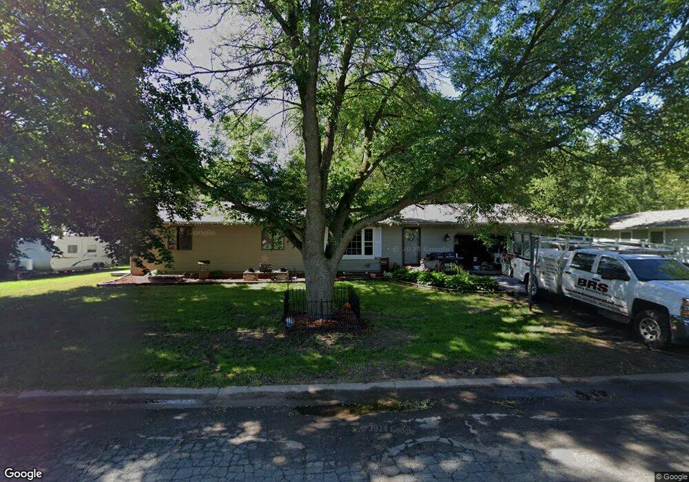
651 Ron Dr New Richmond, WI 54017
Estimated Value: $301,000 - $342,286
--
Bed
--
Bath
--
Sq Ft
0.31
Acres
About This Home
This home is located at 651 Ron Dr, New Richmond, WI 54017 and is currently estimated at $320,822. 651 Ron Dr is a home located in St. Croix County with nearby schools including New Richmond High School and St. Mary School.
Ownership History
Date
Name
Owned For
Owner Type
Purchase Details
Closed on
Sep 2, 2021
Sold by
Daniels Patrick and Daniels Patrick J
Bought by
Muller Mary Ann and Muller Robert
Current Estimated Value
Home Financials for this Owner
Home Financials are based on the most recent Mortgage that was taken out on this home.
Original Mortgage
$262,626
Outstanding Balance
$238,613
Interest Rate
2.7%
Mortgage Type
New Conventional
Estimated Equity
$82,209
Purchase Details
Closed on
Sep 4, 2007
Sold by
Federal Home Loan Mortgage Corporation
Bought by
Daniels Patrick
Home Financials for this Owner
Home Financials are based on the most recent Mortgage that was taken out on this home.
Original Mortgage
$91,500
Interest Rate
6.44%
Mortgage Type
New Conventional
Purchase Details
Closed on
Jun 25, 2007
Sold by
Merrill Chad M and Urness Michele L
Bought by
Wells Fargo Bank Na
Create a Home Valuation Report for This Property
The Home Valuation Report is an in-depth analysis detailing your home's value as well as a comparison with similar homes in the area
Home Values in the Area
Average Home Value in this Area
Purchase History
| Date | Buyer | Sale Price | Title Company |
|---|---|---|---|
| Muller Mary Ann | $260,000 | St Croix County Abstract & T | |
| Daniels Patrick | -- | None Available | |
| Wells Fargo Bank Na | $164,000 | None Available |
Source: Public Records
Mortgage History
| Date | Status | Borrower | Loan Amount |
|---|---|---|---|
| Open | Muller Mary Ann | $262,626 | |
| Previous Owner | Daniels Patrick | $91,500 |
Source: Public Records
Tax History Compared to Growth
Tax History
| Year | Tax Paid | Tax Assessment Tax Assessment Total Assessment is a certain percentage of the fair market value that is determined by local assessors to be the total taxable value of land and additions on the property. | Land | Improvement |
|---|---|---|---|---|
| 2024 | $45 | $301,700 | $32,100 | $269,600 |
| 2023 | $4,242 | $297,200 | $32,100 | $265,100 |
| 2022 | $2,952 | $260,000 | $32,100 | $227,900 |
| 2021 | $2,819 | $187,900 | $32,100 | $155,800 |
| 2020 | $2,885 | $118,500 | $21,300 | $97,200 |
| 2019 | $2,736 | $118,500 | $21,300 | $97,200 |
| 2018 | $2,732 | $118,500 | $21,300 | $97,200 |
| 2017 | $2,634 | $118,500 | $21,300 | $97,200 |
| 2016 | $2,634 | $118,500 | $21,300 | $97,200 |
| 2015 | $2,668 | $118,500 | $21,300 | $97,200 |
| 2014 | $2,609 | $118,500 | $21,300 | $97,200 |
| 2013 | $2,556 | $118,500 | $21,300 | $97,200 |
Source: Public Records
Map
Nearby Homes
- 572 Williamsburg Place
- 1575 Evan Ct
- 1448 Valley Creek Dr
- 425 Paperjack Dr
- 524 Cassandra Dr Unit 44
- 1600 Hallewood Blvd
- 1208 Tierney Dr
- 1389 Mallard Ln
- 1185 (Lot 2) Wisteria Ln
- 1131 Alfred Place
- 1187 Wisteria Ln
- 1186 Wisteria Ln
- 1203 Poppy Ct
- 1202 Poppy Ct
- 1102 Highpoint Ct
- 1336 Orchid Way
- 1350 Orchid Way
- Arlow Plan at Meadow Crossing
- Hudson Plan at Meadow Crossing
- Nora Plan at Meadow Crossing