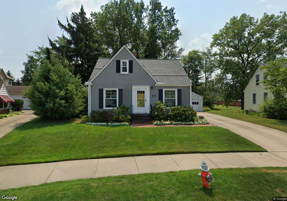
651 S Kensington Rd Rocky River, OH 44116
Estimated Value: $323,841 - $373,000
3
Beds
2
Baths
1,228
Sq Ft
$283/Sq Ft
Est. Value
About This Home
This home is located at 651 S Kensington Rd, Rocky River, OH 44116 and is currently estimated at $347,960, approximately $283 per square foot. 651 S Kensington Rd is a home located in Cuyahoga County with nearby schools including Kensington Intermediate Elementary School, Goldwood Primary Elementary School, and Rocky River Middle School.
Ownership History
Date
Name
Owned For
Owner Type
Purchase Details
Closed on
Nov 16, 2023
Sold by
Clifford Randall and Clifford Ramona M
Bought by
Randall Clifford and Clifford Ramona M
Current Estimated Value
Purchase Details
Closed on
Apr 6, 1987
Sold by
Irene Lestock
Bought by
Clifford Randall
Purchase Details
Closed on
Nov 8, 1982
Sold by
Lestock Irene
Bought by
Irene Lestock
Purchase Details
Closed on
Jul 10, 1978
Sold by
Tinal Stephen L
Bought by
Lestock Irene
Purchase Details
Closed on
Jan 1, 1975
Bought by
Tinal Stephen L
Create a Home Valuation Report for This Property
The Home Valuation Report is an in-depth analysis detailing your home's value as well as a comparison with similar homes in the area
Home Values in the Area
Average Home Value in this Area
Purchase History
| Date | Buyer | Sale Price | Title Company |
|---|---|---|---|
| Randall Clifford | -- | None Listed On Document | |
| Clifford Randall | $62,000 | -- | |
| Irene Lestock | $30,000 | -- | |
| Lestock Irene | $49,900 | -- | |
| Tinal Stephen L | -- | -- |
Source: Public Records
Tax History Compared to Growth
Tax History
| Year | Tax Paid | Tax Assessment Tax Assessment Total Assessment is a certain percentage of the fair market value that is determined by local assessors to be the total taxable value of land and additions on the property. | Land | Improvement |
|---|---|---|---|---|
| 2024 | $4,549 | $82,285 | $21,280 | $61,005 |
| 2023 | $4,271 | $64,060 | $17,400 | $46,660 |
| 2022 | $4,241 | $64,050 | $17,400 | $46,660 |
| 2021 | $3,884 | $64,050 | $17,400 | $46,660 |
| 2020 | $3,643 | $52,500 | $14,250 | $38,260 |
| 2019 | $3,580 | $150,000 | $40,700 | $109,300 |
| 2018 | $3,620 | $52,500 | $14,250 | $38,260 |
| 2017 | $3,770 | $50,370 | $9,800 | $40,570 |
| 2016 | $3,670 | $50,370 | $9,800 | $40,570 |
| 2015 | $3,288 | $50,370 | $9,800 | $40,570 |
| 2014 | $3,288 | $43,060 | $8,370 | $34,690 |
Source: Public Records
Map
Nearby Homes
- 19740 Lake Rd Unit 19740
- 20695 Beaconsfield Blvd
- 19665 Roslyn Dr
- 20333 Detroit Rd Unit 311B
- 20333 Detroit Rd Unit 213B
- 459 Wagar Rd
- 1744 Lakeview Ave
- 19334 Frazier Dr
- 19204 Frazier Dr
- 19575 Shoreland Ave
- 0 Riverdale Dr Unit 5078145
- 0 Riverdale Dr
- 21307 Lake Rd
- 416 Riverdale Dr
- 19712 Laurel Ave
- 19486 Frazier Dr
- 387 S Island Dr
- 2039 Wooster Rd Unit D51
- 829 Elmwood Rd
- 19000 Lake Rd Unit 915
- 647 S Kensington Rd
- 643 S Kensington Rd
- 642 S Kensington Rd
- 645 S Falmouth Dr
- 628 S Kensington Rd
- 639 S Kensington Rd
- 640 S Falmouth Dr
- 30 Astor Place
- 29 Astor Place
- 627 S Falmouth Dr
- 620 S Kensington Rd
- 28 Astor Place
- 656 S Falmouth Dr
- 631 S Kensington Rd
- 619 S Falmouth Dr
- 27 Astor Place
- 632 S Falmouth Dr
- 614 S Kensington Rd
- 26 Astor Place
- 26 Astor Place Unit 165