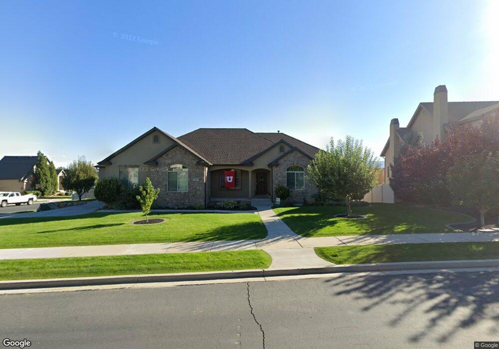
651 W 1040 N Unit 20 American Fork, UT 84003
Estimated Value: $904,000 - $996,932
3
Beds
4
Baths
2,012
Sq Ft
$471/Sq Ft
Est. Value
About This Home
This home is located at 651 W 1040 N Unit 20, American Fork, UT 84003 and is currently estimated at $947,483, approximately $470 per square foot. 651 W 1040 N Unit 20 is a home located in Utah County with nearby schools including Shelley Elementary School, American Fork Junior High School, and American Fork High School.
Ownership History
Date
Name
Owned For
Owner Type
Purchase Details
Closed on
Mar 4, 2020
Sold by
Miner Jason Allen and Miner Keri Lynn
Bought by
Miner Jason Allen and Miner Keri Lynn
Current Estimated Value
Home Financials for this Owner
Home Financials are based on the most recent Mortgage that was taken out on this home.
Original Mortgage
$253,000
Outstanding Balance
$200,439
Interest Rate
3.6%
Mortgage Type
New Conventional
Estimated Equity
$747,044
Purchase Details
Closed on
Sep 3, 2010
Sold by
Miner Jason and Miner Keri
Bought by
Miner Jason Allen and Miner Keri Lynn
Home Financials for this Owner
Home Financials are based on the most recent Mortgage that was taken out on this home.
Original Mortgage
$267,200
Interest Rate
4.48%
Mortgage Type
New Conventional
Purchase Details
Closed on
Jan 25, 2010
Sold by
Miner Jason and Miner Keri
Bought by
Miner Jason Allen and Miner Keri Lynn
Purchase Details
Closed on
Nov 20, 2009
Sold by
Miner Jason and Miner Keri
Bought by
Miner Jason and Miner Keri
Home Financials for this Owner
Home Financials are based on the most recent Mortgage that was taken out on this home.
Original Mortgage
$265,000
Interest Rate
4.88%
Mortgage Type
New Conventional
Purchase Details
Closed on
Jun 11, 2009
Sold by
Castle Builders Inc
Bought by
Miner Jason and Miner Keri
Purchase Details
Closed on
Apr 25, 2006
Sold by
First Choice Communities Llc
Bought by
Castle Builders Inc
Home Financials for this Owner
Home Financials are based on the most recent Mortgage that was taken out on this home.
Original Mortgage
$386,598
Interest Rate
6.29%
Mortgage Type
Purchase Money Mortgage
Create a Home Valuation Report for This Property
The Home Valuation Report is an in-depth analysis detailing your home's value as well as a comparison with similar homes in the area
Home Values in the Area
Average Home Value in this Area
Purchase History
| Date | Buyer | Sale Price | Title Company |
|---|---|---|---|
| Miner Jason Allen | -- | Oasis Title Llc | |
| Miner Jason Allen | -- | Oasis Title Llc | |
| Miner Jason Allen | -- | Integrated Title Insurance | |
| Miner Jason | -- | Integrated Title Insurance | |
| Miner Jason Allen | -- | None Available | |
| Miner Jason | -- | Integrated Title Insurance | |
| Miner Jason | -- | First American Title Insuran | |
| Castle Builders Inc | -- | First American Title Agency | |
| First Choice Communities Llc | -- | First American Title Agency |
Source: Public Records
Mortgage History
| Date | Status | Borrower | Loan Amount |
|---|---|---|---|
| Open | Miner Jason Allen | $253,000 | |
| Closed | Miner Jason | $267,200 | |
| Closed | Miner Jason | $265,000 | |
| Previous Owner | Castle Builders Inc | $386,598 |
Source: Public Records
Tax History Compared to Growth
Tax History
| Year | Tax Paid | Tax Assessment Tax Assessment Total Assessment is a certain percentage of the fair market value that is determined by local assessors to be the total taxable value of land and additions on the property. | Land | Improvement |
|---|---|---|---|---|
| 2025 | $3,947 | $518,210 | $306,600 | $635,600 |
| 2024 | $3,947 | $438,570 | $0 | $0 |
| 2023 | $3,619 | $426,360 | $0 | $0 |
| 2022 | $3,888 | $452,045 | $0 | $0 |
| 2021 | $3,413 | $619,800 | $214,800 | $405,000 |
| 2020 | $3,319 | $584,600 | $198,900 | $385,700 |
| 2019 | $3,177 | $578,600 | $198,900 | $379,700 |
| 2018 | $3,119 | $543,200 | $191,300 | $351,900 |
| 2017 | $2,927 | $275,110 | $0 | $0 |
| 2016 | $2,724 | $237,875 | $0 | $0 |
| 2015 | $2,794 | $231,550 | $0 | $0 |
| 2014 | $2,806 | $229,405 | $0 | $0 |
Source: Public Records
Map
Nearby Homes
- 3935 W 1000 N Unit 438
- 3983 W 1000 N Unit 442
- 4007 W 1000 N
- 3947 W 1000 N Unit 439
- 3959 W 1000 N
- 602 W 860 N
- 471 W 1040 N
- 987 N 410 W
- 822 N 860 W Unit 317
- 822 W 800 St N Unit LOT319
- 425 W 1120 N
- 901 N Lakota Rd
- 9435 N Aspen Hollow Cir
- 914 N 400 W Unit A
- 344 W 1080 N
- 962 N 780 St W Unit 508
- 974 N 780 St W Unit 509
- 916 N 780 St W Unit 501
- 3889 W 950 Cir N Unit 366
- 893 N 1580 E
- 656 W 1000 N
- 673 W 1040 N
- 673 W 1040 N Unit 21
- 639 W 1040 N
- 639 W 1040 N Unit 19
- 652 W 1040 N
- 652 W 1040 N Unit 31
- 638 W 1040 N
- 1018 N 640 W
- 674 W 1040 N
- 674 W 1040 N Unit 30
- 685 W 1040 N
- 685 W 1040 N Unit 22
- 626 W 1040 N
- 686 W 1040 N
- 617 W 1040 N
- 617 W 1040 N Unit 18
- 645 W 1080 North Cir
- 633 W 1080 North Cir Unit 35
- 633 W 1080 North Cir Unit 35