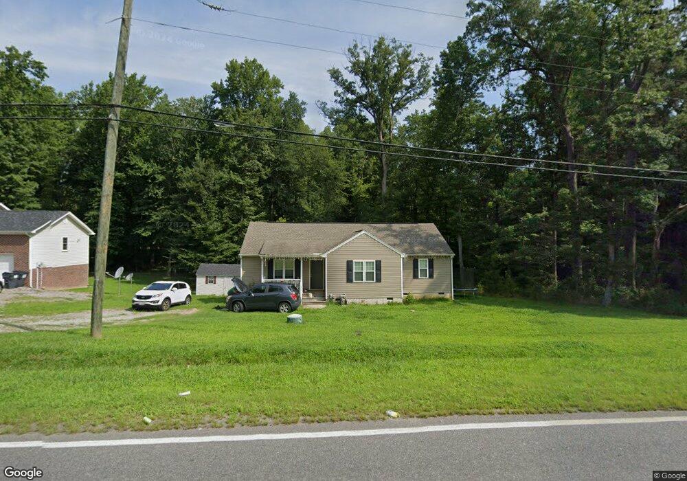
6510 Sandy Ridge Rd North Prince George, VA 23860
Estimated Value: $295,000 - $358,000
3
Beds
2
Baths
1,108
Sq Ft
$288/Sq Ft
Est. Value
About This Home
This home is located at 6510 Sandy Ridge Rd, North Prince George, VA 23860 and is currently estimated at $319,278, approximately $288 per square foot. 6510 Sandy Ridge Rd is a home located in Prince George County with nearby schools including North Elementary School, Prince George High School, and West End Christian School.
Ownership History
Date
Name
Owned For
Owner Type
Purchase Details
Closed on
Feb 29, 2016
Sold by
Richard W Shaver Builder Inc
Bought by
Anderson Denise R
Current Estimated Value
Home Financials for this Owner
Home Financials are based on the most recent Mortgage that was taken out on this home.
Original Mortgage
$147,283
Outstanding Balance
$116,960
Interest Rate
3.75%
Mortgage Type
FHA
Estimated Equity
$202,318
Purchase Details
Closed on
Jul 18, 2005
Purchase Details
Closed on
Jun 30, 2003
Purchase Details
Closed on
Oct 20, 1981
Create a Home Valuation Report for This Property
The Home Valuation Report is an in-depth analysis detailing your home's value as well as a comparison with similar homes in the area
Home Values in the Area
Average Home Value in this Area
Purchase History
| Date | Buyer | Sale Price | Title Company |
|---|---|---|---|
| Anderson Denise R | $150,000 | Old Dominion Title | |
| -- | $65,000 | -- | |
| -- | -- | -- | |
| -- | -- | -- |
Source: Public Records
Mortgage History
| Date | Status | Borrower | Loan Amount |
|---|---|---|---|
| Open | Anderson Denise R | $147,283 |
Source: Public Records
Tax History Compared to Growth
Tax History
| Year | Tax Paid | Tax Assessment Tax Assessment Total Assessment is a certain percentage of the fair market value that is determined by local assessors to be the total taxable value of land and additions on the property. | Land | Improvement |
|---|---|---|---|---|
| 2025 | $2,110 | $308,400 | $72,800 | $235,600 |
| 2024 | $2,110 | $257,300 | $60,000 | $197,300 |
| 2023 | $1,953 | $257,300 | $63,100 | $194,200 |
| 2021 | $1,989 | $203,700 | $52,400 | $151,300 |
| 2020 | $1,376 | $194,700 | $52,400 | $142,300 |
| 2019 | $1,412 | $160,000 | $39,700 | $120,300 |
| 2018 | $1,327 | $160,100 | $39,700 | $120,400 |
| 2017 | $1,316 | $150,100 | $39,700 | $110,400 |
| 2016 | $1,316 | $148,800 | $39,700 | $109,100 |
| 2014 | -- | $26,500 | $26,500 | $0 |
Source: Public Records
Map
Nearby Homes
- 000 Prince George Dr
- 3539 Perrins Hill Way
- 3551 Perrins Hill Way
- 3535 Perrins Hill Way
- 3540 Perrins Hill Way
- 3536 Perrins Hill Way
- 3544 Perrins Hill Way
- 3547 Perrins Hill Way
- 3555 Perrins Hill Way
- 3532 Perrins Hill Way
- 3543 Perrins Hill Way
- DELMAR Plan at Lakewood Village
- 3528 Perrins Hill Way
- TBD 0011
- 3587 Perrins Hill Way
- 1904 Arlington Rd
- 1902 Dellrose Dr
- 4200 Esposito Place
- 2834 Meadowview Blvd
- 1702 Tabb Ave
- 6500 Sandy Ridge Rd
- 3125 Prince George Dr
- 3125 Prince George Dr Unit GEORGE
- 3125 Prince George Dr
- 3290 Prince George Dr
- 3200 Prince George Dr
- 3075 Prince George Dr
- 6812 Sandy Ridge Rd
- 3400 Prince George Dr
- 2808 Manchester Dr
- 4517 Arlington Rd
- 3415 Prince George Dr
- 3400 Ontario Dr
- 2340 Dellrose Dr
- 2338 Dellrose Dr
- 2807 Manchester Dr
- 2334 Dellrose Dr
- 2256 Dellrose Dr
- 3410 Prince George Dr
- 3417 Prince George Dr