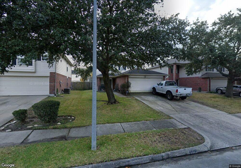
6511 Bryant Park Ct Houston, TX 77086
North Houston NeighborhoodEstimated Value: $216,276 - $237,000
3
Beds
3
Baths
1,440
Sq Ft
$158/Sq Ft
Est. Value
About This Home
This home is located at 6511 Bryant Park Ct, Houston, TX 77086 and is currently estimated at $227,069, approximately $157 per square foot. 6511 Bryant Park Ct is a home located in Harris County with nearby schools including Kujawa EC/Pre-K/K School, Wilson Intermediate School, and Shotwell Middle School.
Ownership History
Date
Name
Owned For
Owner Type
Purchase Details
Closed on
Apr 20, 2000
Sold by
Kaufman & Broad Lone Star Lp
Bought by
Holden Thomas E and Holden Terry Ann
Current Estimated Value
Home Financials for this Owner
Home Financials are based on the most recent Mortgage that was taken out on this home.
Original Mortgage
$86,166
Outstanding Balance
$29,435
Interest Rate
8.19%
Mortgage Type
VA
Estimated Equity
$197,634
Create a Home Valuation Report for This Property
The Home Valuation Report is an in-depth analysis detailing your home's value as well as a comparison with similar homes in the area
Home Values in the Area
Average Home Value in this Area
Purchase History
| Date | Buyer | Sale Price | Title Company |
|---|---|---|---|
| Holden Thomas E | -- | -- |
Source: Public Records
Mortgage History
| Date | Status | Borrower | Loan Amount |
|---|---|---|---|
| Open | Holden Thomas E | $86,166 |
Source: Public Records
Tax History Compared to Growth
Tax History
| Year | Tax Paid | Tax Assessment Tax Assessment Total Assessment is a certain percentage of the fair market value that is determined by local assessors to be the total taxable value of land and additions on the property. | Land | Improvement |
|---|---|---|---|---|
| 2025 | $994 | $200,874 | $32,695 | $168,179 |
| 2024 | $994 | $206,728 | $32,695 | $174,033 |
| 2023 | $994 | $206,728 | $33,877 | $172,851 |
| 2022 | $4,056 | $186,347 | $26,059 | $160,288 |
| 2021 | $3,679 | $151,590 | $26,059 | $125,531 |
| 2020 | $3,718 | $149,820 | $26,059 | $123,761 |
| 2019 | $3,514 | $127,907 | $17,981 | $109,926 |
| 2018 | $1,275 | $116,146 | $17,981 | $98,165 |
| 2017 | $2,800 | $108,792 | $16,157 | $92,635 |
| 2016 | $2,546 | $108,792 | $16,157 | $92,635 |
| 2015 | $1,810 | $94,604 | $16,157 | $78,447 |
| 2014 | $1,810 | $81,668 | $16,157 | $65,511 |
Source: Public Records
Map
Nearby Homes
- 6411 Halstead Meadows Cir
- 10730 Antoine Dr
- 6622 Sutton Meadows Dr
- 6706 Redding Springs Ln
- 0 Tomball Pkwy
- 5914 Stirring Winds Ln
- 6703 Deer Ridge Ln
- 12610 Twilight Bend Ct
- 10214 Trade Winds Dr
- 7011 Lower Arrow Dr
- 6830 Desert Rose Ln
- 6606 Dusty Dawn Dr
- 9815 Lonsford Dr
- 00 Romona Blvd
- 10306 Jillana Kaye Dr
- 6822 Dusty Dawn Dr
- 3265 Frick Rd
- 12623 Ann Louise Rd
- 00 Essie Rd
- 6911 Silver Star Dr
- 6507 Bryant Park Ct
- 6515 Bryant Park Ct
- 6519 Bryant Park Ct
- 6503 Bryant Park Ct
- 6518 Sutton Meadows Dr
- 6514 Sutton Meadows Dr
- 6522 Sutton Meadows Dr
- 6523 Bryant Park Ct
- 6510 Sutton Meadows Dr
- 6526 Sutton Meadows Dr
- 6510 Bryant Park Ct
- 6506 Bryant Park Ct
- 6514 Bryant Park Ct
- 6530 Sutton Meadows Dr
- 6527 Bryant Park Ct
- 6502 Bryant Park Ct
- 6518 Bryant Park Ct
- 6522 Bryant Park Ct
- 6534 Sutton Meadows Dr
- 6531 Bryant Park Ct