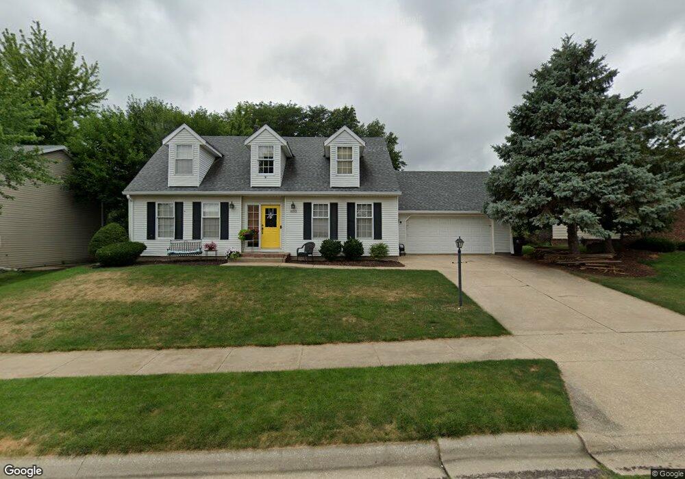
6511 N Camelot Rd Peoria, IL 61615
North Peoria NeighborhoodEstimated Value: $239,261 - $292,000
4
Beds
4
Baths
1,988
Sq Ft
$138/Sq Ft
Est. Value
About This Home
This home is located at 6511 N Camelot Rd, Peoria, IL 61615 and is currently estimated at $274,065, approximately $137 per square foot. 6511 N Camelot Rd is a home located in Peoria County with nearby schools including Charter Oak Primary School, Mark W. Bills Middle School, and Richwoods High School.
Ownership History
Date
Name
Owned For
Owner Type
Purchase Details
Closed on
Nov 14, 2008
Sold by
Benko John H and Benko Joyce H
Bought by
Byrkit Andrew P and Byrkit Mary P
Current Estimated Value
Home Financials for this Owner
Home Financials are based on the most recent Mortgage that was taken out on this home.
Original Mortgage
$202,991
Interest Rate
4.12%
Mortgage Type
New Conventional
Create a Home Valuation Report for This Property
The Home Valuation Report is an in-depth analysis detailing your home's value as well as a comparison with similar homes in the area
Home Values in the Area
Average Home Value in this Area
Purchase History
| Date | Buyer | Sale Price | Title Company |
|---|---|---|---|
| Byrkit Andrew P | $210,000 | Attorney Only | |
| Byrkit Andrew P | $210,000 | -- |
Source: Public Records
Mortgage History
| Date | Status | Borrower | Loan Amount |
|---|---|---|---|
| Previous Owner | Byrkit Andrew P | $202,991 |
Source: Public Records
Tax History Compared to Growth
Tax History
| Year | Tax Paid | Tax Assessment Tax Assessment Total Assessment is a certain percentage of the fair market value that is determined by local assessors to be the total taxable value of land and additions on the property. | Land | Improvement |
|---|---|---|---|---|
| 2024 | $6,405 | $76,810 | $11,050 | $65,760 |
| 2023 | $6,066 | $70,470 | $10,140 | $60,330 |
| 2022 | $5,782 | $65,940 | $9,520 | $56,420 |
| 2021 | $5,647 | $62,800 | $9,070 | $53,730 |
| 2020 | $5,629 | $62,180 | $8,980 | $53,200 |
| 2019 | $5,723 | $63,450 | $9,160 | $54,290 |
| 2018 | $5,656 | $64,080 | $9,250 | $54,830 |
| 2017 | $5,661 | $64,720 | $9,340 | $55,380 |
| 2016 | $5,492 | $64,720 | $9,340 | $55,380 |
| 2015 | $5,265 | $63,450 | $9,160 | $54,290 |
| 2014 | $5,272 | $63,190 | $8,780 | $54,410 |
| 2013 | -- | $63,960 | $8,890 | $55,070 |
Source: Public Records
Map
Nearby Homes
- 4327 W Tara Cir
- 6403 N Talisman Terrace
- 4326 W Shawnda Ct
- 4303 W Lynnhurst Dr
- 6809 N Frostwood Pkwy Unit 43
- 6809 N Frostwood Pkwy Unit 51
- 4201 W Richards Way
- 6831 N Frostwood Pkwy Unit 19
- 6831 N Frostwood Pkwy
- 6831 N Frostwood Pkwy Unit 13
- 4022 W Creighton Terrace
- 3925 W Creighton Terrace
- 6345 N Randwick Rd
- 4417 W Rockwell Dr
- 5310 W Fieldstone Dr
- 6718 N Fieldstone Ct
- 3711 W Creighton Terrace
- 3707 W Creighton Terrace
- 5900 N Bent Oak Ln Unit 107
- 5413 W Briarstone Dr
- 6503 N Camelot Rd
- 6515 N Camelot Rd
- 6506 N Suffolk Dr
- 6500 N Suffolk Dr
- 6514 N Suffolk Dr
- 6421 N Camelot Rd
- 6519 N Camelot Rd
- 6422 N Suffolk Dr
- 6508 N Camelot Rd
- 6502 N Camelot Rd
- 6514 N Camelot Rd
- 6520 N Suffolk Dr
- 6415 N Camelot Rd
- 6420 N Camelot Rd
- 6520 N Camelot Rd
- 6416 N Suffolk Dr
- 6507 N Suffolk Dr
- 6501 N Suffolk Dr
- 6513 N Suffolk Dr
- 6414 N Camelot Rd