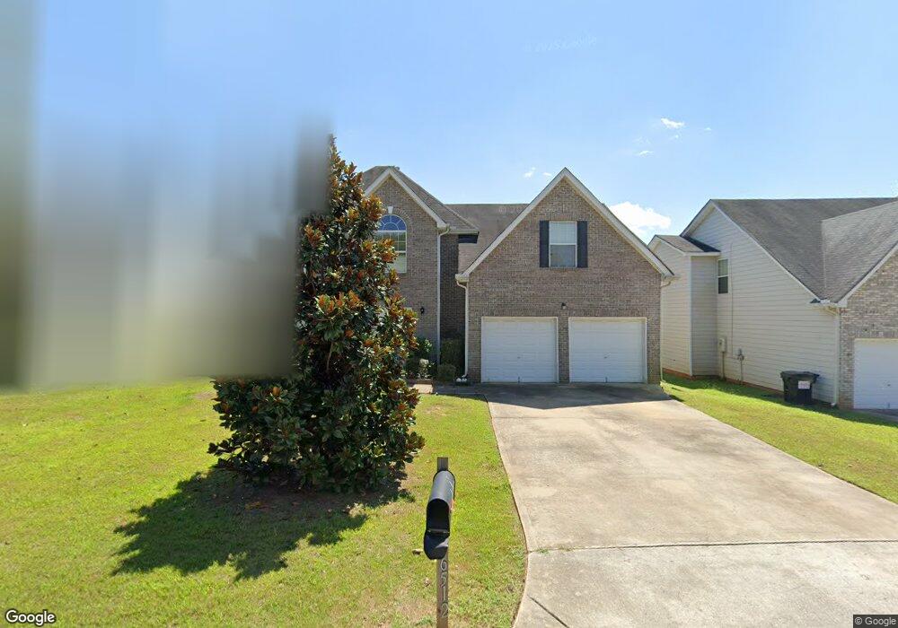
6512 Dekeon Dr Unit 25 Atlanta, GA 30349
Estimated Value: $332,413 - $372,000
4
Beds
3
Baths
2,973
Sq Ft
$117/Sq Ft
Est. Value
About This Home
This home is located at 6512 Dekeon Dr Unit 25, Atlanta, GA 30349 and is currently estimated at $347,103, approximately $116 per square foot. 6512 Dekeon Dr Unit 25 is a home located in Fulton County with nearby schools including Wolf Creek Elementary, Renaissance Middle School, and Langston Hughes High School.
Ownership History
Date
Name
Owned For
Owner Type
Purchase Details
Closed on
Aug 24, 2021
Sold by
Nickens Diane
Bought by
Sfr Jv 2 Property Llc
Current Estimated Value
Purchase Details
Closed on
Jun 8, 2017
Sold by
Jean-Baptiste Rosette
Bought by
Nickens Diane
Home Financials for this Owner
Home Financials are based on the most recent Mortgage that was taken out on this home.
Original Mortgage
$157,102
Interest Rate
4.62%
Mortgage Type
FHA
Purchase Details
Closed on
Apr 27, 2006
Sold by
Legacy Communities Of Cooks La
Bought by
Jean-Baptiste Rosette
Home Financials for this Owner
Home Financials are based on the most recent Mortgage that was taken out on this home.
Original Mortgage
$92,550
Interest Rate
6.28%
Mortgage Type
New Conventional
Create a Home Valuation Report for This Property
The Home Valuation Report is an in-depth analysis detailing your home's value as well as a comparison with similar homes in the area
Home Values in the Area
Average Home Value in this Area
Purchase History
| Date | Buyer | Sale Price | Title Company |
|---|---|---|---|
| Sfr Jv 2 Property Llc | $287,000 | -- | |
| Nickens Diane | $160,000 | -- | |
| Jean-Baptiste Rosette | $192,600 | -- |
Source: Public Records
Mortgage History
| Date | Status | Borrower | Loan Amount |
|---|---|---|---|
| Previous Owner | Nickens Diane | $157,102 | |
| Previous Owner | Jean-Baptiste Rosette | $92,550 |
Source: Public Records
Tax History Compared to Growth
Tax History
| Year | Tax Paid | Tax Assessment Tax Assessment Total Assessment is a certain percentage of the fair market value that is determined by local assessors to be the total taxable value of land and additions on the property. | Land | Improvement |
|---|---|---|---|---|
| 2025 | $5,168 | $134,160 | $25,840 | $108,320 |
| 2023 | $5,168 | $134,160 | $25,840 | $108,320 |
| 2022 | $4,173 | $106,440 | $18,440 | $88,000 |
| 2021 | $3,444 | $86,040 | $18,600 | $67,440 |
| 2020 | $3,029 | $74,440 | $12,680 | $61,760 |
| 2019 | $2,989 | $75,680 | $15,000 | $60,680 |
| 2018 | $2,540 | $63,800 | $8,360 | $55,440 |
| 2017 | $1,798 | $44,120 | $10,200 | $33,920 |
| 2016 | $1,798 | $44,120 | $10,200 | $33,920 |
| 2015 | $1,804 | $44,120 | $10,200 | $33,920 |
| 2014 | $1,903 | $44,120 | $10,200 | $33,920 |
Source: Public Records
Map
Nearby Homes
- 4270 Holliday Rd
- 4369 Estate St
- 4189 Post Oak Grove
- 6292 Dekeon Dr
- 4185 Post Oak Grove
- 6639 Overlook Ridge
- 4224 Butternut Place
- 4327 Shamrock Dr
- 6640 E Stubbs Rd
- 4140 Butternut Place
- 6474 E Stubbs Rd
- 6476 Snowden Dr
- 6390 E Stubbs Rd
- 6843 Foxfire Place
- 0 Jones Rd Unit 10486732
- 0 Jones Rd Unit 7548174
- 6684 Crane Ave
- 6300 E Stubbs Rd
- 3985 Demooney Rd
- 436 Berkshire Place
- 6512 Dekeon Dr
- 6512 Dekeon Dr
- 6522 Dekeon Dr
- 6502 Dekeon Dr
- 6532 Dekeon Dr
- 6492 Dekeon Dr
- 4482 Estate St
- 4301 Holliday Rd
- 4454 Holliday Rd
- 4486 Estate St
- 4305 Holiday Rd
- 4305 Holliday Rd
- 6507 Dekeon Dr
- 6537 Dekeon Dr
- 6517 Dekeon Dr
- 6497 Dekeon Dr
- 6527 Dekeon Dr
- 4490 Estate St
- 4309 Holliday Rd
- 6472 Dekeon Dr