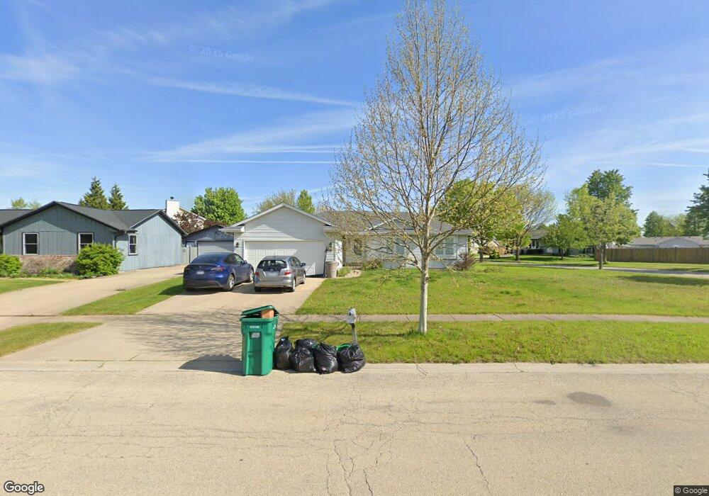
6513 Langsford Ln Unit 10 Plainfield, IL 60586
Fall Creek NeighborhoodEstimated Value: $318,000 - $341,000
Studio
1
Bath
1,292
Sq Ft
$253/Sq Ft
Est. Value
About This Home
This home is located at 6513 Langsford Ln Unit 10, Plainfield, IL 60586 and is currently estimated at $326,318, approximately $252 per square foot. 6513 Langsford Ln Unit 10 is a home located in Will County with nearby schools including Meadow View Elementary School, Aux Sable Middle School, and Plainfield South High School.
Ownership History
Date
Name
Owned For
Owner Type
Purchase Details
Closed on
Feb 28, 1996
Sold by
First National Bank Of Joliet
Bought by
Peterson Dale E and Peterson Elizabeth E
Current Estimated Value
Home Financials for this Owner
Home Financials are based on the most recent Mortgage that was taken out on this home.
Original Mortgage
$136,200
Outstanding Balance
$5,359
Interest Rate
7.06%
Mortgage Type
FHA
Estimated Equity
$320,959
Create a Home Valuation Report for This Property
The Home Valuation Report is an in-depth analysis detailing your home's value as well as a comparison with similar homes in the area
Home Values in the Area
Average Home Value in this Area
Purchase History
We collect this data history from publicly available records. To have your information removed, we recommend requesting removal directly through your county’s website.
| Date | Buyer | Sale Price | Title Company |
|---|---|---|---|
| Peterson Dale E | $136,000 | -- |
Source: Public Records
Mortgage History
We collect this data history from publicly available records. To have your information removed, we recommend requesting removal directly through your county’s website.
| Date | Status | Borrower | Loan Amount |
|---|---|---|---|
| Open | Peterson Dale E | $136,200 |
Source: Public Records
Tax History
| Year | Tax Paid | Tax Assessment Tax Assessment Total Assessment is a certain percentage of the fair market value that is determined by local assessors to be the total taxable value of land and additions on the property. | Land | Improvement |
|---|---|---|---|---|
| 2024 | $7,133 | $95,928 | $21,940 | $73,988 |
| 2023 | $6,314 | $86,640 | $19,816 | $66,824 |
| 2022 | $5,639 | $77,814 | $17,797 | $60,017 |
| 2021 | $5,126 | $70,053 | $16,633 | $53,420 |
| 2020 | $5,046 | $68,065 | $16,161 | $51,904 |
| 2019 | $4,864 | $64,855 | $15,399 | $49,456 |
| 2018 | $4,648 | $60,935 | $14,469 | $46,466 |
| 2017 | $4,502 | $57,907 | $13,750 | $44,157 |
| 2016 | $4,404 | $55,228 | $13,114 | $42,114 |
| 2015 | $4,155 | $51,736 | $12,285 | $39,451 |
| 2014 | $4,155 | $49,909 | $11,851 | $38,058 |
| 2013 | $4,155 | $49,909 | $11,851 | $38,058 |
Source: Public Records
Map
Nearby Homes
- 2704 Ruth Fitzgerald Dr
- 6605 Langsford Ln
- 0001 S State Route 59
- 0002 S State Route 59
- 2814 Stonebridge Dr
- 2604 Discovery Dr
- 25446 W Ryan Ln
- 2707 Cedar Breaks Ct Unit 9
- 25609 W Cerena Cir
- 2813 Twin Falls Dr Unit 1
- 25436 W Ashton Dr
- 2516 Oasis Dr
- 6814 Sahara Dr
- 25400 W Cerena Cir
- 17245 County Line Rd
- 2671 Canyon Dr Unit 66
- 6903 Lewis Clark Dr
- 2635 Canyon Dr Unit 933
- 2219 Daly Ln
- 6907 Manchester Dr
- 6509 Langsford Ln Unit 10
- 6507 Langsford Ln
- 2704 Billie Limacher Ln Unit 20
- 2709 Ruth Fitzgerald Dr
- 2706 Billie Limacher Ln
- 2711 Ruth Fitzgerald Dr Unit 8B
- 2707 Ruth Fitzgerald Dr
- 2619 John Bourg Dr
- 2618 John Bourg Dr
- 2713 Ruth Fitzgerald Dr
- 6515 Langsford Ln
- 6514 Langsford Ln Unit 10
- 2708 Billie Limacher Ln
- 2703 Billie Limacher Ln
- 6506 Langsford Ln
- 2617 John Bourg Dr Unit 10
- 2715 Ruth Fitzgerald Dr
- 2618 Labrecque Dr
- 6504 Langsford Ln
- 2710 Billie Limacher Ln
Your Personal Tour Guide
Ask me questions while you tour the home.