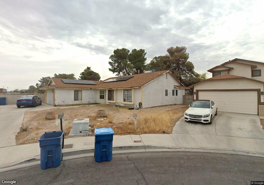
6513 Romance Cir Las Vegas, NV 89108
Estimated Value: $300,000 - $404,000
3
Beds
2
Baths
1,432
Sq Ft
$257/Sq Ft
Est. Value
About This Home
This home is located at 6513 Romance Cir, Las Vegas, NV 89108 and is currently estimated at $368,059, approximately $257 per square foot. 6513 Romance Cir is a home located in Clark County with nearby schools including Ruthe Deskin Elementary School, Justice Myron E Leavitt Middle School, and Centennial High School.
Ownership History
Date
Name
Owned For
Owner Type
Purchase Details
Closed on
Nov 29, 2017
Sold by
Perez Gilbert Lopez and Perez Sandra Martina
Bought by
Perez Gilbert Lopez and Perez Sandra Martina
Current Estimated Value
Home Financials for this Owner
Home Financials are based on the most recent Mortgage that was taken out on this home.
Original Mortgage
$86,487
Outstanding Balance
$72,682
Interest Rate
3.87%
Mortgage Type
FHA
Estimated Equity
$295,377
Purchase Details
Closed on
Mar 20, 2009
Sold by
The Bank Of New York
Bought by
Perez Gilbert L and Perez Sandra M O
Home Financials for this Owner
Home Financials are based on the most recent Mortgage that was taken out on this home.
Original Mortgage
$88,271
Interest Rate
4.71%
Mortgage Type
FHA
Purchase Details
Closed on
Aug 21, 2008
Sold by
Rohlfing Sharon K
Bought by
The Bank Of New York and Cwalt Inc Alternative Loan Tr 2006-Oc10
Purchase Details
Closed on
Jul 16, 2001
Sold by
Collins Melinda Gayle
Bought by
Collins Richard T
Home Financials for this Owner
Home Financials are based on the most recent Mortgage that was taken out on this home.
Original Mortgage
$136,852
Interest Rate
7.21%
Mortgage Type
FHA
Purchase Details
Closed on
Jun 15, 2001
Sold by
Collins Richard T
Bought by
Rohlfing Sharon K
Home Financials for this Owner
Home Financials are based on the most recent Mortgage that was taken out on this home.
Original Mortgage
$136,852
Interest Rate
7.21%
Mortgage Type
FHA
Purchase Details
Closed on
Dec 4, 1995
Sold by
Gil Luis F
Bought by
Collins Richard T
Home Financials for this Owner
Home Financials are based on the most recent Mortgage that was taken out on this home.
Original Mortgage
$113,300
Interest Rate
7.48%
Mortgage Type
Assumption
Purchase Details
Closed on
Oct 18, 1994
Sold by
Gil Maria G
Bought by
Gil Luis F
Home Financials for this Owner
Home Financials are based on the most recent Mortgage that was taken out on this home.
Original Mortgage
$20,323
Interest Rate
8.54%
Purchase Details
Closed on
Sep 8, 1994
Sold by
Gil Luis F
Bought by
Gil Luis F and Gil Maria G
Home Financials for this Owner
Home Financials are based on the most recent Mortgage that was taken out on this home.
Original Mortgage
$20,323
Interest Rate
8.54%
Create a Home Valuation Report for This Property
The Home Valuation Report is an in-depth analysis detailing your home's value as well as a comparison with similar homes in the area
Home Values in the Area
Average Home Value in this Area
Purchase History
| Date | Buyer | Sale Price | Title Company |
|---|---|---|---|
| Perez Gilbert Lopez | -- | First American Title Ins | |
| Perez Gilbert L | $89,900 | First American Title Paseo V | |
| The Bank Of New York | $116,250 | Fidelity National Default So | |
| Collins Richard T | $139,000 | Fidelity National Title | |
| Rohlfing Sharon K | $139,000 | Fidelity National Title | |
| Collins Richard T | $110,000 | Nevada Title Company | |
| Gil Luis F | -- | First American Title Company | |
| Gil Luis F | -- | First American Title Company |
Source: Public Records
Mortgage History
| Date | Status | Borrower | Loan Amount |
|---|---|---|---|
| Open | Perez Gilbert Lopez | $86,487 | |
| Previous Owner | Perez Gilbert L | $88,271 | |
| Previous Owner | Rohlfing Sharon K | $136,852 | |
| Previous Owner | Collins Richard T | $113,300 | |
| Previous Owner | Gil Luis F | $20,323 |
Source: Public Records
Tax History Compared to Growth
Tax History
| Year | Tax Paid | Tax Assessment Tax Assessment Total Assessment is a certain percentage of the fair market value that is determined by local assessors to be the total taxable value of land and additions on the property. | Land | Improvement |
|---|---|---|---|---|
| 2025 | $965 | $63,309 | $27,300 | $36,009 |
| 2024 | $938 | $63,309 | $27,300 | $36,009 |
| 2023 | $765 | $64,849 | $30,450 | $34,399 |
| 2022 | $910 | $56,822 | $24,850 | $31,972 |
| 2021 | $884 | $52,611 | $21,700 | $30,911 |
| 2020 | $855 | $53,135 | $22,050 | $31,085 |
| 2019 | $830 | $49,586 | $18,550 | $31,036 |
| 2018 | $806 | $47,030 | $16,800 | $30,230 |
| 2017 | $1,485 | $45,293 | $14,350 | $30,943 |
| 2016 | $765 | $40,462 | $8,820 | $31,642 |
| 2015 | $762 | $31,583 | $6,300 | $25,283 |
| 2014 | $992 | $21,891 | $6,300 | $15,591 |
Source: Public Records
Map
Nearby Homes
- 6608 Messenger Ct
- 6425 Wheelbarrow Peak Dr
- 6636 Painted Desert Dr
- 6508 Faith Peak Dr
- 6633 Wheelbarrow Peak Dr
- 6521 Faith Peak Dr
- 6802 W Craig Rd
- 6628 Plumflower Ln
- 5031 N Rainbow Blvd Unit 110
- 6300 Hill Haven Ave
- 6277 Kraft Ave
- 6540 Angel Mountain Ave Unit 2
- 6732 Accent Ct
- 6741 Accent Ct
- 5774 Smithsonian Way
- 6505 Quantum Ln
- 4252 Orangeblossom St
- 6256 Hill Haven Ave
- 4517 Carbine Chapel St
- 4217 Jasper Ave
- 6517 Romance Cir
- 6517 Romance Cir Unit None
- 6512 Wheelbarrow Peak Dr
- 6521 Romance Cir
- 6508 Wheelbarrow Peak Dr
- 6512 Romance Cir
- 6516 Wheelbarrow Peak Dr
- 6516 Romance Cir
- 6520 Wheelbarrow Peak Dr
- 6504 Wheelbarrow Peak Dr
- 6525 Romance Cir Unit 1
- 6520 Romance Cir
- 6524 Wheelbarrow Peak Dr
- 6500 Wheelbarrow Peak Dr
- 6524 Romance Cir
- 6513 Wheelbarrow Peak Dr
- 6509 Wheelbarrow Peak Dr
- 6517 Wheelbarrow Peak Dr
- 6528 Romance Cir
- 6440 Wheelbarrow Peak Dr