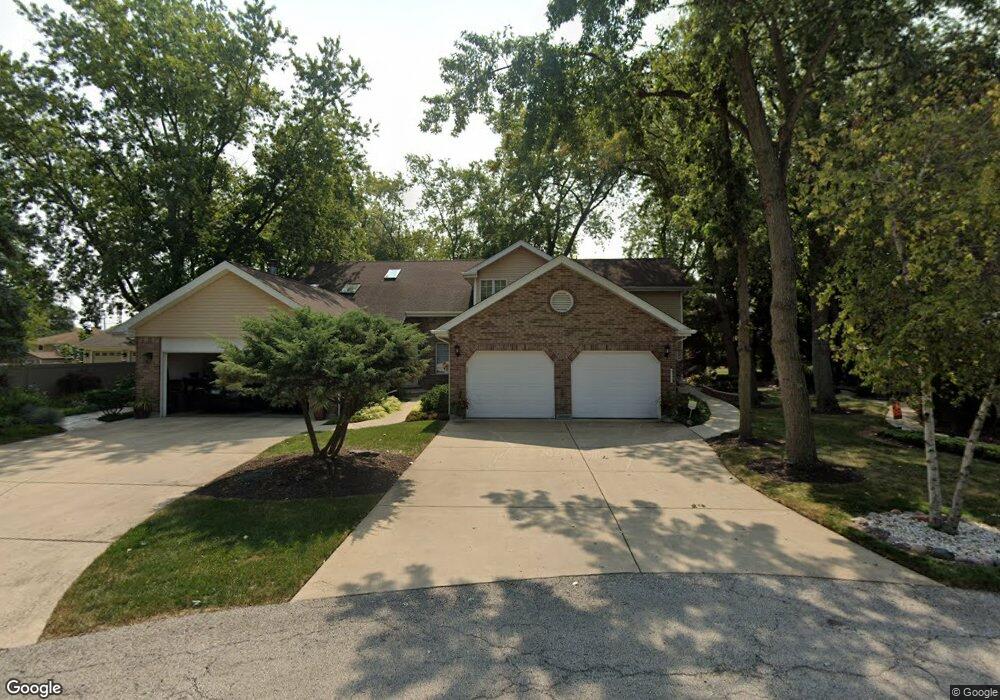
6513 W 126th Place Palos Heights, IL 60463
Navajo Hills NeighborhoodEstimated Value: $376,000 - $443,000
3
Beds
3
Baths
2,723
Sq Ft
$156/Sq Ft
Est. Value
About This Home
This home is located at 6513 W 126th Place, Palos Heights, IL 60463 and is currently estimated at $424,418, approximately $155 per square foot. 6513 W 126th Place is a home located in Cook County with nearby schools including Navajo Heights Elementary School, Chippewa Elementary School, and Independence Jr High School.
Ownership History
Date
Name
Owned For
Owner Type
Purchase Details
Closed on
Oct 13, 2015
Sold by
Chic Title Land Trust Company
Bought by
Fred Gruenberg Revocable Living Trust and Donna R Gruenberg Revocable Living Trust
Current Estimated Value
Create a Home Valuation Report for This Property
The Home Valuation Report is an in-depth analysis detailing your home's value as well as a comparison with similar homes in the area
Home Values in the Area
Average Home Value in this Area
Purchase History
| Date | Buyer | Sale Price | Title Company |
|---|---|---|---|
| Fred Gruenberg Revocable Living Trust | -- | Chicago Title Land Trust Co |
Source: Public Records
Tax History Compared to Growth
Tax History
| Year | Tax Paid | Tax Assessment Tax Assessment Total Assessment is a certain percentage of the fair market value that is determined by local assessors to be the total taxable value of land and additions on the property. | Land | Improvement |
|---|---|---|---|---|
| 2024 | $9,394 | $37,001 | $3,523 | $33,478 |
| 2023 | $7,376 | $37,001 | $3,523 | $33,478 |
| 2022 | $7,376 | $26,583 | $3,100 | $23,483 |
| 2021 | $7,098 | $26,582 | $3,099 | $23,483 |
| 2020 | $7,102 | $26,582 | $3,099 | $23,483 |
| 2019 | $7,910 | $30,048 | $2,818 | $27,230 |
| 2018 | $7,485 | $30,048 | $2,818 | $27,230 |
| 2017 | $7,944 | $31,423 | $2,818 | $28,605 |
| 2016 | $5,362 | $20,600 | $2,395 | $18,205 |
| 2015 | $5,181 | $20,600 | $2,395 | $18,205 |
| 2014 | $5,059 | $20,600 | $2,395 | $18,205 |
| 2013 | $7,029 | $28,817 | $2,395 | $26,422 |
Source: Public Records
Map
Nearby Homes
- 6519 W 126th Place
- 12611 Natoma Ave
- 6711 W Shiawassie Dr
- 6709 W Menominee Pkwy
- 12753 S Oak Park Ave
- 6839 W 127th St
- 12246 S Nagle Ave
- 12646 S 69th Ct
- 12718 S 69th Ct
- 12722 S 69th Ct
- 6052 W 128th St
- 430 Shadow Creek Dr
- 13007 S Oak Park Ave
- 12256 S Arbor Trail Unit 11W
- 12513 S Mcvickers Ave
- 13097 Laurel Glen Ct Unit 202
- 6052 W 129th Place
- 12732 S Austin Ave
- 12422 S 70th Ct
- 38 Shadow Creek Cir
- 6511 W 126th Place
- 6515 W 126th Place
- 6517 W 126th Place
- 6214 W 127th St
- 6507 W 126th Place
- 6218 W 127th St
- 14 W Maple Ln
- 16 W Maple Ln
- 12 W Maple Ln
- 18 W Maple Ln
- 6518 W 126th Place
- 20 W Maple Ln
- 6504 W 127th St
- 6516 W 126th Place
- 22 W Maple Ln
- 6501 W 126th Place
- 6512 W 126th Place
- 6514 W 126th Place
- 24 W Maple Ln
- 12643 Natoma Ave