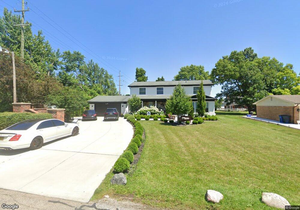
6515 Perham Dr West Bloomfield, MI 48322
Estimated Value: $424,000 - $466,000
4
Beds
3
Baths
2,411
Sq Ft
$185/Sq Ft
Est. Value
About This Home
This home is located at 6515 Perham Dr, West Bloomfield, MI 48322 and is currently estimated at $446,439, approximately $185 per square foot. 6515 Perham Dr is a home located in Oakland County with nearby schools including Sheiko Elementary School, West Bloomfield Middle School, and Bloomfield Maples Montessori.
Ownership History
Date
Name
Owned For
Owner Type
Purchase Details
Closed on
May 2, 2017
Sold by
Salem Ahmed and Salem Hosam
Bought by
Lucaj Zef
Current Estimated Value
Home Financials for this Owner
Home Financials are based on the most recent Mortgage that was taken out on this home.
Original Mortgage
$63,000
Outstanding Balance
$51,882
Interest Rate
3.75%
Mortgage Type
Adjustable Rate Mortgage/ARM
Estimated Equity
$394,557
Purchase Details
Closed on
Apr 25, 2017
Sold by
Lucaj Zef and Lucaj Vera
Bought by
Lucaj Zej and Lucaj Vera
Home Financials for this Owner
Home Financials are based on the most recent Mortgage that was taken out on this home.
Original Mortgage
$63,000
Outstanding Balance
$51,882
Interest Rate
3.75%
Mortgage Type
Adjustable Rate Mortgage/ARM
Estimated Equity
$394,557
Create a Home Valuation Report for This Property
The Home Valuation Report is an in-depth analysis detailing your home's value as well as a comparison with similar homes in the area
Home Values in the Area
Average Home Value in this Area
Purchase History
| Date | Buyer | Sale Price | Title Company |
|---|---|---|---|
| Lucaj Zef | $143,500 | None Available | |
| Lucaj Zej | -- | None Available |
Source: Public Records
Mortgage History
| Date | Status | Borrower | Loan Amount |
|---|---|---|---|
| Open | Lucaj Zej | $63,000 |
Source: Public Records
Tax History Compared to Growth
Tax History
| Year | Tax Paid | Tax Assessment Tax Assessment Total Assessment is a certain percentage of the fair market value that is determined by local assessors to be the total taxable value of land and additions on the property. | Land | Improvement |
|---|---|---|---|---|
| 2024 | $2,750 | $180,340 | $0 | $0 |
| 2022 | $2,633 | $158,610 | $40,000 | $118,610 |
| 2021 | $4,007 | $151,440 | $0 | $0 |
| 2020 | $2,581 | $147,610 | $34,100 | $113,510 |
| 2018 | $3,860 | $135,740 | $28,150 | $107,590 |
| 2015 | -- | $109,810 | $0 | $0 |
| 2014 | -- | $98,150 | $0 | $0 |
| 2011 | -- | $88,510 | $0 | $0 |
Source: Public Records
Map
Nearby Homes
- 6564 Alderley Way
- 6545 Post Oak Dr
- 6882 Post Oak Dr
- 5764 Bloomfield Glens Rd
- 5312 Cambourne Place
- 7251 N Briarcliff Knoll Dr
- 7209 Stonebrook Rd
- 6843 Leslee Crest Dr
- 5815 Bloomfield Glens Rd
- 6151 Orchard Lake Rd Unit 103
- 6145 Orchard Lake Rd Unit 204
- 7335 Coach Ln
- 7477 Gramercy Cir Unit 17
- 5622 Powder Horn Dr
- 5780 Swan Lake Ct
- 7479 Gramercy Cir Unit 16
- 7431 N Briarcliff Knoll Dr
- 3104 Spring St
- 3865 Stonecrest Rd
- 6322 Pepper Hill St Unit 62
- 6529 Perham Dr
- 5368 Centerbrook Dr
- 5382 Centerbrook Dr
- 5356 Centerbrook Dr
- 6514 Perham Dr
- 3169 Rutledge Park Ct
- 3181 Rutledge Park Ct
- 6528 Perham Dr
- 3157 Rutledge Park Ct
- 6542 Perham Dr
- 5348 Centerbrook Dr
- 3193 Rutledge Park Ct
- 5365 Centerbrook Dr
- 5377 Centerbrook Dr
- 5389 Centerbrook Dr
- 5353 Centerbrook Dr
- 5414 Centerbrook Dr
- 6481 Rutledge Park Dr
- 5340 Centerbrook Dr
- 5405 W Maple Rd