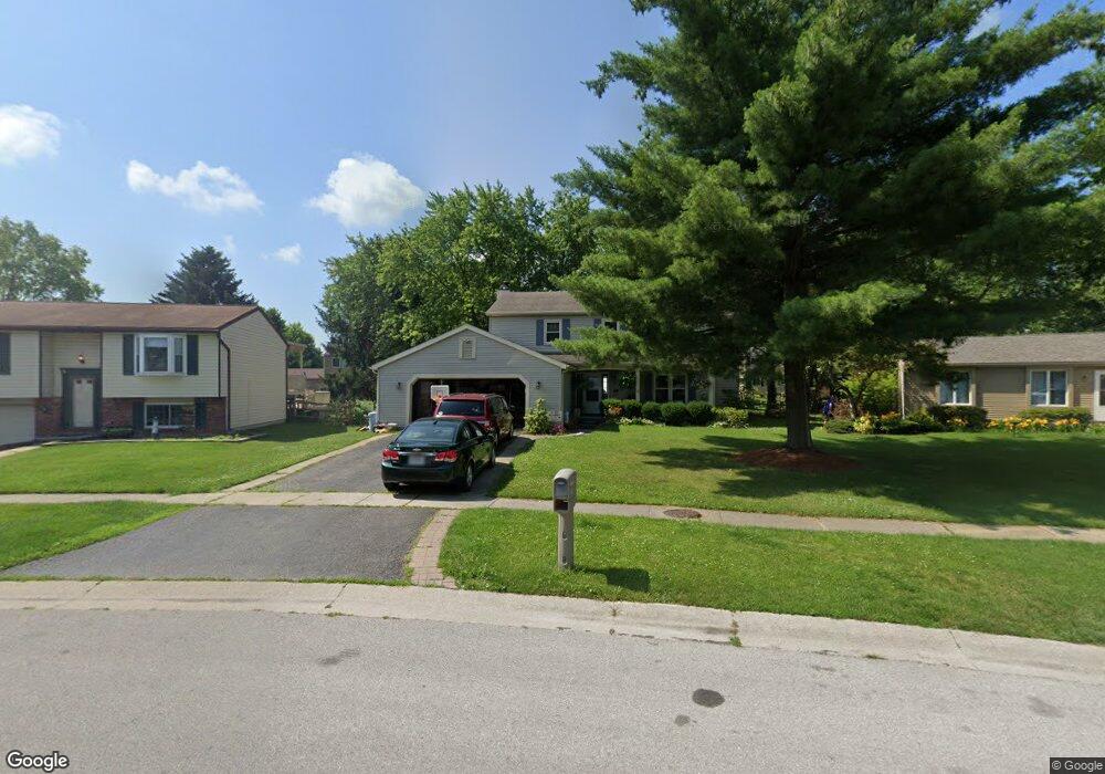
6515 Scarsdale Rd Maumee, OH 43537
Estimated Value: $271,000 - $300,684
4
Beds
3
Baths
1,982
Sq Ft
$146/Sq Ft
Est. Value
About This Home
This home is located at 6515 Scarsdale Rd, Maumee, OH 43537 and is currently estimated at $288,421, approximately $145 per square foot. 6515 Scarsdale Rd is a home located in Lucas County with nearby schools including Holloway Elementary School, Springfield Middle School, and Springfield High School.
Ownership History
Date
Name
Owned For
Owner Type
Purchase Details
Closed on
Sep 2, 1997
Sold by
Hoyle Donald W
Bought by
Matanick Ronald and Matanick Julie A
Current Estimated Value
Home Financials for this Owner
Home Financials are based on the most recent Mortgage that was taken out on this home.
Original Mortgage
$40,000
Outstanding Balance
$6,254
Interest Rate
7.57%
Mortgage Type
New Conventional
Estimated Equity
$282,167
Purchase Details
Closed on
Apr 30, 1991
Sold by
Rainwater Michael D and Rainwater #
Purchase Details
Closed on
Jun 19, 1990
Sold by
Barwig Gary A and Barwig Judy E
Purchase Details
Closed on
Jun 13, 1989
Sold by
Reed Michael A and Reed Martha X
Create a Home Valuation Report for This Property
The Home Valuation Report is an in-depth analysis detailing your home's value as well as a comparison with similar homes in the area
Home Values in the Area
Average Home Value in this Area
Purchase History
| Date | Buyer | Sale Price | Title Company |
|---|---|---|---|
| Matanick Ronald | $152,500 | -- | |
| -- | $115,000 | -- | |
| -- | $120,500 | -- | |
| -- | $117,900 | -- |
Source: Public Records
Mortgage History
| Date | Status | Borrower | Loan Amount |
|---|---|---|---|
| Open | Matanick Ronald | $40,000 |
Source: Public Records
Tax History Compared to Growth
Tax History
| Year | Tax Paid | Tax Assessment Tax Assessment Total Assessment is a certain percentage of the fair market value that is determined by local assessors to be the total taxable value of land and additions on the property. | Land | Improvement |
|---|---|---|---|---|
| 2024 | $2,667 | $88,375 | $14,840 | $73,535 |
| 2023 | $4,469 | $64,680 | $11,130 | $53,550 |
| 2022 | $4,468 | $64,680 | $11,130 | $53,550 |
| 2021 | $4,200 | $64,680 | $11,130 | $53,550 |
| 2020 | $3,997 | $55,825 | $9,310 | $46,515 |
| 2019 | $3,904 | $55,825 | $9,310 | $46,515 |
| 2018 | $3,680 | $55,825 | $9,310 | $46,515 |
| 2017 | $3,489 | $46,480 | $10,675 | $35,805 |
| 2016 | $3,521 | $132,800 | $30,500 | $102,300 |
| 2015 | $3,515 | $132,800 | $30,500 | $102,300 |
| 2014 | $3,209 | $44,700 | $10,260 | $34,440 |
| 2013 | $3,137 | $44,700 | $10,260 | $34,440 |
Source: Public Records
Map
Nearby Homes
- 6524 Glenhurst Dr
- 6325 Millbrook Rd
- 6620 Pilliod Rd
- 2001 Perrysburg Holland Rd Unit 118
- 6705 Garden Rd Unit 6705
- 6652 Sue Ln
- 6666 Inglewood Rd
- 6833 Greentree Ln
- 6917 Greentree Ln
- 6627 Embassy Ct Unit I38
- 6696 Embassy Ct Unit C11
- 6716 Embassy Ct Unit 8
- 6505 Airport Hwy
- 2437 Knights Hill Ln
- 6949 Nightingale Dr
- 2425 Winding Creek Dr
- 2258 Tanglewood Dr
- 1705 Henthorne Dr
- 5844 Swan Creek Dr
- 7040 Country Creek Rd
- 6509 Scarsdale Rd
- 6519 Scarsdale Rd
- 6514 Millbrook Rd
- 6522 Millbrook Rd
- 6508 Millbrook Rd
- 6503 Scarsdale Rd
- 2238 Longport Dr
- 6528 Millbrook Rd
- 2233 Longport Dr
- 6502 Millbrook Rd
- 6534 Millbrook Rd
- 2232 Longport Dr
- 6452 Millbrook Rd
- 6502 Scarsdale Rd
- 2225 Longport Dr
- 2251 Kingston Dr
- 2245 Kingston Dr
- 2226 Longport Dr
- 6466 Scarsdale Rd
- 2237 Kingston Dr