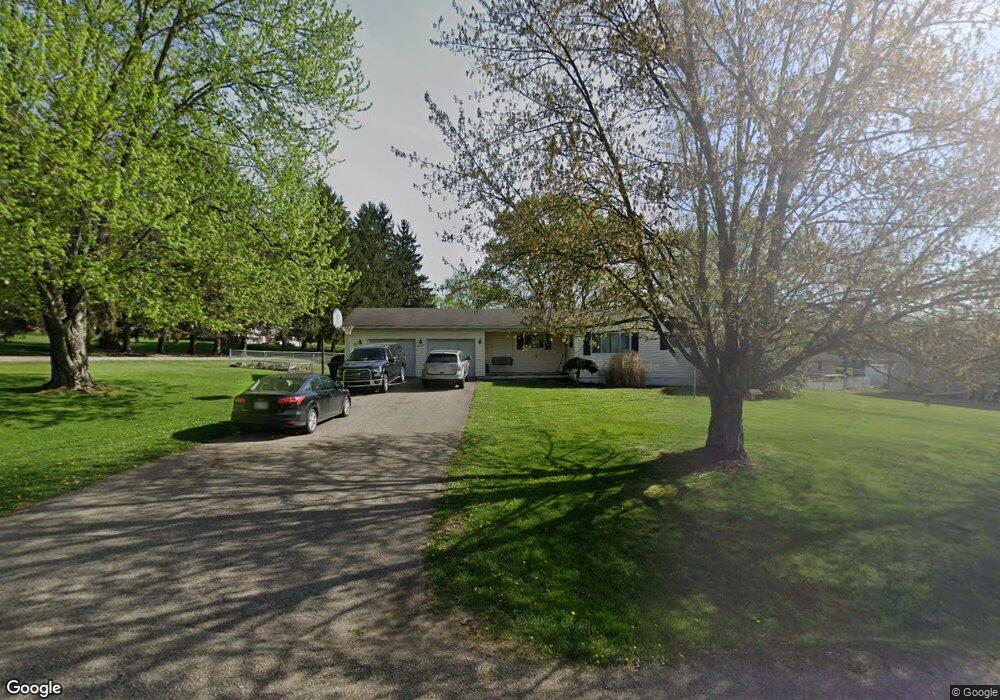
6515 Swing A Long Ln Nashport, OH 43830
Estimated Value: $237,000 - $272,578
3
Beds
1
Bath
944
Sq Ft
$268/Sq Ft
Est. Value
About This Home
This home is located at 6515 Swing A Long Ln, Nashport, OH 43830 and is currently estimated at $253,145, approximately $268 per square foot. 6515 Swing A Long Ln is a home located in Muskingum County with nearby schools including Tri-Valley High School.
Ownership History
Date
Name
Owned For
Owner Type
Purchase Details
Closed on
Oct 23, 2003
Sold by
Cronin Carl B and Cronin Valarie A
Bought by
Wilson Joshua C
Current Estimated Value
Home Financials for this Owner
Home Financials are based on the most recent Mortgage that was taken out on this home.
Original Mortgage
$117,500
Outstanding Balance
$54,908
Interest Rate
6.23%
Mortgage Type
Purchase Money Mortgage
Estimated Equity
$198,237
Purchase Details
Closed on
Jun 1, 1992
Bought by
Mcconaha Mark B and Mcconaha Polly R
Create a Home Valuation Report for This Property
The Home Valuation Report is an in-depth analysis detailing your home's value as well as a comparison with similar homes in the area
Home Values in the Area
Average Home Value in this Area
Purchase History
| Date | Buyer | Sale Price | Title Company |
|---|---|---|---|
| Wilson Joshua C | $112,000 | -- | |
| Mcconaha Mark B | $58,700 | -- |
Source: Public Records
Mortgage History
| Date | Status | Borrower | Loan Amount |
|---|---|---|---|
| Open | Wilson Joshua C | $117,500 |
Source: Public Records
Tax History Compared to Growth
Tax History
| Year | Tax Paid | Tax Assessment Tax Assessment Total Assessment is a certain percentage of the fair market value that is determined by local assessors to be the total taxable value of land and additions on the property. | Land | Improvement |
|---|---|---|---|---|
| 2024 | $2,165 | $59,290 | $16,030 | $43,260 |
| 2023 | $1,732 | $43,155 | $8,855 | $34,300 |
| 2022 | $1,693 | $43,155 | $8,855 | $34,300 |
| 2021 | $1,542 | $43,155 | $8,855 | $34,300 |
| 2020 | $1,372 | $37,520 | $7,700 | $29,820 |
| 2019 | $1,372 | $37,520 | $7,700 | $29,820 |
| 2018 | $1,316 | $37,520 | $7,700 | $29,820 |
| 2017 | $1,101 | $29,855 | $7,700 | $22,155 |
| 2016 | $1,116 | $29,860 | $7,700 | $22,160 |
| 2015 | $1,114 | $29,860 | $7,700 | $22,160 |
| 2013 | $1,106 | $26,180 | $7,700 | $18,480 |
Source: Public Records
Map
Nearby Homes
- 6355 Brentcrest Dr
- 6365 Brentcrest Dr
- 6250 Tanglewood Dr
- 6740 Swing A Long Ln
- 6730 Dillon Hills Dr
- 6850 Newark Rd
- 6080 Poplar Dr
- 6805 Dillon Hills Dr
- 5605 Pleasant View Dr
- 5295 Milford Dr
- 5880 Ballard Rd
- 5290 Hampton Ct
- 5220 Hampton Ct
- 0 Newark Rd
- 5240 Stonegate Dr
- 5050 Wilshire Dr
- 5260 Stonegate Dr
- 5270 Stonegate Dr
- 5255 Stonegate Dr
- 5265 Stonegate Dr
- 6535 Swing A Long Ln
- 6320 Brentcrest Dr
- 6545 Swing A Long Ln
- 6345 Brentcrest Dr
- 6510 Swing A Long Ln
- 6325 Brentcrest Dr
- 6520 Swing A Long Ln
- 6310 Brentcrest Dr
- 6360 Brentcrest Dr
- 6351 Brentcrest Dr
- 6315 Brentcrest Dr
- 6530 Swing A Long Ln
- 6555 Swing A Long Ln
- 6550 Swing A Long Ln
- 6500 Mack Dr
- 6565 Swing A Long Ln
- 6320 Windsong Way
- 6330 Windsong Way
- 6285 Brentcrest Dr
- 6520 Mack Dr