Estimated Value: $385,052 - $428,000
3
Beds
2
Baths
1,813
Sq Ft
$223/Sq Ft
Est. Value
About This Home
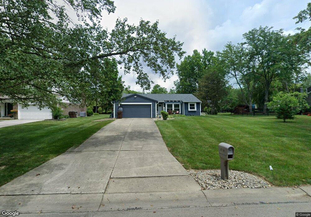
This home is located at 6516 Bluebird Ct, Mason, OH 45040 and is currently estimated at $403,513, approximately $222 per square foot. 6516 Bluebird Ct is a home located in Warren County with nearby schools including Stewart Elementary School, Princeton Community Middle School, and Princeton High School.
Ownership History
Date
Name
Owned For
Owner Type
Purchase Details
Closed on
Sep 10, 1996
Sold by
Komanduri Krishna
Bought by
Brenda Larry R and Brenda Mcguffey
Current Estimated Value
Home Financials for this Owner
Home Financials are based on the most recent Mortgage that was taken out on this home.
Original Mortgage
$70,600
Interest Rate
8.27%
Mortgage Type
New Conventional
Purchase Details
Closed on
May 4, 1992
Sold by
Powell Steven D and Powell Diane
Bought by
Komanduri and Komanduri Krishna M
Purchase Details
Closed on
Oct 3, 1978
Sold by
Lucke & Strassel Builders &
Purchase Details
Closed on
Jun 19, 1978
Sold by
Rippe Rippe and Rippe Elaine B
Create a Home Valuation Report for This Property
The Home Valuation Report is an in-depth analysis detailing your home's value as well as a comparison with similar homes in the area
Home Values in the Area
Average Home Value in this Area
Purchase History
| Date | Buyer | Sale Price | Title Company |
|---|---|---|---|
| Brenda Larry R | $126,500 | -- | |
| Komanduri | $117,500 | -- | |
| -- | $75,400 | -- | |
| -- | $87,000 | -- |
Source: Public Records
Mortgage History
| Date | Status | Borrower | Loan Amount |
|---|---|---|---|
| Previous Owner | Brenda Larry R | $70,600 |
Source: Public Records
Tax History
| Year | Tax Paid | Tax Assessment Tax Assessment Total Assessment is a certain percentage of the fair market value that is determined by local assessors to be the total taxable value of land and additions on the property. | Land | Improvement |
|---|---|---|---|---|
| 2025 | $4,625 | $108,870 | $31,500 | $77,370 |
| 2024 | $4,625 | $108,870 | $31,500 | $77,370 |
| 2023 | $3,865 | $86,348 | $17,220 | $69,128 |
| 2022 | $4,327 | $86,349 | $17,220 | $69,129 |
| 2021 | $4,072 | $86,349 | $17,220 | $69,129 |
| 2020 | $3,656 | $70,203 | $14,000 | $56,203 |
| 2019 | $3,865 | $70,203 | $14,000 | $56,203 |
| 2018 | $3,601 | $70,203 | $14,000 | $56,203 |
| 2017 | $3,337 | $62,136 | $13,115 | $49,021 |
| 2016 | $3,470 | $62,136 | $13,115 | $49,021 |
| 2015 | $3,487 | $62,136 | $13,115 | $49,021 |
| 2014 | $3,081 | $53,560 | $11,310 | $42,260 |
| 2013 | $2,980 | $66,340 | $14,000 | $52,340 |
Source: Public Records
Map
Nearby Homes
- 12114 4th Ave
- 12152 3rd Ave
- 9907 Kensington Ln
- 9867 Kensington Ln
- 11756 Thayer Ln
- 12102 Paulmeadows Dr
- 9509 Butler Warren Rd
- 12173 Crestfield Ct
- 6891 Fields Ertel Rd
- 12168 Crestfield Ct
- 5686 Farm Field Dr
- 8830 Butler Warren Rd
- 8820 Butler Warren Rd
- 5449 Old Farm Dr
- Winslow Plan at Losh Landing - Masterpiece Collection
- Paxton Plan at Losh Landing - Masterpiece Collection
- Huxley Plan at Losh Landing - Masterpiece Collection
- Pearson Plan at Losh Landing - Masterpiece Collection
- Beckett Plan at Losh Landing - Masterpiece Collection
- Leland Plan at Losh Landing - Masterpiece Collection
- 6530 Bluebird Ct
- 6500 Bluebird Ct
- 9911 Whippoorwill Ln
- 6546 Bluebird Ct
- 6517 Owlwood Dr
- 6531 Owlwood Dr
- 6499 Owlwood Dr
- 6545 Owlwood Dr
- 6517 Bluebird Ct
- 9963 Whippoorwill Ln
- 6560 Bluebird Ct
- 6531 Bluebird Ct
- 9895 Whippoorwill Ln
- 6561 Owlwood Dr
- 6547 Bluebird Ct
- 6575 Owlwood Dr
- 6574 Bluebird Ct
- 6561 Bluebird Ct
- 9954 Whippoorwill Ln
- 9920 Whippoorwill Ln
Your Personal Tour Guide
Ask me questions while you tour the home.