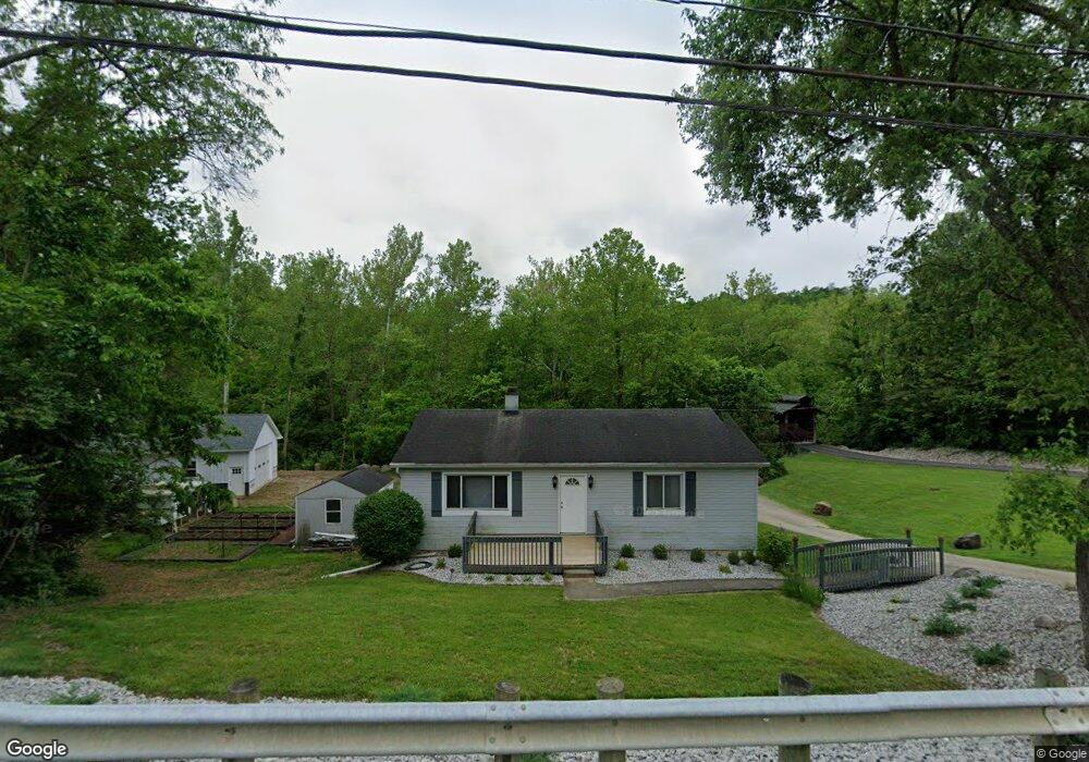
6517 Blue Rock Rd Cincinnati, OH 45247
Estimated Value: $176,000 - $220,000
2
Beds
1
Bath
1,064
Sq Ft
$192/Sq Ft
Est. Value
About This Home
This home is located at 6517 Blue Rock Rd, Cincinnati, OH 45247 and is currently estimated at $204,221, approximately $191 per square foot. 6517 Blue Rock Rd is a home located in Hamilton County with nearby schools including Colerain Elementary School, Colerain Middle School, and Colerain High School.
Ownership History
Date
Name
Owned For
Owner Type
Purchase Details
Closed on
Jan 16, 2004
Sold by
Reuter James F
Bought by
Kinross Ronald C and Kinross Stephanie L
Current Estimated Value
Purchase Details
Closed on
Apr 27, 1995
Sold by
Shackleford Alta F and Stamper Raymond D
Bought by
Kinross Ronald C and Kinross Stephanie L
Home Financials for this Owner
Home Financials are based on the most recent Mortgage that was taken out on this home.
Original Mortgage
$121,600
Interest Rate
8.42%
Create a Home Valuation Report for This Property
The Home Valuation Report is an in-depth analysis detailing your home's value as well as a comparison with similar homes in the area
Home Values in the Area
Average Home Value in this Area
Purchase History
We collect this data history from publicly available records. To have your information removed, we recommend requesting removal directly through your county’s website.
| Date | Buyer | Sale Price | Title Company |
|---|---|---|---|
| Kinross Ronald C | -- | -- | |
| Kinross Ronald C | $152,000 | -- |
Source: Public Records
Mortgage History
We collect this data history from publicly available records. To have your information removed, we recommend requesting removal directly through your county’s website.
| Date | Status | Borrower | Loan Amount |
|---|---|---|---|
| Previous Owner | Kinross Ronald C | $121,600 |
Source: Public Records
Tax History
| Year | Tax Paid | Tax Assessment Tax Assessment Total Assessment is a certain percentage of the fair market value that is determined by local assessors to be the total taxable value of land and additions on the property. | Land | Improvement |
|---|---|---|---|---|
| 2025 | $2,016 | $44,976 | $11,603 | $33,373 |
| 2024 | $1,878 | $44,976 | $11,603 | $33,373 |
| 2023 | $1,931 | $44,976 | $11,603 | $33,373 |
| 2022 | $1,262 | $27,756 | $14,249 | $13,507 |
| 2021 | $1,243 | $27,756 | $14,249 | $13,507 |
| 2020 | $1,266 | $27,756 | $14,249 | $13,507 |
| 2019 | $1,055 | $23,520 | $12,075 | $11,445 |
| 2018 | $948 | $23,520 | $12,075 | $11,445 |
| 2017 | $893 | $23,520 | $12,075 | $11,445 |
| 2016 | $921 | $23,895 | $11,473 | $12,422 |
| 2015 | $936 | $23,895 | $11,473 | $12,422 |
| 2014 | $938 | $23,895 | $11,473 | $12,422 |
| 2013 | $968 | $25,151 | $12,075 | $13,076 |
Source: Public Records
Map
Nearby Homes
- 6109 Thompson Rd
- 10232 Roppelt Rd
- 6983 Daybreak Dr
- 8029 Valley Crossing Dr
- 7970 Valley Crossing Dr
- 5778 Blue Rock Hill Rd
- 5630 Dry Ridge Rd
- 6251 Springdale Rd
- 6811 Chapel Ln
- 5638 Springdale Rd
- 6184 Mullen Rd
- 5663 Old Blue Rock Rd Unit 47
- 6968 Chapel Ln
- 6982 Chapel Ln
- 7351 Vista View Cir
- 5609 Old Blue Rock Rd Unit 25
- 7282 Villa Ln
- 6590 River Rd
- 7117 Fort Scott Blvd
- 9873 Kittywood Dr
- 6565 Blue Rock Rd
- 6481 Blue Rock Rd
- 6481 Blue Rock Rd Unit Lt 14
- 6544 Blue Rock Rd
- 6558 Blue Rock Rd
- 6534 Blue Rock Rd
- 6582 Blue Rock Rd
- 6521 Blue Rock Rd
- 6590 Blue Rock Rd
- 6594 Blue Rock Rd
- 9603 Weik Rd
- 6598 Blue Rock Rd
- 6600 Blue Rock Rd
- 6606 Blue Rock Rd
- 9649 Weik Rd
- 9661 Weik Rd
- 9635 Weik Rd
- 9623 Weik Rd
- 6365 Blue Rock Rd
- 9673 Weik Rd
Your Personal Tour Guide
Ask me questions while you tour the home.