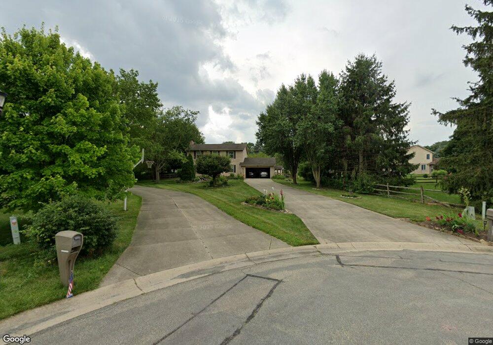
6518 Karincrest Dr Liberty Township, OH 45044
Estimated Value: $434,695 - $493,000
4
Beds
3
Baths
2,104
Sq Ft
$219/Sq Ft
Est. Value
About This Home
This home is located at 6518 Karincrest Dr, Liberty Township, OH 45044 and is currently estimated at $461,674, approximately $219 per square foot. 6518 Karincrest Dr is a home located in Butler County with nearby schools including Woodland Elementary School, Liberty Junior School, and Lakota East High School.
Ownership History
Date
Name
Owned For
Owner Type
Purchase Details
Closed on
Feb 15, 2000
Sold by
Cuervo Michael A and Cuervo Darlene F
Bought by
Cohn Bradley and Cohn Annette
Current Estimated Value
Home Financials for this Owner
Home Financials are based on the most recent Mortgage that was taken out on this home.
Original Mortgage
$172,380
Interest Rate
8.5%
Mortgage Type
VA
Purchase Details
Closed on
Sep 3, 1997
Sold by
Landmark Communities Inc
Bought by
Cuervo Michael A and Cuervo Darlene
Home Financials for this Owner
Home Financials are based on the most recent Mortgage that was taken out on this home.
Original Mortgage
$55,200
Interest Rate
7.54%
Mortgage Type
New Conventional
Purchase Details
Closed on
Dec 19, 1994
Sold by
Harold Maggard Trst
Bought by
P R Properties Inc
Create a Home Valuation Report for This Property
The Home Valuation Report is an in-depth analysis detailing your home's value as well as a comparison with similar homes in the area
Home Values in the Area
Average Home Value in this Area
Purchase History
| Date | Buyer | Sale Price | Title Company |
|---|---|---|---|
| Cohn Bradley | $169,000 | -- | |
| Cuervo Michael A | $145,200 | -- | |
| P R Properties Inc | $96,000 | -- |
Source: Public Records
Mortgage History
| Date | Status | Borrower | Loan Amount |
|---|---|---|---|
| Previous Owner | Cohn Bradley | $172,380 | |
| Previous Owner | Cuervo Michael A | $55,200 |
Source: Public Records
Tax History Compared to Growth
Tax History
| Year | Tax Paid | Tax Assessment Tax Assessment Total Assessment is a certain percentage of the fair market value that is determined by local assessors to be the total taxable value of land and additions on the property. | Land | Improvement |
|---|---|---|---|---|
| 2024 | $4,629 | $116,240 | $13,180 | $103,060 |
| 2023 | $4,570 | $115,710 | $13,180 | $102,530 |
| 2022 | $4,079 | $81,110 | $13,180 | $67,930 |
| 2021 | $4,058 | $81,110 | $13,180 | $67,930 |
| 2020 | $4,158 | $81,110 | $13,180 | $67,930 |
| 2019 | $6,577 | $68,280 | $13,010 | $55,270 |
| 2018 | $3,900 | $68,280 | $13,010 | $55,270 |
| 2017 | $3,957 | $68,280 | $13,010 | $55,270 |
| 2016 | $3,560 | $61,080 | $13,010 | $48,070 |
| 2015 | $3,510 | $61,080 | $13,010 | $48,070 |
| 2014 | $3,593 | $61,080 | $13,010 | $48,070 |
| 2013 | $3,593 | $57,760 | $13,010 | $44,750 |
Source: Public Records
Map
Nearby Homes
- 6405 Cincinnati Dayton Rd
- 6681 Cincinnati Dayton Rd
- 6335 Gem Stone Dr
- 7232 Eaglestone Ct
- 6703 Cincinnati Dayton Rd
- 7241 Stonebrook Ct
- 7162 Wyandot Ln
- 6821 Cincinnati Dayton Rd
- 7109 Maple Creek Dr
- 7147 Wilhelmina Dr
- 6951 Ash Creek Ct
- 6300 Lindsey Ct
- 6921 Woodland View Dr
- 7644 Millikin Rd
- 5933 Old Pebble Path
- 7120 Shady Brook Bend
- 5913 Stones Throw Way
- 6895 Dutchland Blvd
- 7113 Shady Brook Bend
- 6919 Millikin Rd
- 6508 Karincrest Dr
- 6548 Karincrest Dr
- 6558 Karincrest Dr
- 6588 Karincrest Dr
- 6498 Karincrest Dr
- 6528 Karincrest Dr
- 6598 Karincrest Dr
- 6568 Karincrest Dr
- 6608 Karincrest Dr
- 6501 Karincrest Dr
- 6618 Karincrest Dr
- 6507 Karincrest Dr
- 6513 Streamstone Dr
- 6513 Karincrest Dr
- 7360 Stoney Pointe
- 6499 Streamstone Dr
- 7361 Stoney Point
- 6589 Karincrest Dr
- 6579 Karincrest Dr
- 6559 Karincrest Dr