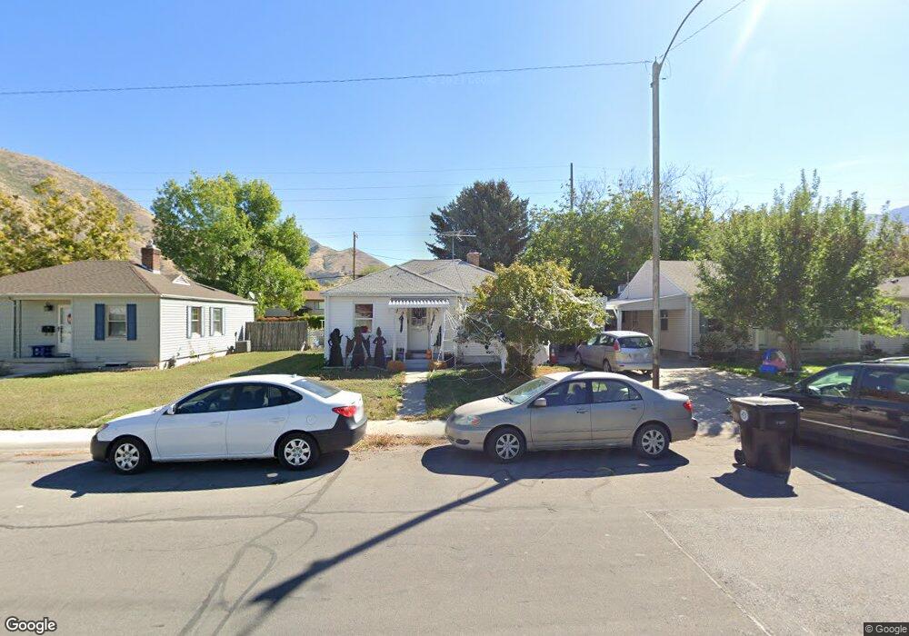
652 Brookside Dr Springville, UT 84663
East Hobble Creek NeighborhoodEstimated Value: $385,000 - $418,000
3
Beds
2
Baths
1,596
Sq Ft
$251/Sq Ft
Est. Value
About This Home
This home is located at 652 Brookside Dr, Springville, UT 84663 and is currently estimated at $400,832, approximately $251 per square foot. 652 Brookside Dr is a home located in Utah County with nearby schools including Brookside School, Springville Junior High School, and Springville High School.
Ownership History
Date
Name
Owned For
Owner Type
Purchase Details
Closed on
May 23, 2016
Sold by
American Pension Service Inc
Bought by
Equity Trust Coampany and Barbara Lewis Palfreyman Ira
Current Estimated Value
Purchase Details
Closed on
Sep 27, 2012
Sold by
Komp Jennie
Bought by
American Pensions Services Inc
Purchase Details
Closed on
May 28, 2010
Sold by
Palfreyman Robert E
Bought by
Komp Jennie
Home Financials for this Owner
Home Financials are based on the most recent Mortgage that was taken out on this home.
Original Mortgage
$146,000
Interest Rate
5.03%
Mortgage Type
Purchase Money Mortgage
Purchase Details
Closed on
May 18, 2010
Sold by
Palfreyman Robert E and Palfreyman Barbara Lewis
Bought by
Palfreyman Robert E
Home Financials for this Owner
Home Financials are based on the most recent Mortgage that was taken out on this home.
Original Mortgage
$146,000
Interest Rate
5.03%
Mortgage Type
Purchase Money Mortgage
Purchase Details
Closed on
Mar 3, 2010
Sold by
Aurora Loan Services Llc
Bought by
Palfreyman Robert E and Palfreyman Barbara Lewis
Purchase Details
Closed on
Feb 1, 2010
Sold by
Waite Bryan and Waite Nicole
Bought by
Aurora Loan Services Llc
Purchase Details
Closed on
May 24, 2002
Sold by
Richards Jeremy L and Richards Rachel P
Bought by
Waite Bryan K and Waite Nicole R
Home Financials for this Owner
Home Financials are based on the most recent Mortgage that was taken out on this home.
Original Mortgage
$112,050
Interest Rate
8.62%
Purchase Details
Closed on
Jan 26, 2001
Sold by
Richards Jeremy L
Bought by
Richards Jeremy L and Richards Rachel P
Home Financials for this Owner
Home Financials are based on the most recent Mortgage that was taken out on this home.
Original Mortgage
$108,000
Interest Rate
7.13%
Purchase Details
Closed on
Jul 13, 2000
Sold by
Jordison Carrie D and Jordison John Robert
Bought by
Richards Jeremy L
Home Financials for this Owner
Home Financials are based on the most recent Mortgage that was taken out on this home.
Original Mortgage
$106,125
Interest Rate
8.55%
Mortgage Type
FHA
Create a Home Valuation Report for This Property
The Home Valuation Report is an in-depth analysis detailing your home's value as well as a comparison with similar homes in the area
Home Values in the Area
Average Home Value in this Area
Purchase History
| Date | Buyer | Sale Price | Title Company |
|---|---|---|---|
| Equity Trust Coampany | -- | None Available | |
| American Pensions Services Inc | -- | Inwest Title Services Inc | |
| Komp Jennie | -- | Inwest Title Services Inc | |
| Palfreyman Robert E | -- | Inwest Title Services Inc | |
| Palfreyman Robert E | -- | Backman Fptp | |
| Aurora Loan Services Llc | $141,300 | Security Title Insurance Ag | |
| Waite Bryan K | -- | Wasatch Land & Title | |
| Richards Jeremy L | -- | Associated Title Company | |
| Richards Jeremy L | -- | Associated Title Company |
Source: Public Records
Mortgage History
| Date | Status | Borrower | Loan Amount |
|---|---|---|---|
| Previous Owner | Komp Jennie | $146,000 | |
| Previous Owner | Waite Bryan K | $112,050 | |
| Previous Owner | Richards Jeremy L | $108,000 | |
| Previous Owner | Richards Jeremy L | $106,125 |
Source: Public Records
Tax History
| Year | Tax Paid | Tax Assessment Tax Assessment Total Assessment is a certain percentage of the fair market value that is determined by local assessors to be the total taxable value of land and additions on the property. | Land | Improvement |
|---|---|---|---|---|
| 2025 | $1,720 | $191,070 | -- | -- |
| 2024 | $1,720 | $176,165 | $0 | $0 |
| 2023 | $1,650 | $169,235 | $0 | $0 |
| 2022 | $1,660 | $167,145 | $0 | $0 |
| 2021 | $1,491 | $233,800 | $85,400 | $148,400 |
| 2020 | $1,370 | $208,200 | $71,200 | $137,000 |
| 2019 | $1,252 | $193,700 | $71,200 | $122,500 |
| 2018 | $1,290 | $190,400 | $68,000 | $122,400 |
| 2017 | $1,141 | $89,485 | $0 | $0 |
| 2016 | $986 | $75,790 | $0 | $0 |
| 2015 | $953 | $74,910 | $0 | $0 |
| 2014 | $904 | $70,565 | $0 | $0 |
Source: Public Records
Map
Nearby Homes
- 883 E 700 S
- 68 Brookside Dr
- 805 E 400 S
- 1062 E 350 S
- 645 Swenson Ave Unit 5
- 645 Swenson Ave Unit 3
- 647 Swenson Ave Unit 3
- 2554 E 350 S Unit 4
- 1185 Hillcrest Dr
- 677 E 800 South St
- 1361 E 400 S
- 949 S 1060 E
- 445 E 535 S
- 557 S 1470 E
- 579 E 800 St S
- 629 E 800 St S
- 616 E Aaron Ave
- 337 E 600 S
- 511 S 300 E Unit 2
- 66 E 750 S Unit 23
- 638 Brookside Dr
- 666 Brookside Dr
- 624 Brookside Dr
- 680 Brookside Dr
- 680 S Brookside Dr
- 605 S Weight Ave
- 659 Brookside Dr
- 610 Brookside Dr
- 585 S Weight Ave
- 692 Brookside Dr
- 629 Brookside Dr
- 679 Brookside Dr
- 598 S Brookside Dr
- 704 Brookside Dr
- 611 Brookside Dr
- 155 B St
- 695 Brookside Dr
- 635 S Weight Ave
- 146 B St
- 586 Brookside Dr
Your Personal Tour Guide
Ask me questions while you tour the home.