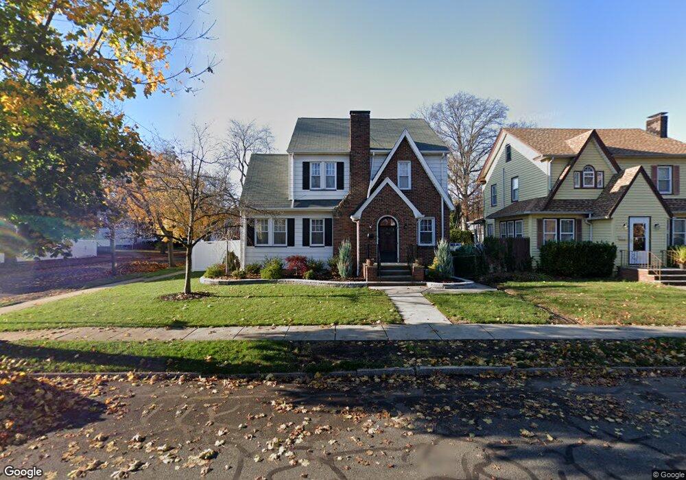
652 Bryant St Rahway, NJ 07065
Estimated Value: $590,000 - $631,524
3
Beds
3
Baths
1,796
Sq Ft
$340/Sq Ft
Est. Value
About This Home
This home is located at 652 Bryant St, Rahway, NJ 07065 and is currently estimated at $611,381, approximately $340 per square foot. 652 Bryant St is a home located in Union County with nearby schools including Rahway High School.
Ownership History
Date
Name
Owned For
Owner Type
Purchase Details
Closed on
Sep 28, 2007
Sold by
Aguilla Pedro A and Aguilla Michele
Bought by
Potnoski Thomas and White Shelly
Current Estimated Value
Home Financials for this Owner
Home Financials are based on the most recent Mortgage that was taken out on this home.
Original Mortgage
$330,000
Outstanding Balance
$209,243
Interest Rate
6.51%
Mortgage Type
Purchase Money Mortgage
Estimated Equity
$402,138
Create a Home Valuation Report for This Property
The Home Valuation Report is an in-depth analysis detailing your home's value as well as a comparison with similar homes in the area
Home Values in the Area
Average Home Value in this Area
Purchase History
| Date | Buyer | Sale Price | Title Company |
|---|---|---|---|
| Potnoski Thomas | $412,500 | Coastal Title Agency Inc |
Source: Public Records
Mortgage History
| Date | Status | Borrower | Loan Amount |
|---|---|---|---|
| Open | Potnoski Thomas | $330,000 |
Source: Public Records
Tax History Compared to Growth
Tax History
| Year | Tax Paid | Tax Assessment Tax Assessment Total Assessment is a certain percentage of the fair market value that is determined by local assessors to be the total taxable value of land and additions on the property. | Land | Improvement |
|---|---|---|---|---|
| 2025 | $11,855 | $160,100 | $52,200 | $107,900 |
| 2024 | $11,482 | $160,100 | $52,200 | $107,900 |
| 2023 | $11,482 | $160,100 | $52,200 | $107,900 |
| 2022 | $11,242 | $160,100 | $52,200 | $107,900 |
| 2021 | $11,129 | $160,100 | $52,200 | $107,900 |
| 2020 | $11,087 | $160,100 | $52,200 | $107,900 |
| 2019 | $10,946 | $160,100 | $52,200 | $107,900 |
| 2018 | $10,715 | $160,100 | $52,200 | $107,900 |
| 2017 | $10,451 | $160,100 | $52,200 | $107,900 |
| 2016 | $10,229 | $160,100 | $52,200 | $107,900 |
| 2015 | $10,114 | $160,100 | $52,200 | $107,900 |
| 2014 | $9,933 | $160,100 | $52,200 | $107,900 |
Source: Public Records
Map
Nearby Homes
- 275 Forbes St
- 182 W Lake Ave
- 181 W Stearns St
- 59 Minna St
- 277 Orchard St
- 331 W Inman Ave
- 163 Stanton St
- 306 Orchard St
- 653 New Brunswick Ave
- 372 W Hazelwood Ave
- 48 W Hazelwood Ave
- 1016 Jaques Ave
- 591 Harris Dr
- 723 Dianne Ct
- 139 Maple Ave Unit 104
- 593 W Hazelwood Ave
- 156 W Emerson Ave
- 1025 New Brunswick Ave
- 935 Thorn St
- 276 E Stearns St