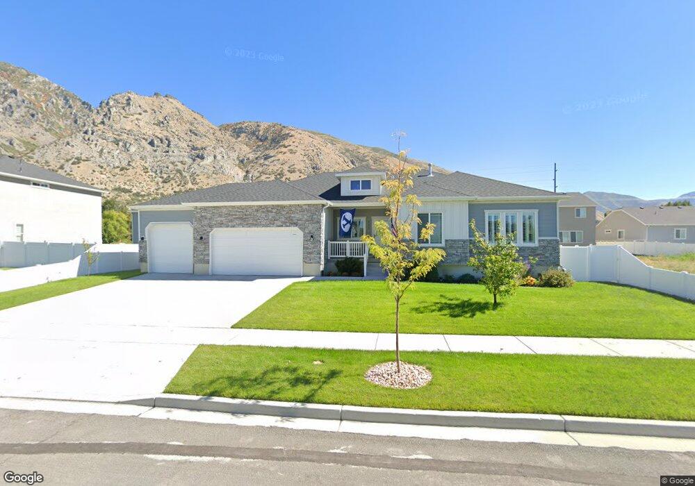
652 N 375 E Unit LOT 23 Springville, UT 84663
Little Rock Canyon NeighborhoodEstimated Value: $653,656 - $679,000
4
Beds
3
Baths
3,353
Sq Ft
$199/Sq Ft
Est. Value
About This Home
This home is located at 652 N 375 E Unit LOT 23, Springville, UT 84663 and is currently estimated at $667,885, approximately $199 per square foot. 652 N 375 E Unit LOT 23 is a home located in Utah County with nearby schools including Cherry Creek Elementary School, Springville Junior High School, and Springville High School.
Ownership History
Date
Name
Owned For
Owner Type
Purchase Details
Closed on
Feb 12, 2019
Sold by
Camberlango Development Group Llc
Bought by
Lesue Geoffrey Martin and Lesue Dianne
Current Estimated Value
Home Financials for this Owner
Home Financials are based on the most recent Mortgage that was taken out on this home.
Original Mortgage
$258,500
Outstanding Balance
$197,393
Interest Rate
4.5%
Mortgage Type
New Conventional
Estimated Equity
$470,492
Purchase Details
Closed on
Jul 11, 2017
Sold by
Peay Construction Co Inc
Bought by
Camberlango Development Group Llc
Home Financials for this Owner
Home Financials are based on the most recent Mortgage that was taken out on this home.
Original Mortgage
$179,132
Interest Rate
3.94%
Mortgage Type
Commercial
Create a Home Valuation Report for This Property
The Home Valuation Report is an in-depth analysis detailing your home's value as well as a comparison with similar homes in the area
Home Values in the Area
Average Home Value in this Area
Purchase History
| Date | Buyer | Sale Price | Title Company |
|---|---|---|---|
| Lesue Geoffrey Martin | -- | Provo Land Title Co | |
| Camberlango Development Group Llc | -- | Bartlett Title Ins Agency |
Source: Public Records
Mortgage History
| Date | Status | Borrower | Loan Amount |
|---|---|---|---|
| Open | Lesue Geoffrey Martin | $258,500 | |
| Previous Owner | Camberlango Development Group Llc | $179,132 |
Source: Public Records
Tax History
| Year | Tax Paid | Tax Assessment Tax Assessment Total Assessment is a certain percentage of the fair market value that is determined by local assessors to be the total taxable value of land and additions on the property. | Land | Improvement |
|---|---|---|---|---|
| 2025 | $3,156 | $343,750 | -- | -- |
| 2024 | $3,156 | $323,290 | $0 | $0 |
| 2023 | $3,123 | $320,320 | $0 | $0 |
| 2022 | $3,046 | $306,735 | $0 | $0 |
| 2021 | $2,593 | $406,500 | $118,900 | $287,600 |
| 2020 | $2,414 | $366,900 | $95,100 | $271,800 |
| 2019 | $1,662 | $257,100 | $95,100 | $162,000 |
| 2018 | $1,171 | $95,100 | $95,100 | $0 |
| 2017 | $898 | $70,400 | $0 | $0 |
Source: Public Records
Map
Nearby Homes
- 696 N 375 E
- 677 N 400 E Unit LOT 26
- 643 N 400 E Unit LOT 27
- 691 N 400 E Unit LOT 25
- 369 E 625 N Unit LOT 16
- 368 E 700 N
- 368 E 700 N Unit LOT 15
- 605 N 400 E Unit LOT 28
- 605 N 400 E
- 373 E 625 N
- 586 N 350 E
- 347 E 625 N Unit LOT 17
- 587 N 400 E Unit LOT 29
- 708 N 375 E
- 344 E 700 N
- 344 E 700 N Unit LOT 14
- 709 N 375 E
- 602 N 400 E
- 712 N 375 E
- 387 E 550 N
Your Personal Tour Guide
Ask me questions while you tour the home.