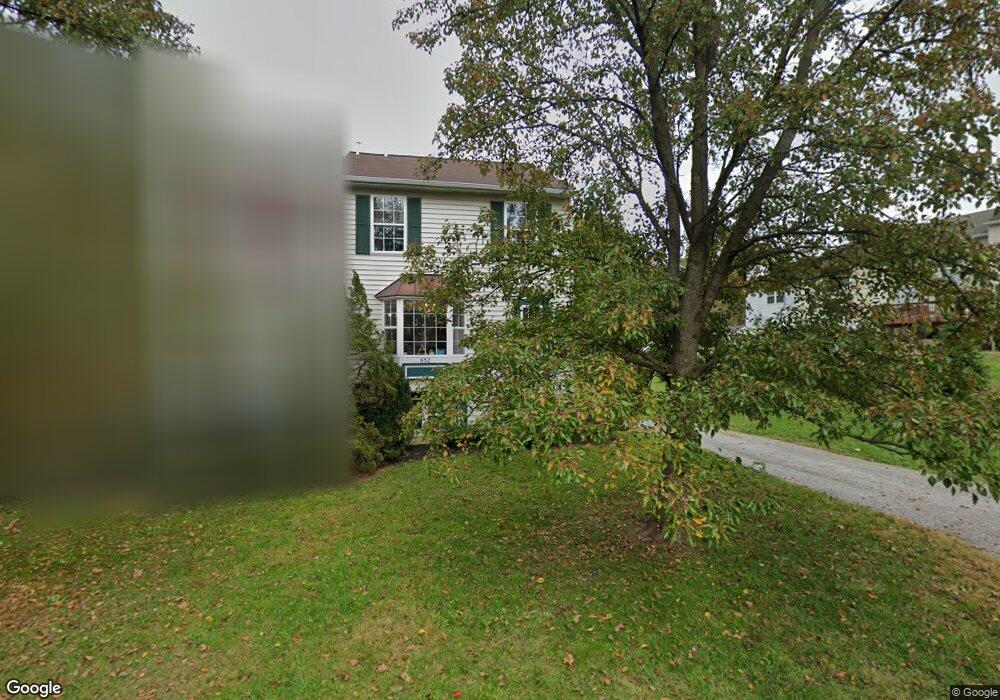
652 Retriever Dr Hampstead, MD 21074
Estimated Value: $280,593 - $324,000
Studio
2
Baths
1,216
Sq Ft
$247/Sq Ft
Est. Value
About This Home
This home is located at 652 Retriever Dr, Hampstead, MD 21074 and is currently estimated at $300,898, approximately $247 per square foot. 652 Retriever Dr is a home located in Carroll County with nearby schools including Spring Garden Elementary School, Shiloh Middle School, and Manchester Valley High School.
Ownership History
Date
Name
Owned For
Owner Type
Purchase Details
Closed on
Jan 25, 2024
Sold by
Breznicky Kathy A
Bought by
Breznicky Family Revocable Living Trust and Breznicky
Current Estimated Value
Purchase Details
Closed on
Apr 28, 2003
Sold by
Kearns Michael Stewart
Bought by
Mcquaid Kathy A
Purchase Details
Closed on
Oct 12, 1994
Sold by
Woodhaven Building & Dev Inc
Bought by
Kearns Michael S
Home Financials for this Owner
Home Financials are based on the most recent Mortgage that was taken out on this home.
Original Mortgage
$118,700
Interest Rate
8.43%
Create a Home Valuation Report for This Property
The Home Valuation Report is an in-depth analysis detailing your home's value as well as a comparison with similar homes in the area
Home Values in the Area
Average Home Value in this Area
Purchase History
| Date | Buyer | Sale Price | Title Company |
|---|---|---|---|
| Breznicky Family Revocable Living Trust | -- | None Listed On Document | |
| Mcquaid Kathy A | $135,000 | -- | |
| Kearns Michael S | $116,411 | -- |
Source: Public Records
Mortgage History
| Date | Status | Borrower | Loan Amount |
|---|---|---|---|
| Previous Owner | Kearns Michael S | $118,700 |
Source: Public Records
Tax History
| Year | Tax Paid | Tax Assessment Tax Assessment Total Assessment is a certain percentage of the fair market value that is determined by local assessors to be the total taxable value of land and additions on the property. | Land | Improvement |
|---|---|---|---|---|
| 2025 | $3,609 | $261,700 | $90,000 | $171,700 |
| 2024 | $3,395 | $245,767 | $0 | $0 |
| 2023 | $3,182 | $229,833 | $0 | $0 |
| 2022 | $2,968 | $213,900 | $70,000 | $143,900 |
| 2021 | $2,914 | $210,600 | $0 | $0 |
| 2020 | $2,870 | $207,300 | $0 | $0 |
| 2019 | $2,846 | $204,000 | $70,000 | $134,000 |
| 2018 | $2,739 | $197,567 | $0 | $0 |
| 2017 | $2,653 | $191,133 | $0 | $0 |
| 2016 | -- | $184,700 | $0 | $0 |
| 2015 | -- | $184,700 | $0 | $0 |
| 2014 | -- | $184,700 | $0 | $0 |
Source: Public Records
Map
Nearby Homes
- 4440 N Woods Trail
- 4470 Woodsman Dr Unit 731
- 4367 Sycamore Dr
- 0 Trenton Mill Rd Unit MDBC2117946
- 4220 Crystal Ct Unit 3D
- 4240 Crystal Ct Unit 2A
- 806 Clearview Ave
- 1209 Woodland Ct
- 920 N Houcksville Rd
- 4138 Hillcrest Ave
- 3992 Terrace Dr
- 3870 Normandy Dr Unit 1D
- 820 Wembley Dr Unit 2C
- 820 Wembley Dr Unit 2A
- 820 Wembley Dr Unit 2B
- 820 Wembley Dr Unit 3D
- 820 Wembley Dr Unit 2D
- 820 Wembley Dr Unit 1D
- 820 Wembley Dr Unit 1A
- 820 Wembley Dr Unit 3B
- 654 Retriever Dr
- 4700 Barbed Ct
- 4702 Barbed Ct
- 4704 Barbed Ct
- 653 Retriever Dr
- 4706 Barbed Ct
- 655 Retriever Dr
- 4668 Marksman Ct
- 4664 Marksman Ct
- 4662 Marksman Ct
- 4658 Marksman Ct
- 4656 Marksman Ct
- 4712 Barbed Ct
- 4654 Marksman Ct
- 4714 Barbed Ct
- 4869 Hillock Ln
- 4652 Marksman Ct
- 4701 Barbed Ct
- 4659 Marksman Ct
- 4716 Barbed Ct
Your Personal Tour Guide
Ask me questions while you tour the home.