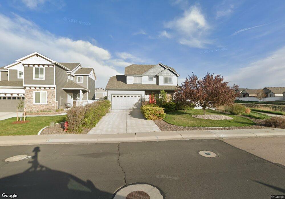
652 Sundance Dr Windsor, CO 80550
Estimated Value: $528,274 - $638,000
3
Beds
3
Baths
1,992
Sq Ft
$294/Sq Ft
Est. Value
About This Home
This home is located at 652 Sundance Dr, Windsor, CO 80550 and is currently estimated at $585,069, approximately $293 per square foot. 652 Sundance Dr is a home located in Weld County with nearby schools including Severance Middle School, Windsor High School, and Windsor Charter Academy Elementary School.
Ownership History
Date
Name
Owned For
Owner Type
Purchase Details
Closed on
Jul 3, 2024
Sold by
Fuentes Jarred M
Bought by
Fuentes Gwendolyn L
Current Estimated Value
Purchase Details
Closed on
Dec 22, 2010
Sold by
Sage Homes Llc
Bought by
Fuentes Jarred M
Home Financials for this Owner
Home Financials are based on the most recent Mortgage that was taken out on this home.
Original Mortgage
$198,872
Interest Rate
4.18%
Mortgage Type
New Conventional
Create a Home Valuation Report for This Property
The Home Valuation Report is an in-depth analysis detailing your home's value as well as a comparison with similar homes in the area
Purchase History
| Date | Buyer | Sale Price | Title Company |
|---|---|---|---|
| Fuentes Gwendolyn L | -- | None Listed On Document | |
| Fuentes Jarred M | $257,982 | Land Title Guarantee Company |
Source: Public Records
Mortgage History
| Date | Status | Borrower | Loan Amount |
|---|---|---|---|
| Previous Owner | Fuentes Jarred M | $198,872 |
Source: Public Records
Tax History
| Year | Tax Paid | Tax Assessment Tax Assessment Total Assessment is a certain percentage of the fair market value that is determined by local assessors to be the total taxable value of land and additions on the property. | Land | Improvement |
|---|---|---|---|---|
| 2025 | $4,117 | $33,340 | $7,500 | $25,840 |
| 2024 | $4,117 | $33,340 | $7,500 | $25,840 |
| 2023 | $3,869 | $36,100 | $6,770 | $29,330 |
| 2022 | $3,537 | $26,110 | $6,320 | $19,790 |
| 2021 | $3,395 | $26,870 | $6,510 | $20,360 |
| 2020 | $3,252 | $25,250 | $5,010 | $20,240 |
| 2019 | $3,254 | $25,250 | $5,010 | $20,240 |
| 2018 | $3,356 | $23,850 | $5,040 | $18,810 |
| 2017 | $3,433 | $23,850 | $5,040 | $18,810 |
| 2016 | $3,264 | $22,500 | $3,420 | $19,080 |
| 2015 | $3,120 | $22,500 | $3,420 | $19,080 |
| 2014 | $2,632 | $18,240 | $2,790 | $15,450 |
Source: Public Records
Map
Nearby Homes
- 621 Denali Ct
- 444 Stonebrook Dr
- 597 Red Jewel Dr
- 355 Antora Ct
- 679 Red Jewel Dr
- 18 Boxwood Dr
- 175 Boxwood Dr
- 77 Boxwood Dr
- 848 Shirttail Peak Dr
- 265 Hillspire Dr
- 542 Cherryridge Dr
- 743 Little Leaf Dr
- 244 Veronica Dr
- 240 Hillspire Dr
- 366 Bluestar Dr
- 356 Blue Star Dr
- 9067 County Road 70
- 293 Turnberry Dr
- 283 Turnberry Dr
- 273 Turnberry Dr
- 642 Sundance Dr
- 651 Bighorn Ct
- 641 Bighorn Ct
- 632 Sundance Dr
- 631 Bighorn Ct
- 622 Sundance Dr
- 661 Bighorn Ct
- 634 Vermilion Peak Dr
- 621 Bighorn Ct
- 626 Vermilion Peak Dr
- 612 Sundance Dr
- 640 Vermilion Peak Dr
- 611 Bighorn Ct
- 622 Vermilion Peak Dr
- 652 Bighorn Ct
- 642 Vermilion Peak Dr
- 642 Bighorn Ct
- 544 Kenai Ct
- 602 Sundance Dr
- 614 Vermilion Peak Dr
Your Personal Tour Guide
Ask me questions while you tour the home.