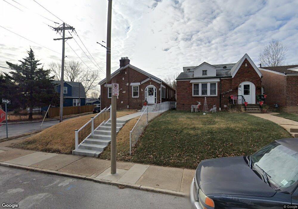
6520 Dale Ave Saint Louis, MO 63139
Franz Park NeighborhoodEstimated Value: $191,000 - $267,000
2
Beds
1
Bath
1,078
Sq Ft
$210/Sq Ft
Est. Value
About This Home
This home is located at 6520 Dale Ave, Saint Louis, MO 63139 and is currently estimated at $226,183, approximately $209 per square foot. 6520 Dale Ave is a home located in St. Louis City with nearby schools including Mason Elementary School, Long International Middle School, and Roosevelt High School.
Ownership History
Date
Name
Owned For
Owner Type
Purchase Details
Closed on
May 27, 2010
Sold by
Rosen Mary and Rosen David A
Bought by
Huge Christopher P
Current Estimated Value
Home Financials for this Owner
Home Financials are based on the most recent Mortgage that was taken out on this home.
Original Mortgage
$76,963
Outstanding Balance
$51,657
Interest Rate
5%
Mortgage Type
FHA
Estimated Equity
$174,526
Create a Home Valuation Report for This Property
The Home Valuation Report is an in-depth analysis detailing your home's value as well as a comparison with similar homes in the area
Home Values in the Area
Average Home Value in this Area
Purchase History
| Date | Buyer | Sale Price | Title Company |
|---|---|---|---|
| Huge Christopher P | -- | U S Title |
Source: Public Records
Mortgage History
| Date | Status | Borrower | Loan Amount |
|---|---|---|---|
| Open | Huge Christopher P | $76,963 |
Source: Public Records
Tax History Compared to Growth
Tax History
| Year | Tax Paid | Tax Assessment Tax Assessment Total Assessment is a certain percentage of the fair market value that is determined by local assessors to be the total taxable value of land and additions on the property. | Land | Improvement |
|---|---|---|---|---|
| 2025 | $2,066 | $29,290 | $1,920 | $27,370 |
| 2024 | $1,966 | $24,350 | $1,920 | $22,430 |
| 2023 | $1,966 | $24,350 | $1,920 | $22,430 |
| 2022 | $1,828 | $21,770 | $1,920 | $19,850 |
| 2021 | $1,825 | $21,770 | $1,920 | $19,850 |
| 2020 | $1,734 | $20,830 | $1,920 | $18,910 |
| 2019 | $1,727 | $20,830 | $1,920 | $18,910 |
| 2018 | $1,528 | $17,820 | $1,920 | $15,900 |
| 2017 | $1,503 | $17,820 | $1,920 | $15,900 |
| 2016 | $1,353 | $15,810 | $1,920 | $13,890 |
| 2015 | $1,228 | $15,810 | $1,920 | $13,890 |
| 2014 | $1,230 | $15,810 | $1,920 | $13,890 |
| 2013 | -- | $15,850 | $1,920 | $13,930 |
Source: Public Records
Map
Nearby Homes
- 1371 Mobile Ct
- 6437 Brockschmidt Place
- 1511 Fairmount Ave
- 1361 Louisville Ave
- 6454 Wade Ave
- 1597 Fairmount Ave
- 1348 Kraft St
- 6750 Plateau Ave
- 1320 Tamm Ave
- 6819 Clyde Terrace
- 6719 Nashville Ave
- 1225 Kraft St
- 1326 Graham St
- 1324 Graham St
- 2020 Prather Ave
- 2036 Prather Ave
- 6827 R Dale Ave
- 1126 Art Hill Place
- 1617 Forest Ave
- 1623 Forest Ave
- 6524 Dale Ave
- 6528 Dale Ave
- 6514 Dale Ave
- 1511 Sanford Ave
- 6532 Dale Ave
- 1515 Sanford Ave
- 6536 Dale Ave
- 6500 Dale Ave
- 6523 Dale Ave
- 1514 Louisville Ave
- 1519 Sanford Ave
- 6540 Dale Ave
- 6490 Lloyd Ave
- 1518 Louisville Ave
- 6527 Dale Ave
- 6495 Lloyd Ave
- 6498 Dale Ave
- 6531 Dale Ave
- 1523 Sanford Ave
- 6493 Lloyd Ave