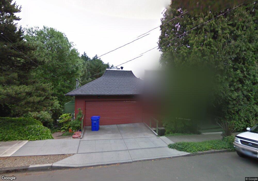
6520 SE Scott Dr Portland, OR 97215
Mount Tabor NeighborhoodEstimated Value: $1,223,000 - $1,784,000
3
Beds
3
Baths
4,303
Sq Ft
$343/Sq Ft
Est. Value
About This Home
This home is located at 6520 SE Scott Dr, Portland, OR 97215 and is currently estimated at $1,475,858, approximately $342 per square foot. 6520 SE Scott Dr is a home located in Multnomah County with nearby schools including Glencoe Elementary School, Mt Tabor Middle School, and Franklin High School.
Ownership History
Date
Name
Owned For
Owner Type
Purchase Details
Closed on
Jun 13, 2015
Sold by
Emery Richard Scott
Bought by
Emery Richard Scott and Beaver Heidi Elise
Current Estimated Value
Home Financials for this Owner
Home Financials are based on the most recent Mortgage that was taken out on this home.
Original Mortgage
$300,000
Outstanding Balance
$113,849
Interest Rate
3.77%
Mortgage Type
New Conventional
Estimated Equity
$1,362,009
Purchase Details
Closed on
Nov 22, 2011
Sold by
Felt James W
Bought by
Felt James W and Hills Jody M
Home Financials for this Owner
Home Financials are based on the most recent Mortgage that was taken out on this home.
Original Mortgage
$361,500
Interest Rate
4.09%
Mortgage Type
New Conventional
Purchase Details
Closed on
Mar 1, 2000
Sold by
Hage Noella A
Bought by
Hills Jody M
Create a Home Valuation Report for This Property
The Home Valuation Report is an in-depth analysis detailing your home's value as well as a comparison with similar homes in the area
Home Values in the Area
Average Home Value in this Area
Purchase History
| Date | Buyer | Sale Price | Title Company |
|---|---|---|---|
| Emery Richard Scott | $1,145,000 | First American | |
| Felt James W | -- | Wfg Title | |
| Hills Jody M | -- | -- |
Source: Public Records
Mortgage History
| Date | Status | Borrower | Loan Amount |
|---|---|---|---|
| Open | Emery Richard Scott | $300,000 | |
| Closed | Felt James W | $361,500 |
Source: Public Records
Tax History Compared to Growth
Tax History
| Year | Tax Paid | Tax Assessment Tax Assessment Total Assessment is a certain percentage of the fair market value that is determined by local assessors to be the total taxable value of land and additions on the property. | Land | Improvement |
|---|---|---|---|---|
| 2024 | $17,043 | $636,990 | -- | -- |
| 2023 | $16,388 | $618,440 | $0 | $0 |
| 2022 | $16,033 | $600,430 | $0 | $0 |
| 2021 | $15,762 | $582,950 | $0 | $0 |
| 2020 | $14,459 | $565,980 | $0 | $0 |
| 2019 | $13,928 | $549,500 | $0 | $0 |
| 2018 | $13,518 | $533,500 | $0 | $0 |
| 2017 | $12,956 | $517,970 | $0 | $0 |
| 2016 | $11,857 | $502,890 | $0 | $0 |
| 2015 | $11,245 | $475,540 | $0 | $0 |
| 2014 | $11,075 | $461,690 | $0 | $0 |
Source: Public Records
Map
Nearby Homes
- 6401 SE Belmont St
- 0 SE Alder St
- 7700 SE Stark St
- 510 SE 62nd Ave
- 6505 SE Thorburn St
- 6300 SE Yamhill St
- 0 SE Ash Place Unit 10 24522620
- 512 SE 60th Ave Unit 206
- 223 SE 62nd Ave
- 6825 SE Pine Ct
- 6647 SE Thorburn St
- 6134 E Burnside St
- 6541 E Burnside St
- 6055 E Burnside St
- 905 SE 73rd Ave
- 540 SE 73rd Ave
- 5618 SE Pine St
- 5842 E Burnside St
- 7287 SE Thorburn St
- 304 NE 63rd Ave
- 6515 SE Morrison St
- 6538 SE Scott Dr
- 6451 SE Morrison Ct
- 6539 SE Morrison St
- 6523 SE Scott Dr
- 6441 SE Morrison Ct Unit 1
- 6441 SE Morrison Ct
- 6549 SE Scott Dr
- 6560 SE Scott Dr
- 6423 SE Morrison Ct
- 6557 SE Morrison St
- 6557 SE Morrison St
- 6440 SE Scott Dr
- 6510 SE Morrison St
- 6505 SE Scott Dr
- 6431 SE Morrison St
- 6520 SE Morrison St Unit 6520
- 6550 SE Morrison St
- 6421 SE Morrison St
- 6565 SE Scott Dr