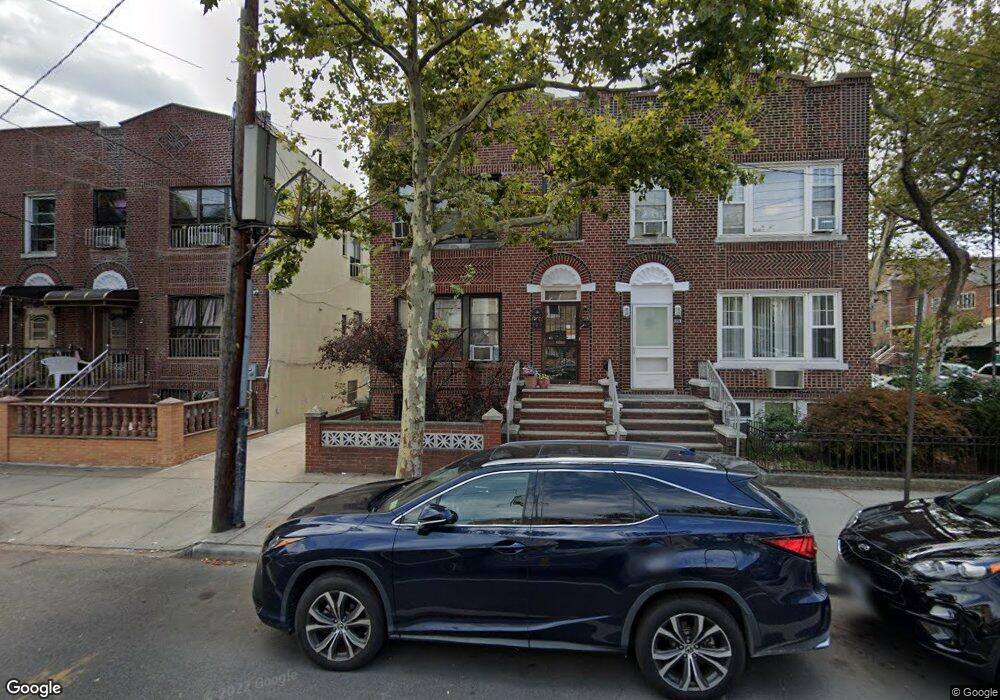
6521 10th Ave Brooklyn, NY 11219
Dyker Heights NeighborhoodEstimated Value: $1,663,597 - $1,898,000
--
Bed
--
Bath
2,320
Sq Ft
$753/Sq Ft
Est. Value
About This Home
This home is located at 6521 10th Ave, Brooklyn, NY 11219 and is currently estimated at $1,746,649, approximately $752 per square foot. 6521 10th Ave is a home located in Kings County with nearby schools including Public School 310, Junior High School 227 Edward B Shallow, and Fort Hamilton High School.
Ownership History
Date
Name
Owned For
Owner Type
Purchase Details
Closed on
Jun 1, 2023
Sold by
Mandile Laura and Stedman Susan
Bought by
W Xin Hui Llc
Current Estimated Value
Home Financials for this Owner
Home Financials are based on the most recent Mortgage that was taken out on this home.
Original Mortgage
$700,000
Outstanding Balance
$681,418
Interest Rate
6.43%
Mortgage Type
Purchase Money Mortgage
Estimated Equity
$1,065,231
Purchase Details
Closed on
Dec 22, 2021
Sold by
Moltisanti Rita
Bought by
Mandile Laura and Moltisanti Rita
Create a Home Valuation Report for This Property
The Home Valuation Report is an in-depth analysis detailing your home's value as well as a comparison with similar homes in the area
Home Values in the Area
Average Home Value in this Area
Purchase History
| Date | Buyer | Sale Price | Title Company |
|---|---|---|---|
| W Xin Hui Llc | $1,540,000 | -- | |
| Mandile Laura | -- | -- |
Source: Public Records
Mortgage History
| Date | Status | Borrower | Loan Amount |
|---|---|---|---|
| Open | W Xin Hui Llc | $700,000 |
Source: Public Records
Tax History Compared to Growth
Tax History
| Year | Tax Paid | Tax Assessment Tax Assessment Total Assessment is a certain percentage of the fair market value that is determined by local assessors to be the total taxable value of land and additions on the property. | Land | Improvement |
|---|---|---|---|---|
| 2025 | $10,104 | $96,900 | $23,820 | $73,080 |
| 2024 | $10,104 | $76,560 | $23,820 | $52,740 |
| 2023 | $9,408 | $93,960 | $23,820 | $70,140 |
| 2022 | $8,725 | $89,580 | $23,820 | $65,760 |
| 2021 | $9,205 | $72,780 | $23,820 | $48,960 |
| 2020 | $6,904 | $83,040 | $23,820 | $59,220 |
| 2019 | $8,476 | $83,040 | $23,820 | $59,220 |
| 2018 | $7,809 | $39,770 | $12,941 | $26,829 |
| 2017 | $7,369 | $37,621 | $13,919 | $23,702 |
| 2016 | $7,211 | $37,621 | $14,921 | $22,700 |
| 2015 | $4,061 | $37,024 | $19,300 | $17,724 |
| 2014 | $4,061 | $34,934 | $17,687 | $17,247 |
Source: Public Records
Map
Nearby Homes
- 1015 66th St Unit 2B
- 1041 66th St
- 1002 65th St
- 1021 67th St
- 6524 11th Ave
- 6402 11th Ave
- 6511 Fort Hamilton Pkwy Unit 3C
- 6503 11th Ave
- 6523 11th Ave
- 6313 Fort Hamilton Pkwy
- 1080 67th St
- 6315 Fort Hamilton Pkwy
- 6716 10th Ave
- 1058 62nd St
- 1068 62nd St
- 1001 Bay Ridge Ave
- 1113 68th St
- 6801 Fort Hamilton Pkwy
- 1147 64th St
- 1142 63rd St
- 6523 10th Ave
- 6517 10th Ave
- 6517 10th Ave
- 6513 10th Ave
- 1015 66 St Unit 2A
- 1015 66 St Unit 2B
- 1015 66th St Unit 3B
- 1015 66th St Unit 3A
- 1015 66th St Unit 2A
- 1015 66th St Unit 1B
- 1015 66th St Unit 1A
- 1015 66th St Unit B
- 1015 66th St Unit P5
- 1015 66th St Unit P1
- 1015 66th St Unit P2
- 1015 66th St
- 1015 66th St Unit P3
- 1015 66th St Unit P4
- 6601 10th Ave
- 1019 66th St