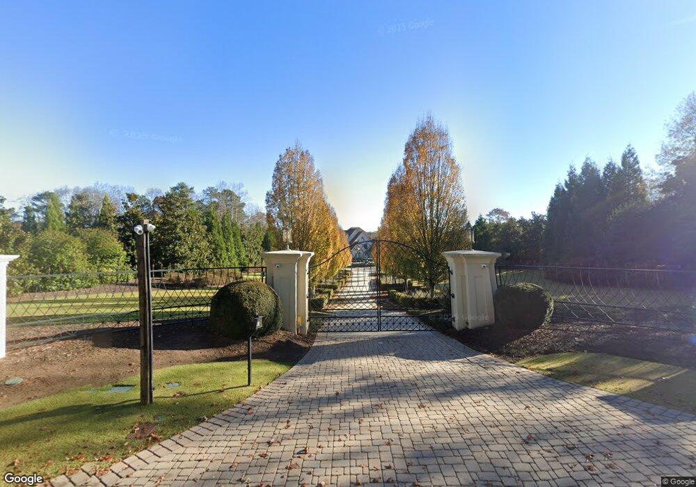
6525 Garrett Rd Buford, GA 30518
Estimated Value: $2,644,353 - $3,652,000
6
Beds
7
Baths
10,706
Sq Ft
$298/Sq Ft
Est. Value
About This Home
This home is located at 6525 Garrett Rd, Buford, GA 30518 and is currently estimated at $3,186,451, approximately $297 per square foot. 6525 Garrett Rd is a home located in Gwinnett County with nearby schools including White Oak Elementary School, Lanier Middle School, and Lanier High School.
Ownership History
Date
Name
Owned For
Owner Type
Purchase Details
Closed on
Jun 20, 2011
Sold by
Branch Bkng & Trust Co
Bought by
Circelli Frank M
Current Estimated Value
Purchase Details
Closed on
Mar 2, 2010
Sold by
Matasaru Jacob and Matasaru Pertita
Bought by
Branch Bkng & Trust Co
Purchase Details
Closed on
Jul 21, 2005
Sold by
Malachai Holding Co Ltd
Bought by
Matasaru Jacob and Matasaru Pertita
Home Financials for this Owner
Home Financials are based on the most recent Mortgage that was taken out on this home.
Original Mortgage
$1,591,373
Interest Rate
5.51%
Purchase Details
Closed on
Mar 17, 2000
Sold by
Simmons Steve A and Simmons Patsy E
Bought by
Malachi Holding Co
Home Financials for this Owner
Home Financials are based on the most recent Mortgage that was taken out on this home.
Original Mortgage
$115,020
Interest Rate
8.37%
Mortgage Type
New Conventional
Create a Home Valuation Report for This Property
The Home Valuation Report is an in-depth analysis detailing your home's value as well as a comparison with similar homes in the area
Home Values in the Area
Average Home Value in this Area
Purchase History
| Date | Buyer | Sale Price | Title Company |
|---|---|---|---|
| Circelli Frank M | $1,200,000 | -- | |
| Branch Bkng & Trust Co | $1,354,988 | -- | |
| Matasaru Jacob | $1,750,000 | -- | |
| Malachi Holding Co | -- | -- |
Source: Public Records
Mortgage History
| Date | Status | Borrower | Loan Amount |
|---|---|---|---|
| Previous Owner | Matasaru Jacob | $1,591,373 | |
| Previous Owner | Malachi Holding Co | $115,020 |
Source: Public Records
Tax History
| Year | Tax Paid | Tax Assessment Tax Assessment Total Assessment is a certain percentage of the fair market value that is determined by local assessors to be the total taxable value of land and additions on the property. | Land | Improvement |
|---|---|---|---|---|
| 2025 | $13,503 | $1,591,960 | $146,440 | $1,445,520 |
| 2024 | $13,488 | $1,408,200 | $144,640 | $1,263,560 |
| 2023 | $13,488 | $1,408,200 | $144,640 | $1,263,560 |
| 2022 | $13,458 | $1,408,200 | $144,640 | $1,263,560 |
| 2021 | $13,159 | $749,320 | $117,840 | $631,480 |
| 2020 | $27,975 | $749,320 | $117,840 | $631,480 |
| 2019 | $26,930 | $749,320 | $117,840 | $631,480 |
| 2018 | $20,332 | $558,560 | $117,840 | $440,720 |
| 2016 | $19,555 | $536,480 | $117,840 | $418,640 |
| 2015 | $19,770 | $536,480 | $117,840 | $418,640 |
| 2014 | $19,294 | $519,840 | $102,120 | $417,720 |
Source: Public Records
Map
Nearby Homes
- 6594 Garrett Rd
- 6220 Stewart Rd
- 6381 Lakeview Dr
- 6219 Woodlake Dr
- 1530 Stewart Ridge Dr
- 5920 Branden Hill Ln
- 1549 Stewart Ridge Dr
- 1001 Lanier Springs Ct
- 2210 Lanier Harbor Pointe
- 1930 Marina Way
- 2079 Lanier Harbor Pointe
- 2075 Pine Tree Dr Unit B2
- 818 Dodd Trail Unit 171
- 1218 Lanier Springs Dr
- 932 Homepark Cir
- 972 Homepark Cir
- 942 Homepark Cir
- 2045 Buford Dam Rd
- 6098 Park Leaf Walk
- 5984 Dolvin Ln
- 6515 Garrett Rd
- 6535 Garrett Rd
- 6529 Garrett Rd
- 6543 Garrett Rd
- 6499 Garrett Rd
- 6553 Garrett Rd
- 6435 Garrett Rd
- 6580 Garrett Rd
- 6563 Garrett Rd
- 6599 Garrett Rd
- 6487 Garrett Rd
- 6579 Garrett Rd
- 6581 Garrett Rd
- 6484 Garrett Rd
- 6536 Garrett Rd
- 6574 Garrett Rd
- 6585 Garrett Rd
- 6502 Garrett Rd
- 6492 Garrett Rd
- 6492 Garrett Rd Unit Sec A
