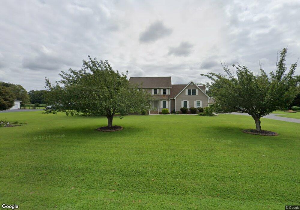
6526 Poplar Pond Dr Gloucester, VA 23061
Gloucester South NeighborhoodEstimated Value: $529,078 - $597,000
3
Beds
3
Baths
2,700
Sq Ft
$205/Sq Ft
Est. Value
About This Home
This home is located at 6526 Poplar Pond Dr, Gloucester, VA 23061 and is currently estimated at $552,770, approximately $204 per square foot. 6526 Poplar Pond Dr is a home located in Gloucester County with nearby schools including Bethel Elementary School, Peasley Middle School, and Gloucester High School.
Ownership History
Date
Name
Owned For
Owner Type
Purchase Details
Closed on
Apr 19, 2016
Sold by
Bartos Dale and Bartos Debra A
Bought by
L A D Builders Inc A Virginia Corporatio
Current Estimated Value
Home Financials for this Owner
Home Financials are based on the most recent Mortgage that was taken out on this home.
Original Mortgage
$275,000
Outstanding Balance
$218,829
Interest Rate
3.73%
Mortgage Type
Seller Take Back
Estimated Equity
$333,941
Create a Home Valuation Report for This Property
The Home Valuation Report is an in-depth analysis detailing your home's value as well as a comparison with similar homes in the area
Home Values in the Area
Average Home Value in this Area
Purchase History
| Date | Buyer | Sale Price | Title Company |
|---|---|---|---|
| L A D Builders Inc A Virginia Corporatio | $50,000 | None Available |
Source: Public Records
Mortgage History
| Date | Status | Borrower | Loan Amount |
|---|---|---|---|
| Open | L A D Builders Inc A Virginia Corporatio | $275,000 |
Source: Public Records
Tax History Compared to Growth
Tax History
| Year | Tax Paid | Tax Assessment Tax Assessment Total Assessment is a certain percentage of the fair market value that is determined by local assessors to be the total taxable value of land and additions on the property. | Land | Improvement |
|---|---|---|---|---|
| 2024 | $2,529 | $433,770 | $69,630 | $364,140 |
| 2023 | $2,529 | $433,770 | $69,630 | $364,140 |
| 2022 | $2,556 | $352,530 | $63,110 | $289,420 |
| 2021 | $2,450 | $352,530 | $63,110 | $289,420 |
| 2020 | $2,450 | $352,530 | $63,110 | $289,420 |
| 2019 | $2,465 | $354,680 | $80,270 | $274,410 |
| 2017 | $2,465 | $354,680 | $80,270 | $274,410 |
| 2016 | $2,395 | $344,570 | $83,780 | $260,790 |
| 2015 | $2,343 | $338,100 | $43,000 | $295,100 |
| 2014 | $2,198 | $338,100 | $43,000 | $295,100 |
Source: Public Records
Map
Nearby Homes
- 6340 Jones Creek Dr
- 3573 Hickory Fork Rd
- 3346 Hickory Fork Rd
- 6279 Jones Creek Dr
- 6365 Stonehenge Way
- 4905 Stephens Way
- 4904 Stephens Way
- 4836 Stephens Way
- Lot 8 Stephens Way
- Lot 4 Stephens Way
- Lot 2 Stephens Way
- Lot 7 Stephens Way
- Lot 3 Stephens Way
- Lot 9 Stephens Way
- Lot 10 Stephens Way
- Hudson Plan at Ryans Run
- Aviano Plan at Ryans Run
- Ballenger Plan at Ryans Run
- Cumberland Plan at Ryans Run
- 4765 Stephens Way
- 6519 Poplar Pond Dr
- 6546 Poplar Pond Dr
- 6498 Poplar Pond Dr
- 6541 Poplar Pond Dr
- 6497 Poplar Pond Dr
- 6558 Poplar Pond Dr
- 6581 Poplar Pond Dr
- 6495 Poplar Pond Dr
- 6568 Poplar Pond Dr
- 4130 Cappahosic Rd
- 6591 Poplar Pond Dr
- 6580 Poplar Pond Dr
- 4152 Cappahosic Rd
- 4140 Cappahosic Rd
- 6588 Poplar Pond Dr
- 4110 Cappahosic Rd
- 6496 Poplar Pond Dr
- 6598 Poplar Pond Dr
- 4153 Cappahosic Rd
- 4100 Cappahosic Rd