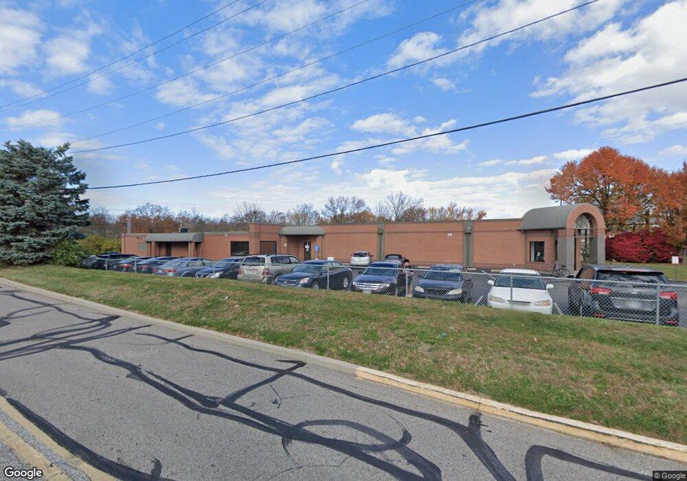
6527 Colerain Ave Cincinnati, OH 45239
--
Bed
--
Bath
6,212
Sq Ft
0.73
Acres
About This Home
This home is located at 6527 Colerain Ave, Cincinnati, OH 45239. 6527 Colerain Ave is a home located in Hamilton County with nearby schools including White Oak Middle School, Colerain High School, and Cincinnati Achievement Academy.
Ownership History
Date
Name
Owned For
Owner Type
Purchase Details
Closed on
Aug 19, 2022
Sold by
Roberts Road Holdings One Llc
Bought by
Woos Corporation
Home Financials for this Owner
Home Financials are based on the most recent Mortgage that was taken out on this home.
Original Mortgage
$300,000
Outstanding Balance
$286,815
Interest Rate
5.51%
Mortgage Type
New Conventional
Purchase Details
Closed on
Aug 25, 2015
Sold by
Hobeika Claude and Hobeika Nisa
Bought by
Knab Enterprises Llc
Create a Home Valuation Report for This Property
The Home Valuation Report is an in-depth analysis detailing your home's value as well as a comparison with similar homes in the area
Home Values in the Area
Average Home Value in this Area
Purchase History
| Date | Buyer | Sale Price | Title Company |
|---|---|---|---|
| Woos Corporation | -- | -- | |
| Woos Corporation | -- | None Listed On Document | |
| Knab Enterprises Llc | $63,000 | Prodigy Title Agency |
Source: Public Records
Mortgage History
| Date | Status | Borrower | Loan Amount |
|---|---|---|---|
| Open | Woos Corporation | $300,000 | |
| Closed | Woos Corporation | $300,000 |
Source: Public Records
Tax History Compared to Growth
Tax History
| Year | Tax Paid | Tax Assessment Tax Assessment Total Assessment is a certain percentage of the fair market value that is determined by local assessors to be the total taxable value of land and additions on the property. | Land | Improvement |
|---|---|---|---|---|
| 2024 | $18,562 | $235,799 | $84,571 | $151,228 |
| 2023 | $18,284 | $235,799 | $84,571 | $151,228 |
| 2022 | $19,622 | $221,928 | $79,114 | $142,814 |
| 2021 | $13,417 | $150,826 | $79,114 | $71,712 |
| 2020 | $13,202 | $150,826 | $79,114 | $71,712 |
| 2019 | $13,132 | $146,433 | $76,811 | $69,622 |
| 2018 | $11,971 | $146,433 | $76,811 | $69,622 |
| 2017 | $11,576 | $146,433 | $76,811 | $69,622 |
| 2016 | $11,871 | $148,750 | $80,801 | $67,949 |
| 2015 | $12,058 | $148,750 | $80,801 | $67,949 |
| 2014 | $12,131 | $148,750 | $80,801 | $67,949 |
| 2013 | $14,369 | $182,147 | $80,801 | $101,346 |
Source: Public Records
Map
Nearby Homes
- 3041 Preserve Ln
- 2811 Breezy Way
- 3219 Banning Rd
- 5970 Colerain Ave
- 6851 Rutherford Ct
- 3250 March Terrace
- 3225 Crimson Ln
- 2937 Blue Rock Rd
- 2897 Blue Rock Rd
- 3279 Rockacres Ct
- 3326 Blueacres Dr
- 5845 Shadymist Ln
- 3335 Lapland Dr
- 2598 Byrneside Dr
- 2536 Flanigan Ct
- 2532 Flanigan Ct
- 5851 Monfort Hills Ave
- 2481 Crosley Meadow
- 2606 Kipling Ave
- 6893 Newbridge Dr
- 3007 Lapland Dr
- 3015 Lapland Dr
- 6571 Colerain Ave
- 3023 Lapland Dr
- 3033 Lapland Dr
- 6601 Colerain Ave
- 6529 Colerain Ave
- 3004 Lapland Dr
- 3053 Lapland Dr
- 3012 Lapland Dr
- 3018 Lapland Dr
- 3044 Lapland Dr
- 3028 Lapland Dr
- 3063 Lapland Dr
- 3052 Lapland Dr
- 3071 Lapland Dr
- 6600 Flagstone Ct
- 6606 Flagstone Ct
- 2897 Geraldine Dr
- 3079 Lapland Dr