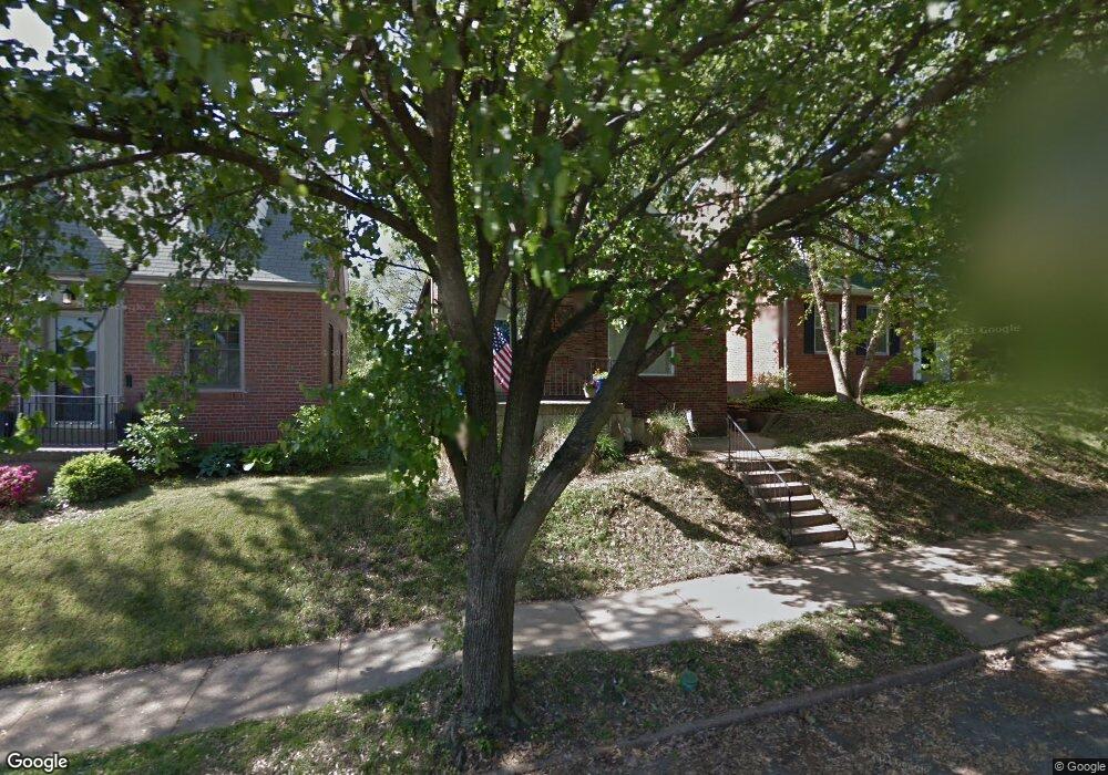
6528 Pernod Ave Saint Louis, MO 63139
Lindenwood Park NeighborhoodEstimated Value: $256,000 - $300,000
2
Beds
2
Baths
975
Sq Ft
$287/Sq Ft
Est. Value
About This Home
This home is located at 6528 Pernod Ave, Saint Louis, MO 63139 and is currently estimated at $279,735, approximately $286 per square foot. 6528 Pernod Ave is a home located in St. Louis City with nearby schools including Mason Elementary School, Long International Middle School, and Roosevelt High School.
Ownership History
Date
Name
Owned For
Owner Type
Purchase Details
Closed on
Jun 12, 2019
Sold by
Dwyer Barcus Rhonda and Dwyer Barcus Davida
Bought by
Dwyer Barcus Rhonda and Dwyer Barcus Davida
Current Estimated Value
Home Financials for this Owner
Home Financials are based on the most recent Mortgage that was taken out on this home.
Original Mortgage
$30,000
Outstanding Balance
$19,632
Interest Rate
4%
Mortgage Type
New Conventional
Estimated Equity
$260,103
Purchase Details
Closed on
Apr 25, 2012
Sold by
Dwyer Barcus Rhonda and Dwyer Barcus Davida
Bought by
Dwyer Barcus Rhonda and Dwyer Barcus David
Home Financials for this Owner
Home Financials are based on the most recent Mortgage that was taken out on this home.
Original Mortgage
$147,483
Outstanding Balance
$102,518
Interest Rate
3.97%
Mortgage Type
VA
Estimated Equity
$177,217
Purchase Details
Closed on
Dec 13, 2011
Sold by
Dwyer Barcus Rhonda and Barcus Rhonda S
Bought by
Dwyer Barcus Rhonda and Dwyer Barcus Davida
Purchase Details
Closed on
Jan 27, 2009
Sold by
Booker Timothy R and Booker Wendy
Bought by
Barcus Rhonda S
Home Financials for this Owner
Home Financials are based on the most recent Mortgage that was taken out on this home.
Original Mortgage
$153,100
Interest Rate
5.09%
Mortgage Type
VA
Purchase Details
Closed on
Oct 7, 2008
Sold by
Booker Timothy R and Booker Wendy
Bought by
Booker Timothy R and Booker Wendy
Purchase Details
Closed on
Mar 1, 2004
Sold by
Haislar Michael J
Bought by
Booker Timothy R
Home Financials for this Owner
Home Financials are based on the most recent Mortgage that was taken out on this home.
Original Mortgage
$129,600
Interest Rate
4.62%
Mortgage Type
Purchase Money Mortgage
Purchase Details
Closed on
May 30, 2003
Sold by
Ward Gregory D
Bought by
Haislar Michael J
Home Financials for this Owner
Home Financials are based on the most recent Mortgage that was taken out on this home.
Original Mortgage
$109,137
Interest Rate
5.65%
Mortgage Type
FHA
Create a Home Valuation Report for This Property
The Home Valuation Report is an in-depth analysis detailing your home's value as well as a comparison with similar homes in the area
Home Values in the Area
Average Home Value in this Area
Purchase History
| Date | Buyer | Sale Price | Title Company |
|---|---|---|---|
| Dwyer Barcus Rhonda | -- | Investors Title Company | |
| Dwyer Barcus Rhonda | -- | Freedom Title Llc | |
| Dwyer Barcus Rhonda | -- | None Available | |
| Barcus Rhonda S | -- | None Available | |
| Booker Timothy R | -- | Pulaski Title Co | |
| Booker Timothy R | -- | -- | |
| Haislar Michael J | -- | -- |
Source: Public Records
Mortgage History
| Date | Status | Borrower | Loan Amount |
|---|---|---|---|
| Open | Dwyer Barcus Rhonda | $30,000 | |
| Open | Dwyer Barcus Rhonda | $147,483 | |
| Closed | Barcus Rhonda S | $153,100 | |
| Previous Owner | Booker Timothy R | $129,600 | |
| Previous Owner | Haislar Michael J | $109,137 |
Source: Public Records
Tax History Compared to Growth
Tax History
| Year | Tax Paid | Tax Assessment Tax Assessment Total Assessment is a certain percentage of the fair market value that is determined by local assessors to be the total taxable value of land and additions on the property. | Land | Improvement |
|---|---|---|---|---|
| 2025 | $2,954 | $41,290 | $3,330 | $37,960 |
| 2024 | $2,811 | $34,960 | $3,330 | $31,630 |
| 2023 | $2,811 | $34,960 | $3,330 | $31,630 |
| 2022 | $2,681 | $32,090 | $3,330 | $28,760 |
| 2021 | $2,677 | $32,090 | $3,330 | $28,760 |
| 2020 | $2,442 | $29,470 | $3,330 | $26,140 |
| 2019 | $2,433 | $29,470 | $3,330 | $26,140 |
| 2018 | $2,353 | $27,610 | $3,000 | $24,610 |
| 2017 | $2,313 | $27,610 | $3,000 | $24,610 |
| 2016 | $2,109 | $24,830 | $3,000 | $21,830 |
| 2015 | $1,913 | $24,830 | $3,000 | $21,830 |
| 2014 | $1,818 | $24,830 | $3,000 | $21,830 |
| 2013 | -- | $23,600 | $3,000 | $20,600 |
Source: Public Records
Map
Nearby Homes
- 6517 Tholozan Ave
- 6541 Lindenwood Place
- 6611 Pernod Ave
- 6439 Mardel Ave
- 6621 Tholozan Ave
- 6631 Pernod Ave
- 6565 Winnebago St
- 6659 Tholozan Ave
- 6656 Oleatha Ave
- 6625 Hancock Ave
- 3905 Tamm Ave
- 6339 Marquette Ave
- 6653 Hancock Ave
- 6437 Hancock Ave
- 6214 Oleatha Ave
- 6325 Marquette Ave
- 6411 Hancock Ave
- 6561 Bancroft Ave
- 6811 Marquette Ave
- 6041 Tholozan Ave
- 6532 Pernod Ave
- 6524 Pernod Ave
- 6520 Pernod Ave
- 6536 Pernod Ave
- 6516 Pernod Ave
- 6540 Pernod Ave
- 6525 Tholozan Ave
- 6544 Pernod Ave
- 6521 Tholozan Ave
- 6531 Tholozan Ave
- 6519 Tholozan Ave
- 6533 Tholozan Ave
- 6546 Pernod Ave
- 6537 Tholozan Ave
- 6527 Pernod Ave
- 6521 Pernod Ave
- 6531 Pernod Ave
- 6519 Pernod Ave
- 6535 Pernod Ave
- 6539 Tholozan Ave