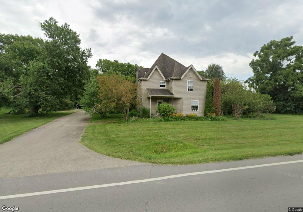
6528 State Route 48 Springboro, OH 45066
Estimated Value: $211,000 - $323,843
12
Beds
4
Baths
4,165
Sq Ft
$65/Sq Ft
Est. Value
About This Home
This home is located at 6528 State Route 48, Springboro, OH 45066 and is currently estimated at $272,461, approximately $65 per square foot. 6528 State Route 48 is a home located in Warren County with nearby schools including Clearcreek Elementary School, Springboro Intermediate School, and Springboro Junior High School.
Ownership History
Date
Name
Owned For
Owner Type
Purchase Details
Closed on
Oct 8, 2012
Sold by
Thompson David M and Thompson Mary K
Bought by
Thompson Mary Kay
Current Estimated Value
Home Financials for this Owner
Home Financials are based on the most recent Mortgage that was taken out on this home.
Original Mortgage
$144,750
Outstanding Balance
$98,724
Interest Rate
3.57%
Mortgage Type
Future Advance Clause Open End Mortgage
Estimated Equity
$173,737
Purchase Details
Closed on
Feb 5, 2002
Sold by
Emc Mtg Corp
Bought by
Thompson David M and Thompson Mary K
Home Financials for this Owner
Home Financials are based on the most recent Mortgage that was taken out on this home.
Original Mortgage
$69,600
Interest Rate
7.26%
Mortgage Type
New Conventional
Purchase Details
Closed on
Jun 28, 2001
Sold by
Shrf James R Parks Pr
Bought by
Emc Mtg Corp
Create a Home Valuation Report for This Property
The Home Valuation Report is an in-depth analysis detailing your home's value as well as a comparison with similar homes in the area
Home Values in the Area
Average Home Value in this Area
Purchase History
| Date | Buyer | Sale Price | Title Company |
|---|---|---|---|
| Thompson Mary Kay | -- | First Central Land Title Age | |
| Thompson David M | $87,600 | -- | |
| Emc Mtg Corp | $90,000 | -- |
Source: Public Records
Mortgage History
| Date | Status | Borrower | Loan Amount |
|---|---|---|---|
| Open | Thompson Mary Kay | $144,750 | |
| Closed | Thompson David M | $69,600 |
Source: Public Records
Tax History
| Year | Tax Paid | Tax Assessment Tax Assessment Total Assessment is a certain percentage of the fair market value that is determined by local assessors to be the total taxable value of land and additions on the property. | Land | Improvement |
|---|---|---|---|---|
| 2025 | $3,275 | $78,210 | $16,280 | $61,930 |
| 2024 | $3,275 | $78,210 | $16,280 | $61,930 |
| 2023 | $2,861 | $64,158 | $9,114 | $55,044 |
| 2022 | $2,861 | $64,159 | $9,114 | $55,045 |
| 2021 | $2,692 | $64,159 | $9,114 | $55,045 |
| 2020 | $2,532 | $52,161 | $7,410 | $44,751 |
| 2019 | $2,352 | $52,161 | $7,410 | $44,751 |
| 2018 | $2,342 | $52,161 | $7,410 | $44,751 |
| 2017 | $2,380 | $47,527 | $6,853 | $40,674 |
| 2016 | $2,476 | $47,527 | $6,853 | $40,674 |
| 2015 | $2,753 | $52,924 | $6,853 | $46,071 |
| 2014 | $2,604 | $47,260 | $6,130 | $41,140 |
| 2013 | $2,604 | $57,170 | $7,400 | $49,770 |
Source: Public Records
Map
Nearby Homes
- 7259 State Route 48
- 441 Ohio 73
- 441 East St Unit 73
- 5690 Bunnell Hill Rd
- 162 E State Route 73
- 7777 State Route 48
- 4870 Bunnell Hill Rd
- 710 White Cedar Way
- 7412 Larkspur Ct
- 7402 Silver Lake Dr
- 2566 E Lower Springboro Rd
- 7411 Waterway Dr
- 7345 Waterway Dr
- 7425 Stoneham Cir
- 701 Grand Wood Ct
- Lot 7 Robert's Way
- 0 Voltaire Ct Unit 1863060
- 8234 Voltaire Ct
- Lot 6 Robert's Way
- Lot 8 Robert's Way
- 9639 St Rt 48
- 6539 Ohio 48
- 6539 State Route 48
- 1088 E Lower Springboro Rd
- 6560 State Route 48 N
- 6560 N St Rt 48
- 6560 State Route 48
- 6539 N Route 48
- 6539 N St Rt 48
- 6525 State Route 48
- 6507 N State Route 48
- 0 N St Rt 48 Unit 1110366
- 1.078ac Ohio 48
- 1134 E Lower Springboro Rd
- 1095 E Lower Springboro Rd
- 6592 N St Rt 48
- 6592 N Route 48
- 6592 State Route 48
- 1033 E Lower Springboro Rd
- 6587 State Route 48
Your Personal Tour Guide
Ask me questions while you tour the home.