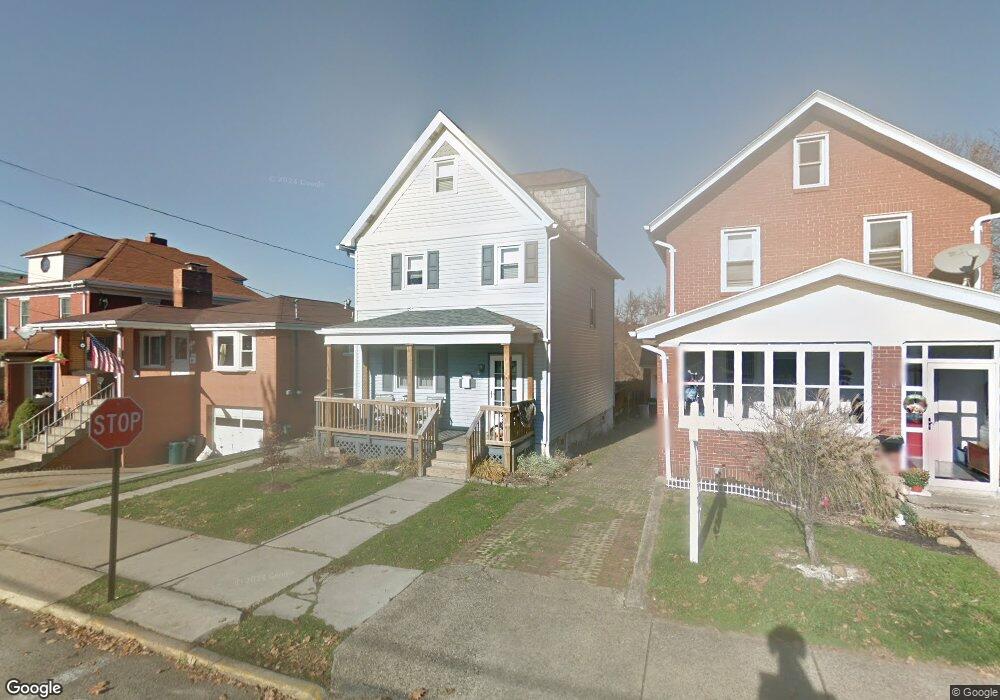
653 6th St Trafford, PA 15085
Estimated Value: $90,217 - $163,000
Studio
--
Bath
--
Sq Ft
3,006
Sq Ft
About This Home
This home is located at 653 6th St, Trafford, PA 15085 and is currently estimated at $139,054. 653 6th St is a home located in Westmoreland County with nearby schools including Penn Trafford High School.
Ownership History
Date
Name
Owned For
Owner Type
Purchase Details
Closed on
Oct 19, 2007
Sold by
Loughner Bruce B and Loughner Nicole J
Bought by
Mcdonough John and Festa Erika
Current Estimated Value
Home Financials for this Owner
Home Financials are based on the most recent Mortgage that was taken out on this home.
Original Mortgage
$84,900
Outstanding Balance
$52,593
Interest Rate
6.51%
Mortgage Type
Purchase Money Mortgage
Estimated Equity
$86,461
Create a Home Valuation Report for This Property
The Home Valuation Report is an in-depth analysis detailing your home's value as well as a comparison with similar homes in the area
Home Values in the Area
Average Home Value in this Area
Purchase History
| Date | Buyer | Sale Price | Title Company |
|---|---|---|---|
| Mcdonough John | $84,900 | None Available |
Source: Public Records
Mortgage History
| Date | Status | Borrower | Loan Amount |
|---|---|---|---|
| Open | Mcdonough John | $84,900 |
Source: Public Records
Tax History
| Year | Tax Paid | Tax Assessment Tax Assessment Total Assessment is a certain percentage of the fair market value that is determined by local assessors to be the total taxable value of land and additions on the property. | Land | Improvement |
|---|---|---|---|---|
| 2026 | $1,600 | $10,410 | $1,780 | $8,630 |
| 2025 | $1,569 | $10,410 | $1,780 | $8,630 |
| 2024 | $1,559 | $10,410 | $1,780 | $8,630 |
| 2023 | $1,486 | $10,410 | $1,780 | $8,630 |
| 2022 | $1,470 | $10,410 | $1,780 | $8,630 |
| 2021 | $1,460 | $10,410 | $1,780 | $8,630 |
| 2020 | $1,449 | $10,410 | $1,780 | $8,630 |
| 2019 | $1,418 | $10,410 | $1,780 | $8,630 |
| 2018 | $1,403 | $10,410 | $1,780 | $8,630 |
| 2017 | $1,382 | $10,410 | $1,780 | $8,630 |
| 2016 | $1,346 | $10,410 | $1,780 | $8,630 |
| 2015 | $1,315 | $10,410 | $1,780 | $8,630 |
| 2014 | $1,294 | $10,410 | $1,780 | $8,630 |
Source: Public Records
Map
Nearby Homes
Your Personal Tour Guide
Ask me questions while you tour the home.