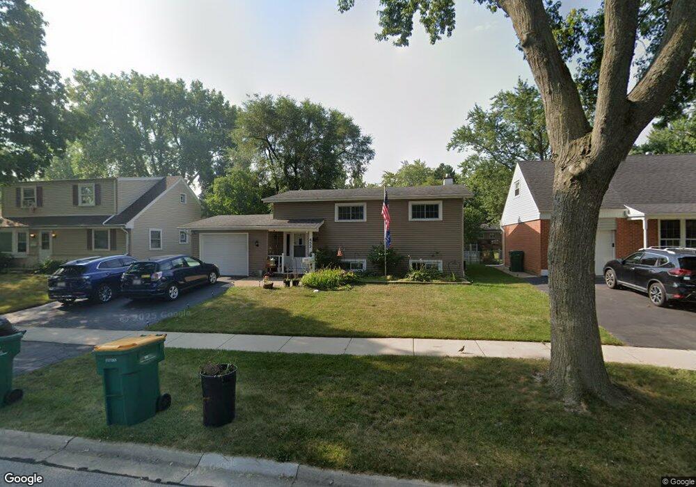
653 Maple Dr Unit 6 Buffalo Grove, IL 60089
South Buffalo Grove NeighborhoodEstimated Value: $404,000 - $475,000
4
Beds
2
Baths
1,608
Sq Ft
$277/Sq Ft
Est. Value
About This Home
This home is located at 653 Maple Dr Unit 6, Buffalo Grove, IL 60089 and is currently estimated at $446,075, approximately $277 per square foot. 653 Maple Dr Unit 6 is a home located in Cook County with nearby schools including Henry W Longfellow Elementary School, Cooper Middle School, and Buffalo Grove High School.
Ownership History
Date
Name
Owned For
Owner Type
Purchase Details
Closed on
Jun 16, 2017
Sold by
Dionesotes Matthew T and Foerster Katie L
Bought by
Demeur Christopher S and Demeur Cathryn R
Current Estimated Value
Home Financials for this Owner
Home Financials are based on the most recent Mortgage that was taken out on this home.
Original Mortgage
$155,000
Outstanding Balance
$129,033
Interest Rate
4.05%
Mortgage Type
New Conventional
Estimated Equity
$317,042
Purchase Details
Closed on
Jun 28, 2011
Sold by
Julian James C and Julian Colleen A
Bought by
Dionesotes Matthew T and Foerster Katie L
Home Financials for this Owner
Home Financials are based on the most recent Mortgage that was taken out on this home.
Original Mortgage
$132,000
Interest Rate
4.56%
Mortgage Type
New Conventional
Purchase Details
Closed on
Nov 15, 2002
Sold by
Julian James C
Bought by
Julian James C and Julian Colleen A
Home Financials for this Owner
Home Financials are based on the most recent Mortgage that was taken out on this home.
Original Mortgage
$175,000
Interest Rate
6.38%
Purchase Details
Closed on
Sep 11, 1997
Sold by
Lakewood Streams Ltd Partnership
Bought by
Cudal Benedicto M and Magbanua May N
Home Financials for this Owner
Home Financials are based on the most recent Mortgage that was taken out on this home.
Original Mortgage
$160,000
Interest Rate
7.55%
Create a Home Valuation Report for This Property
The Home Valuation Report is an in-depth analysis detailing your home's value as well as a comparison with similar homes in the area
Home Values in the Area
Average Home Value in this Area
Purchase History
| Date | Buyer | Sale Price | Title Company |
|---|---|---|---|
| Demeur Christopher S | $235,000 | None Available | |
| Dionesotes Matthew T | $165,000 | Heritage Title Company | |
| Julian James C | -- | Lakeshore Title Agency | |
| Cudal Benedicto M | $118,666 | -- |
Source: Public Records
Mortgage History
| Date | Status | Borrower | Loan Amount |
|---|---|---|---|
| Open | Demeur Christopher S | $155,000 | |
| Previous Owner | Dionesotes Matthew T | $132,000 | |
| Previous Owner | Julian James C | $175,000 | |
| Previous Owner | Cudal Benedicto M | $160,000 |
Source: Public Records
Tax History Compared to Growth
Tax History
| Year | Tax Paid | Tax Assessment Tax Assessment Total Assessment is a certain percentage of the fair market value that is determined by local assessors to be the total taxable value of land and additions on the property. | Land | Improvement |
|---|---|---|---|---|
| 2024 | $8,221 | $29,000 | $6,480 | $22,520 |
| 2023 | $7,877 | $29,000 | $6,480 | $22,520 |
| 2022 | $7,877 | $29,000 | $6,480 | $22,520 |
| 2021 | $6,329 | $21,244 | $4,140 | $17,104 |
| 2020 | $7,304 | $21,244 | $4,140 | $17,104 |
| 2019 | $7,293 | $23,553 | $4,140 | $19,413 |
| 2018 | $9,194 | $26,697 | $3,600 | $23,097 |
| 2017 | $7,884 | $26,697 | $3,600 | $23,097 |
| 2016 | $8,385 | $26,697 | $3,600 | $23,097 |
| 2015 | $7,659 | $22,545 | $3,060 | $19,485 |
| 2014 | $7,532 | $22,545 | $3,060 | $19,485 |
| 2013 | $6,963 | $22,545 | $3,060 | $19,485 |
Source: Public Records
Map
Nearby Homes
- 310 Rosewood Ave
- 410 Chatham Cir
- 98 Stonegate Rd
- 455 Mayfair Ln
- 921 Bernard Dr
- 408 Indian Hill Dr
- 535 Estate Dr
- 476 Raupp Blvd
- 25 Crestview Terrace
- 665 Thornwood Dr
- 859 Beechwood Rd
- 746 Old Checker Rd Unit E5
- 183 Saint Marys Pkwy
- 234 Mohawk Trail
- 813 Stradford Cir Unit 21B2
- 872 Old Checker Rd Unit E3
- 98 Glendale Rd
- 820 Weidner Rd Unit 4013
- 820 Weidner Rd Unit 409
- 443 Diane Dr