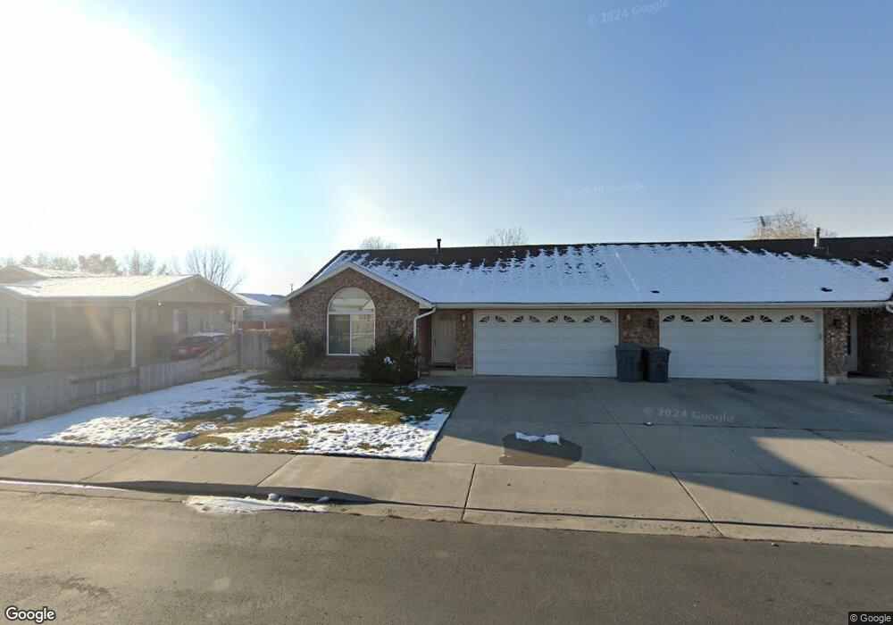
653 N 1800 W Pleasant Grove, UT 84062
Estimated Value: $349,000 - $409,000
3
Beds
2
Baths
1,204
Sq Ft
$310/Sq Ft
Est. Value
About This Home
This home is located at 653 N 1800 W, Pleasant Grove, UT 84062 and is currently estimated at $373,798, approximately $310 per square foot. 653 N 1800 W is a home located in Utah County with nearby schools including Mount Mahogany School, Pleasant Grove Junior High School, and Pleasant Grove High School.
Ownership History
Date
Name
Owned For
Owner Type
Purchase Details
Closed on
Mar 27, 2020
Sold by
Tuckett Ray L and Tuckett Diane C
Bought by
Tuckett Ray L and Tuckett Diane C
Current Estimated Value
Purchase Details
Closed on
Sep 4, 2012
Sold by
Federal National Mortgage Association
Bought by
Tuckett Ray L and Tuckett Diane C
Home Financials for this Owner
Home Financials are based on the most recent Mortgage that was taken out on this home.
Original Mortgage
$121,500
Outstanding Balance
$83,795
Interest Rate
3.5%
Mortgage Type
New Conventional
Estimated Equity
$290,003
Purchase Details
Closed on
May 25, 2012
Sold by
Thompson Jo Ann
Bought by
Federal National Mortgage Asociation
Purchase Details
Closed on
Dec 28, 2007
Sold by
Alomia Eric S
Bought by
Thompson Jo Ann
Home Financials for this Owner
Home Financials are based on the most recent Mortgage that was taken out on this home.
Original Mortgage
$170,910
Interest Rate
5.96%
Mortgage Type
Purchase Money Mortgage
Purchase Details
Closed on
Dec 29, 2004
Sold by
Saavedra Angel
Bought by
Alomia Eric S
Home Financials for this Owner
Home Financials are based on the most recent Mortgage that was taken out on this home.
Original Mortgage
$132,000
Interest Rate
5.74%
Mortgage Type
New Conventional
Purchase Details
Closed on
Jan 11, 2002
Sold by
Tidwell Michael Todd
Bought by
Saavedra Angel
Purchase Details
Closed on
Jun 1, 2001
Sold by
Tidwell Michael Todd
Bought by
Saavedra Angel
Home Financials for this Owner
Home Financials are based on the most recent Mortgage that was taken out on this home.
Original Mortgage
$121,811
Interest Rate
7.15%
Mortgage Type
FHA
Purchase Details
Closed on
Sep 12, 1996
Sold by
Chrabaszcz Michael P
Bought by
Tidwell Michael Todd
Home Financials for this Owner
Home Financials are based on the most recent Mortgage that was taken out on this home.
Original Mortgage
$108,300
Interest Rate
8.23%
Create a Home Valuation Report for This Property
The Home Valuation Report is an in-depth analysis detailing your home's value as well as a comparison with similar homes in the area
Home Values in the Area
Average Home Value in this Area
Purchase History
| Date | Buyer | Sale Price | Title Company |
|---|---|---|---|
| Tuckett Ray L | -- | None Available | |
| Tuckett Ray L | -- | Security Title Insurnace Age | |
| Federal National Mortgage Asociation | $137,268 | None Available | |
| Thompson Jo Ann | -- | Provo Land Title Co | |
| Alomia Eric S | -- | Preferred Title & Escrow In | |
| Saavedra Angel | -- | Mountain West Title Co | |
| Tidwell Michael Todd | -- | Mountain West Title Co | |
| Saavedra Angel | -- | Mountain West Title Co | |
| Tidwell Michael Todd | -- | -- |
Source: Public Records
Mortgage History
| Date | Status | Borrower | Loan Amount |
|---|---|---|---|
| Open | Tuckett Ray L | $121,500 | |
| Previous Owner | Thompson Jo Ann | $170,910 | |
| Previous Owner | Alomia Eric S | $132,000 | |
| Previous Owner | Saavedra Angel | $121,811 | |
| Previous Owner | Tidwell Michael Todd | $108,300 |
Source: Public Records
Tax History Compared to Growth
Tax History
| Year | Tax Paid | Tax Assessment Tax Assessment Total Assessment is a certain percentage of the fair market value that is determined by local assessors to be the total taxable value of land and additions on the property. | Land | Improvement |
|---|---|---|---|---|
| 2025 | $1,718 | $211,585 | $98,800 | $285,900 |
| 2024 | $1,718 | $205,535 | $0 | $0 |
| 2023 | $1,879 | $229,515 | $0 | $0 |
| 2022 | $1,712 | $208,175 | $0 | $0 |
| 2021 | $1,123 | $207,900 | $83,700 | $124,200 |
| 2020 | $1,146 | $207,900 | $83,700 | $124,200 |
| 2019 | $992 | $186,100 | $83,700 | $102,400 |
| 2018 | $1,049 | $186,100 | $83,700 | $102,400 |
| 2017 | $1,060 | $100,155 | $0 | $0 |
| 2016 | $869 | $79,255 | $0 | $0 |
| 2015 | $891 | $76,945 | $0 | $0 |
| 2014 | $818 | $69,960 | $0 | $0 |
Source: Public Records
Map
Nearby Homes
- 1598 W 220 N
- 293 N 1630 W
- 295 N 1580 W
- 1088 E 390 S
- 1525 W 300 N
- 759 W 930 N Unit 502
- 708 W 930 N Unit 505
- 734 W 930 N Unit 506
- 1541 W 250 N
- 1515 W 1010 St N
- 1491 W 1010 N
- 1593 W 220 N
- 1541 W 1060 N
- 1443 W 1010 N
- 1879 W 1100 N
- 502 S 1040 E Unit 252
- 502 S 1040 E Unit 221
- 502 S 1040 E Unit 137
- 502 S 1040 E Unit 243
- 502 S 1040 E Unit 226
- 655 N 1800 W
- 1872 Garden Dr
- 636 N 1800 W
- 636 N 1800 W Unit 2
- 662 N 1800 W
- 614 N 1800 W
- 1841 W 680 N
- 664 N 1800 W
- 1883 Garden Dr Unit 1883 W Garden Drive
- 1883 Garden Dr
- 1893 Garden Dr
- 1884 Garden Dr
- 612 N 1800 W
- 1845 Garden Dr
- 1780 Garden Dr
- 1831 Garden Dr
- 1780 W Garden Dr
- 1863 W 680 N
- 1802 W 680 N
- 1809 Garden Dr