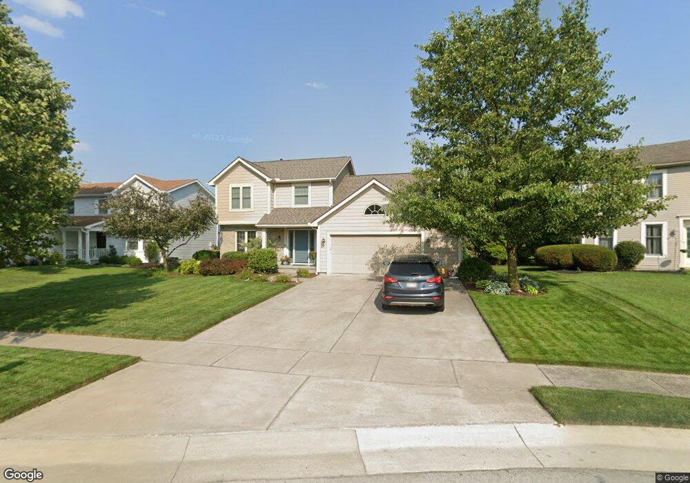
653 Rutledge Ct Perrysburg, OH 43551
Estimated Value: $354,347 - $425,000
4
Beds
3
Baths
2,028
Sq Ft
$186/Sq Ft
Est. Value
About This Home
This home is located at 653 Rutledge Ct, Perrysburg, OH 43551 and is currently estimated at $377,837, approximately $186 per square foot. 653 Rutledge Ct is a home located in Wood County with nearby schools including Fort Meigs Elementary School, Perrysburg Junior High School, and Perrysburg High School.
Ownership History
Date
Name
Owned For
Owner Type
Purchase Details
Closed on
Dec 16, 2002
Sold by
Kear Arthur F and Kear Erica L
Bought by
Dirrim Timothy S and Dirrim Andrea K
Current Estimated Value
Home Financials for this Owner
Home Financials are based on the most recent Mortgage that was taken out on this home.
Original Mortgage
$125,000
Interest Rate
5.94%
Mortgage Type
Purchase Money Mortgage
Purchase Details
Closed on
Nov 30, 2001
Sold by
Barry Vanhoozen
Bought by
Kear Arthur F and Kear Erica L
Home Financials for this Owner
Home Financials are based on the most recent Mortgage that was taken out on this home.
Original Mortgage
$191,250
Interest Rate
6.64%
Mortgage Type
VA
Purchase Details
Closed on
Aug 20, 1993
Bought by
Thomas Terry D
Create a Home Valuation Report for This Property
The Home Valuation Report is an in-depth analysis detailing your home's value as well as a comparison with similar homes in the area
Home Values in the Area
Average Home Value in this Area
Purchase History
| Date | Buyer | Sale Price | Title Company |
|---|---|---|---|
| Dirrim Timothy S | $194,000 | Port Lawrence Title | |
| Kear Arthur F | $187,500 | -- | |
| Thomas Terry D | -- | -- |
Source: Public Records
Mortgage History
| Date | Status | Borrower | Loan Amount |
|---|---|---|---|
| Previous Owner | Dirrim Timothy S | $125,000 | |
| Previous Owner | Kear Arthur F | $191,250 |
Source: Public Records
Tax History Compared to Growth
Tax History
| Year | Tax Paid | Tax Assessment Tax Assessment Total Assessment is a certain percentage of the fair market value that is determined by local assessors to be the total taxable value of land and additions on the property. | Land | Improvement |
|---|---|---|---|---|
| 2024 | $5,411 | $93,520 | $15,365 | $78,155 |
| 2023 | $5,411 | $93,530 | $15,370 | $78,160 |
| 2021 | $4,674 | $74,350 | $13,970 | $60,380 |
| 2020 | $4,649 | $74,350 | $13,970 | $60,380 |
| 2019 | $4,254 | $66,020 | $13,970 | $52,050 |
| 2018 | $3,776 | $66,020 | $13,970 | $52,050 |
| 2017 | $3,548 | $66,020 | $13,970 | $52,050 |
| 2016 | $3,475 | $58,490 | $13,970 | $44,520 |
| 2015 | $3,475 | $58,490 | $13,970 | $44,520 |
| 2014 | $3,505 | $58,490 | $13,970 | $44,520 |
| 2013 | $3,586 | $58,490 | $13,970 | $44,520 |
Source: Public Records
Map
Nearby Homes
- 664 Little Creek Dr
- 26802 Fort Meigs Rd
- 471 Rutledge Ct
- 1528 Indian Creek Dr
- 1626 Woodstream Rd
- 2053 Lexington Dr
- 2062 Lexington Dr
- 26835 Mohawk Dr
- 28330 W River Rd
- 125 Ottekee Dr
- 26951 Ottekee Dr
- 865 Mulberry St
- 229 Twinbrook Dr
- 412 W South Boundary St
- 2074 Coe Ct
- 872 Cherry St
- 700 Delaware Dr
- 220 W Wayne St
- 234 W Dudley St
- 204 W 8th St
- 665 Rutledge Ct
- 639 Rutledge Ct
- 627 Rutledge Ct
- 679 Rutledge Ct
- 646 Rutledge Ct
- 630 Rutledge Ct
- 660 Rutledge Ct
- 678 Rutledge Ct
- 729 Little Creek Dr
- 1071 Iron Trail Rd
- 1226 Sutton Place
- 601 Rutledge Ct
- 1077 Iron Trail Rd
- 672 Rutledge Ct
- 1063 Iron Trail Rd
- 717 Little Creek Dr
- 741 Little Creek Dr
- 381 Nora Dr
- 1244 Sutton Place
- 587 Rutledge Ct