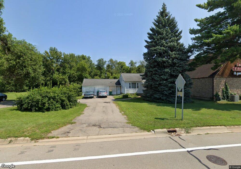
653 S Hewitt Rd Ypsilanti, MI 48197
Estimated Value: $239,933 - $314,000
3
Beds
1
Bath
1,096
Sq Ft
$254/Sq Ft
Est. Value
About This Home
This home is located at 653 S Hewitt Rd, Ypsilanti, MI 48197 and is currently estimated at $277,983, approximately $253 per square foot. 653 S Hewitt Rd is a home located in Washtenaw County with nearby schools including Estabrook Elementary School, Erickson Elementary School, and Holmes Elementary School.
Ownership History
Date
Name
Owned For
Owner Type
Purchase Details
Closed on
Nov 25, 2013
Sold by
Robbins Max A and Robbins Wendie A
Bought by
Evans Juwanda
Current Estimated Value
Home Financials for this Owner
Home Financials are based on the most recent Mortgage that was taken out on this home.
Original Mortgage
$115,000
Outstanding Balance
$85,237
Interest Rate
4%
Mortgage Type
Purchase Money Mortgage
Estimated Equity
$192,746
Purchase Details
Closed on
Oct 23, 2009
Sold by
Robbins Harold W
Bought by
Robbins Max A
Create a Home Valuation Report for This Property
The Home Valuation Report is an in-depth analysis detailing your home's value as well as a comparison with similar homes in the area
Home Values in the Area
Average Home Value in this Area
Purchase History
| Date | Buyer | Sale Price | Title Company |
|---|---|---|---|
| Evans Juwanda | $115,000 | Ct | |
| Robbins Max A | -- | None Available |
Source: Public Records
Mortgage History
| Date | Status | Borrower | Loan Amount |
|---|---|---|---|
| Open | Evans Juwanda | $115,000 |
Source: Public Records
Tax History Compared to Growth
Tax History
| Year | Tax Paid | Tax Assessment Tax Assessment Total Assessment is a certain percentage of the fair market value that is determined by local assessors to be the total taxable value of land and additions on the property. | Land | Improvement |
|---|---|---|---|---|
| 2025 | -- | $86,100 | $0 | $0 |
| 2024 | -- | $70,400 | $0 | $0 |
| 2023 | -- | $66,000 | $0 | $0 |
| 2022 | $0 | $57,400 | $0 | $0 |
| 2021 | $2,268 | $46,900 | $0 | $0 |
| 2020 | $2,268 | $44,600 | $0 | $0 |
| 2019 | $2,268 | $41,700 | $41,700 | $0 |
| 2018 | $0 | $54,900 | $0 | $0 |
| 2017 | $2,274 | $54,300 | $0 | $0 |
| 2016 | $1,418 | $47,792 | $0 | $0 |
| 2015 | $2,108 | $47,650 | $0 | $0 |
| 2014 | $2,108 | $40,000 | $0 | $0 |
| 2013 | -- | $40,000 | $0 | $0 |
Source: Public Records
Map
Nearby Homes
- 2180 Ellsworth Rd
- 2431 Roanoke Dr
- 2418 Draper Ave
- 103 Fairhills Dr
- 2017 Harding Ave
- 3016 Roundtree Blvd Unit 16
- 1355 Lathers Ave
- 1817 Burns Ave
- 95 S Mansfield St
- 2432 Harding Ave
- 246 Kirk St
- 224 N Hewitt Rd
- 2434 Harding Ave
- 1235 W Michigan Ave
- 2002 Midvale Ave
- 1221 S Congress St
- 469 Second Ave
- 1307 N Congress St
- 259 Elmhurst Ave
- 4855 W Michigan Ave
- 639 S Hewitt Rd
- 2105 Ellsworth Rd
- 2080 W Michigan Ave
- 2060 W Michigan Ave
- 2034 W Michigan Ave
- 2075 Ellsworth Rd
- 2200 W Michigan Ave
- 1990 W Michigan Ave
- 2090 Ellsworth Rd
- 2243 Ellsworth Rd
- 2009 W Michigan Ave
- 2287 Ellsworth Rd
- 1965 W Michigan Ave
- 2257 Ellsworth Rd
- 2269 Ellsworth Rd
- 2278 Ellsworth Rd
- 295 S Hewitt Rd
- 800 Gouchnour St
- 1822 W Michigan Ave
- 2059 W Michigan Ave