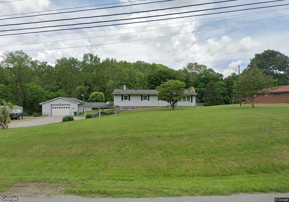
653 Suds Run Rd Mount Clare, WV 26408
Estimated Value: $259,000 - $327,000
3
Beds
2
Baths
1,800
Sq Ft
$166/Sq Ft
Est. Value
About This Home
This home is located at 653 Suds Run Rd, Mount Clare, WV 26408 and is currently estimated at $298,884, approximately $166 per square foot. 653 Suds Run Rd is a home with nearby schools including Mother Goose Land Kindergarten.
Ownership History
Date
Name
Owned For
Owner Type
Purchase Details
Closed on
Dec 28, 2012
Sold by
Queen Michael L
Bought by
Shaughnessy John Thomas
Current Estimated Value
Purchase Details
Closed on
Jul 5, 2009
Sold by
Big Chief Equipment Llc
Bought by
Queen Michael L
Purchase Details
Closed on
May 5, 2008
Sold by
Dearth Joseph A and Dearth Leisa M
Bought by
Big Chief Equipment Llc
Home Financials for this Owner
Home Financials are based on the most recent Mortgage that was taken out on this home.
Original Mortgage
$148,000
Interest Rate
6.1%
Mortgage Type
Purchase Money Mortgage
Create a Home Valuation Report for This Property
The Home Valuation Report is an in-depth analysis detailing your home's value as well as a comparison with similar homes in the area
Home Values in the Area
Average Home Value in this Area
Purchase History
| Date | Buyer | Sale Price | Title Company |
|---|---|---|---|
| Shaughnessy John Thomas | $215,000 | None Available | |
| Queen Michael L | -- | None Available | |
| Big Chief Equipment Llc | -- | None Available |
Source: Public Records
Mortgage History
| Date | Status | Borrower | Loan Amount |
|---|---|---|---|
| Previous Owner | Big Chief Equipment Llc | $148,000 |
Source: Public Records
Tax History Compared to Growth
Tax History
| Year | Tax Paid | Tax Assessment Tax Assessment Total Assessment is a certain percentage of the fair market value that is determined by local assessors to be the total taxable value of land and additions on the property. | Land | Improvement |
|---|---|---|---|---|
| 2024 | $1,610 | $130,500 | $20,460 | $110,040 |
| 2023 | $1,497 | $121,440 | $20,460 | $100,980 |
| 2022 | $1,435 | $121,740 | $20,460 | $101,280 |
| 2021 | $1,401 | $120,360 | $20,460 | $99,900 |
| 2020 | $1,385 | $120,060 | $20,460 | $99,600 |
| 2019 | $1,106 | $119,640 | $20,460 | $99,180 |
| 2018 | $1,368 | $119,100 | $20,460 | $98,640 |
| 2017 | $1,340 | $117,180 | $20,460 | $96,720 |
| 2016 | $1,306 | $115,680 | $19,680 | $96,000 |
| 2015 | $1,282 | $112,920 | $19,320 | $93,600 |
| 2014 | $1,258 | $110,880 | $17,700 | $93,180 |
Source: Public Records
Map
Nearby Homes
- 2189 Chub Run Rd
- 82 Robinwood Dr
- 7 Mayflower Ln
- 186 Robin Ln
- 0 Solomon Dr
- 2410 Buckhannon Pike
- 8037 Maple Ave
- TBD Elk Creek Pike
- 8688 Cost Ave
- 256 Florence Hollow Rd
- 8030 Labrador Ln
- 7644 Buckhannon Pike
- 163 Hutchinson Hollow Rd
- 409 Nutters Run Rd
- 2-A Cherry Tree Dr
- 54 Church St
- 516 Brushy Fork Rd
- 542 Brushy Fork Rd
- TBD N 24th St
- 217 Burton Ave
- 677 Suds Run Rd
- 648 Suds Run Rd
- 660 Suds Run Rd
- 705 Suds Run Rd
- 608 Suds Run Rd
- 780 Suds Run Rd
- 74 Foxden Dr
- 839 Suds Run Rd
- 126 Suds Run Rd
- 896 Suds Run Rd
- 899 Suds Run Rd
- 136 Suds Run Rd
- 1006 Suds Run Rd
- 124 Suds Run Rd Unit G
- 189 Suds Run Rd Unit 21
- 189 Suds Run Rd Unit 13
- 189 Suds Run Rd Unit 16
- 189-15 Suds Run Rd
- 122 Suds Run Rd Unit A
- 1118 Suds Run Rd