Estimated Value: $611,832 - $702,000
3
Beds
3
Baths
1,839
Sq Ft
$358/Sq Ft
Est. Value
About This Home
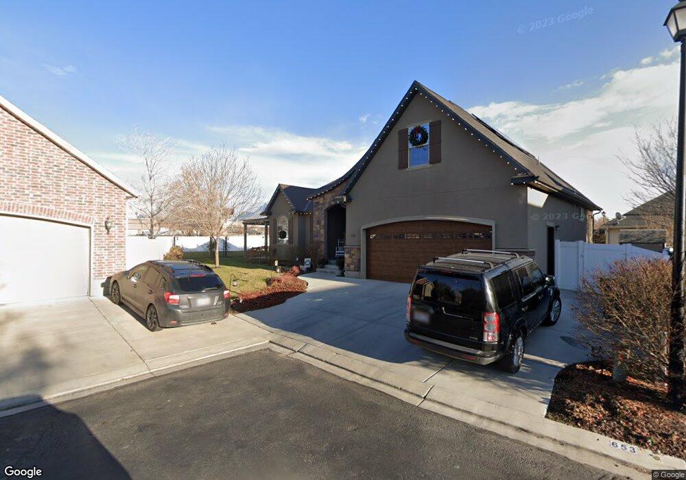
This home is located at 653 W 1310 N, Lehi, UT 84043 and is currently estimated at $658,944, approximately $358 per square foot. 653 W 1310 N is a home with nearby schools including Lehi Elementary School, Lehi Junior High School, and Lehi High School.
Ownership History
Date
Name
Owned For
Owner Type
Purchase Details
Closed on
Aug 30, 2024
Sold by
Hobbs Deborah K and Mcalpin Deborah Kae
Bought by
Mcalpin Deborah Kae
Current Estimated Value
Purchase Details
Closed on
May 3, 2018
Sold by
Hobbs Patrick
Bought by
Hobbs Jared
Purchase Details
Closed on
Sep 26, 2012
Sold by
Taylor Joseph S and Taylor Cindy D
Bought by
Hobbs Deborah K
Purchase Details
Closed on
Oct 30, 2008
Sold by
Taylor Joseph Samuel and Taylor Joseph S
Bought by
Taylor Joseph S and Taylor Cindy D
Home Financials for this Owner
Home Financials are based on the most recent Mortgage that was taken out on this home.
Original Mortgage
$225,000
Interest Rate
6.09%
Mortgage Type
Credit Line Revolving
Purchase Details
Closed on
Jul 15, 2004
Sold by
Courtyard Cove Iii Llc
Bought by
Taylor Joseph S and Taylor Cindy D
Create a Home Valuation Report for This Property
The Home Valuation Report is an in-depth analysis detailing your home's value as well as a comparison with similar homes in the area
Home Values in the Area
Average Home Value in this Area
Purchase History
| Date | Buyer | Sale Price | Title Company |
|---|---|---|---|
| Mcalpin Deborah Kae | -- | Utah First Title | |
| Hobbs Jared | -- | None Available | |
| Hobbs Deborah K | -- | Empier Land Title Inc | |
| Taylor Joseph S | -- | Horizon Title Insurance | |
| Taylor Joseph S | -- | Provo Land Title Co |
Source: Public Records
Mortgage History
| Date | Status | Borrower | Loan Amount |
|---|---|---|---|
| Previous Owner | Taylor Joseph S | $225,000 |
Source: Public Records
Tax History
| Year | Tax Paid | Tax Assessment Tax Assessment Total Assessment is a certain percentage of the fair market value that is determined by local assessors to be the total taxable value of land and additions on the property. | Land | Improvement |
|---|---|---|---|---|
| 2025 | $2,476 | $317,515 | -- | -- |
| 2024 | $2,476 | $289,740 | $0 | $0 |
| 2023 | $2,348 | $298,320 | $0 | $0 |
| 2022 | $2,579 | $317,680 | $0 | $0 |
| 2021 | $2,356 | $438,700 | $105,300 | $333,400 |
| 2020 | $2,222 | $409,100 | $97,500 | $311,600 |
| 2019 | $2,018 | $386,200 | $97,500 | $288,700 |
| 2018 | $1,898 | $343,300 | $87,700 | $255,600 |
| 2017 | $1,820 | $175,065 | $0 | $0 |
| 2016 | $1,962 | $175,065 | $0 | $0 |
| 2015 | $2,027 | $171,710 | $0 | $0 |
| 2014 | $1,997 | $168,190 | $0 | $0 |
Source: Public Records
Map
Nearby Homes
- 1301 N 900 W Unit 12
- 361 W 1560 N
- 1512 N 250 W
- 230 W State St
- 1760 N 340 W
- 495 W 1850 N
- 1150 N 200 W Unit 6
- 356 W 1850 N Unit 6
- 155 W State St Unit TRLR 3
- 1940 N 900 W
- 1329 N 100 E Unit 21
- 68 W State St
- 52 W State St
- 406 W 600 N
- 1272 W 1800 N
- 1423 W 1220 North St Unit 214
- 995 N Titan Dr N
- 755 W 2180 N
- 251 W 2125 N
- 497 W 2200 N
- 640 W 1290 N
- 659 W 1310 N
- 644 W 1290 N
- 662 W 1310 N
- 659 Northlake Dr Unit 1305
- 680 W 1310 N
- 639 W 1290 N
- 641 W 1290 N
- 1378 N Fox Borough Dr
- 1378 N Fox Borough Dr
- 664 W 1290 N
- 689 W 1310 N
- 588 W 1275 N
- 592 W 1275 N
- 586 W 1275 N
- 1390 N 700 W
- 1390 N Fox Borough Dr
- 698 W 1310 N
- 678 W 1290 N
- 693 N 1375 Dr W
Your Personal Tour Guide
Ask me questions while you tour the home.