6532 Smoketree Cir Lancaster, CA 93536
West Lancaster NeighborhoodEstimated Value: $609,000 - $693,000
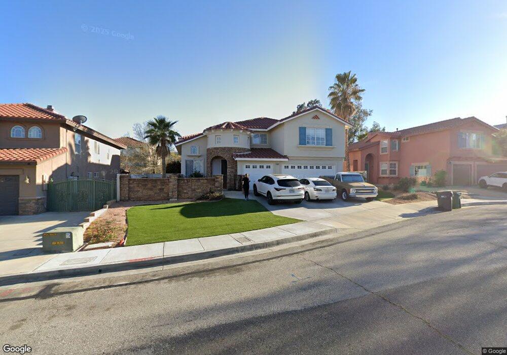
About This Home
This home is located at 6532 Smoketree Cir, Lancaster, CA 93536 and is currently estimated at $632,052, approximately $198 per square foot. 6532 Smoketree Cir is a home located in Los Angeles County with nearby schools including Sundown Elementary School, Joe Walker Middle School, and Quartz Hill High School.
Ownership History
We collect this data history from publicly available records. To have your information removed, we recommend requesting removal directly through your county’s website.
Purchase Details
Purchase Details
Home Financials for this Owner
Home Financials are based on the most recent Mortgage that was taken out on this home.Purchase Details
Home Financials for this Owner
Home Financials are based on the most recent Mortgage that was taken out on this home.Purchase Details
Home Financials for this Owner
Home Financials are based on the most recent Mortgage that was taken out on this home.Home Values in the Area
Average Home Value in this Area
Purchase History
We collect this data history from publicly available records. To have your information removed, we recommend requesting removal directly through your county’s website.
| Date | Buyer | Sale Price | Title Company |
|---|---|---|---|
| -- | -- | ||
| -- | Chicago Title Co | ||
| $315,000 | Chicago Title Co | ||
| $256,500 | First American Title Co |
Mortgage History
We collect this data history from publicly available records. To have your information removed, we recommend requesting removal directly through your county’s website.
| Date | Status | Borrower | Loan Amount |
|---|---|---|---|
| Open | $252,000 | ||
| Previous Owner | $204,850 | ||
| Closed | $51,200 |
Tax History
We collect this data history from publicly available records. To have your information removed, we recommend requesting removal directly through your county’s website.
| Year | Tax Paid | Tax Assessment Tax Assessment Total Assessment is a certain percentage of the fair market value that is determined by local assessors to be the total taxable value of land and additions on the property. | Land | Improvement |
|---|---|---|---|---|
| 2025 | $7,210 | $447,843 | $116,291 | $331,552 |
| 2024 | $6,868 | $439,062 | $114,011 | $325,051 |
| 2023 | $6,799 | $430,454 | $111,776 | $318,678 |
| 2022 | $6,554 | $422,015 | $109,585 | $312,430 |
| 2021 | $6,106 | $413,741 | $107,437 | $306,304 |
| 2019 | $5,951 | $401,471 | $104,251 | $297,220 |
| 2018 | $5,868 | $393,600 | $102,207 | $291,393 |
| 2016 | $5,169 | $347,000 | $86,900 | $260,100 |
| 2015 | $4,690 | $307,000 | $76,900 | $230,100 |
| 2014 | $4,426 | $282,000 | $70,600 | $211,400 |
Map
- 42310 Daniel Dr
- 42355 Willeta Ave
- 42431 Boulder Dr
- 6727 Andover Ave
- 42443 Breeze Way
- 6220 Azalea Dr
- 42508 Biscay St
- 6134 Cabriolet Ct
- 0 65th St W
- 42307 61st St W
- 6727 Miramar Ln
- 6118 Quail Way
- 42060 Jenny Ln
- 6646 Sancerra Dr
- 7027 Kristina Ct
- 6634 Sancerre Dr
- 6622 Sancerre Dr
- 6838 Miramar Ln
- 42547 Camden Way
- 41830 Grenache Ln
- 6518 Smoketree Cir
- 0 Vac Cor Avenue A12 67 St Unit 20-591216
- 0 Vac 235 Stw Drt Vic Ave Unit 20-571136
- 0 Vac Cor Avenue A12 67 St Unit 20-562516
- 6526 Smoketree Cir
- 6521 W Avenue l10
- 6527 W Avenue l10
- 42314 Brittle Bush Dr
- 42320 Brittle Bush Dr
- 6521 Smoketree Cir
- 6533 W Avenue l10
- 42308 Brittle Bush Dr
- 6527 Smoketree Cir
- 42326 Brittle Bush Dr
- 42302 Brittle Bush Dr
- 6540 Smoketree Cir
- 6535 Smoketree Cir
- 42332 Brittle Bush Dr
- 6541 W Avenue l10
- 42257 Brittle Bush Dr
Ask me questions while you tour the home.