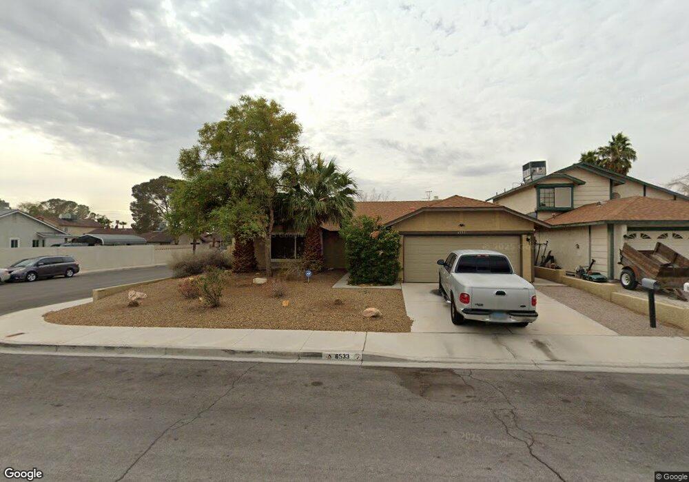
6533 Romance Cir Las Vegas, NV 89108
Estimated Value: $366,000 - $399,000
3
Beds
2
Baths
1,387
Sq Ft
$277/Sq Ft
Est. Value
About This Home
This home is located at 6533 Romance Cir, Las Vegas, NV 89108 and is currently estimated at $383,543, approximately $276 per square foot. 6533 Romance Cir is a home located in Clark County with nearby schools including Ruthe Deskin Elementary School, Justice Myron E Leavitt Middle School, and Centennial High School.
Ownership History
Date
Name
Owned For
Owner Type
Purchase Details
Closed on
Mar 12, 2004
Sold by
Baker William W and Baker Mary A
Bought by
Moore John R
Current Estimated Value
Home Financials for this Owner
Home Financials are based on the most recent Mortgage that was taken out on this home.
Original Mortgage
$158,757
Outstanding Balance
$73,676
Interest Rate
5.57%
Mortgage Type
FHA
Estimated Equity
$309,867
Purchase Details
Closed on
Mar 8, 1996
Sold by
Kelsay Paul
Bought by
Baker William W and Baker Mary A
Home Financials for this Owner
Home Financials are based on the most recent Mortgage that was taken out on this home.
Original Mortgage
$100,000
Interest Rate
7.01%
Mortgage Type
Seller Take Back
Create a Home Valuation Report for This Property
The Home Valuation Report is an in-depth analysis detailing your home's value as well as a comparison with similar homes in the area
Home Values in the Area
Average Home Value in this Area
Purchase History
| Date | Buyer | Sale Price | Title Company |
|---|---|---|---|
| Moore John R | $162,100 | Ticor Title Of Nevada Inc | |
| Baker William W | $101,000 | Land Title |
Source: Public Records
Mortgage History
| Date | Status | Borrower | Loan Amount |
|---|---|---|---|
| Open | Moore John R | $158,757 | |
| Previous Owner | Baker William W | $100,000 | |
| Closed | Moore John R | $6,436 |
Source: Public Records
Tax History Compared to Growth
Tax History
| Year | Tax Paid | Tax Assessment Tax Assessment Total Assessment is a certain percentage of the fair market value that is determined by local assessors to be the total taxable value of land and additions on the property. | Land | Improvement |
|---|---|---|---|---|
| 2025 | $937 | $62,160 | $27,300 | $34,860 |
| 2024 | $910 | $62,160 | $27,300 | $34,860 |
| 2023 | $910 | $63,633 | $30,450 | $33,183 |
| 2022 | $884 | $55,597 | $24,850 | $30,747 |
| 2021 | $858 | $51,305 | $21,700 | $29,605 |
| 2020 | $830 | $51,753 | $22,050 | $29,703 |
| 2019 | $806 | $48,162 | $18,550 | $29,612 |
| 2018 | $782 | $45,610 | $16,800 | $28,810 |
| 2017 | $1,437 | $43,840 | $14,350 | $29,490 |
| 2016 | $742 | $38,504 | $8,400 | $30,104 |
| 2015 | $739 | $30,331 | $6,300 | $24,031 |
| 2014 | $718 | $21,241 | $6,300 | $14,941 |
Source: Public Records
Map
Nearby Homes
- 6608 Messenger Ct
- 6636 Painted Desert Dr
- 6633 Wheelbarrow Peak Dr
- 6425 Wheelbarrow Peak Dr
- 6508 Faith Peak Dr
- 6521 Faith Peak Dr
- 6802 W Craig Rd
- 6628 Plumflower Ln
- 5031 N Rainbow Blvd Unit 110
- 6732 Accent Ct
- 6741 Accent Ct
- 6300 Hill Haven Ave
- 6540 Angel Mountain Ave Unit 2
- 4252 Orangeblossom St
- 6277 Kraft Ave
- 6505 Quantum Ln
- 5774 Smithsonian Way
- 6256 Hill Haven Ave
- 6900 Quail Hollow Dr
- 4217 Jasper Ave
- 6537 Romance Cir
- 6537 Romance Cir
- 6532 Wheelbarrow Peak Dr Unit 1
- 6525 Romance Cir Unit 1
- 6541 Romance Cir
- 6536 Wheelbarrow Peak Dr
- 6532 Romance Cir
- 6532 Romance Cir
- 6532 Romance Cir
- 6524 Wheelbarrow Peak Dr
- 6528 Romance Cir
- 6536 Romance Cir
- 6540 Wheelbarrow Peak Dr
- 6545 Romance Cir
- 6521 Romance Cir
- 6524 Romance Cir
- 6540 Romance Cir
- 6544 Wheelbarrow Peak Dr
- 6520 Wheelbarrow Peak Dr
- 6544 Romance Cir