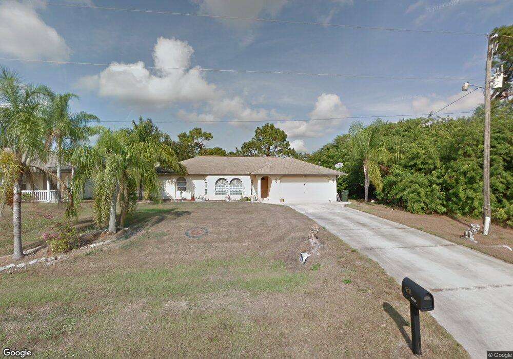
6534 E Hillsborough Blvd North Port, FL 34288
Estimated Value: $279,435 - $390,000
3
Beds
2
Baths
1,435
Sq Ft
$221/Sq Ft
Est. Value
About This Home
This home is located at 6534 E Hillsborough Blvd, North Port, FL 34288 and is currently estimated at $316,859, approximately $220 per square foot. 6534 E Hillsborough Blvd is a home located in Sarasota County with nearby schools including Atwater Elementary School, North Port High School, and Woodland Middle School.
Ownership History
Date
Name
Owned For
Owner Type
Purchase Details
Closed on
Aug 13, 2002
Sold by
Tottman Derek Joseph and Tottman Lesley Jennifer
Bought by
Milosz Kenneth
Current Estimated Value
Home Financials for this Owner
Home Financials are based on the most recent Mortgage that was taken out on this home.
Original Mortgage
$99,000
Outstanding Balance
$41,313
Interest Rate
6.49%
Estimated Equity
$275,547
Purchase Details
Closed on
Jan 29, 1999
Sold by
Quality Homes Of Port Charlotte Inc
Bought by
Tottman Derek Joseph and Tottman Lesley Jennifer
Create a Home Valuation Report for This Property
The Home Valuation Report is an in-depth analysis detailing your home's value as well as a comparison with similar homes in the area
Home Values in the Area
Average Home Value in this Area
Purchase History
| Date | Buyer | Sale Price | Title Company |
|---|---|---|---|
| Milosz Kenneth | $124,900 | -- | |
| Tottman Derek Joseph | $20,000 | -- | |
| Tottman Derek Joseph | $20,000 | -- |
Source: Public Records
Mortgage History
| Date | Status | Borrower | Loan Amount |
|---|---|---|---|
| Open | Milosz Kenneth | $99,000 |
Source: Public Records
Tax History Compared to Growth
Tax History
| Year | Tax Paid | Tax Assessment Tax Assessment Total Assessment is a certain percentage of the fair market value that is determined by local assessors to be the total taxable value of land and additions on the property. | Land | Improvement |
|---|---|---|---|---|
| 2024 | $1,304 | $84,004 | -- | -- |
| 2023 | $1,304 | $74,157 | $0 | $0 |
| 2022 | $1,344 | $79,397 | $0 | $0 |
| 2021 | $1,308 | $77,084 | $0 | $0 |
| 2020 | $1,276 | $76,020 | $0 | $0 |
| 2019 | $1,234 | $74,311 | $0 | $0 |
| 2018 | $1,134 | $72,925 | $0 | $0 |
| 2017 | $1,115 | $71,425 | $0 | $0 |
| 2016 | $1,110 | $95,200 | $3,500 | $91,700 |
| 2015 | $1,121 | $81,400 | $5,400 | $76,000 |
| 2014 | $1,100 | $67,900 | $0 | $0 |
Source: Public Records
Map
Nearby Homes
- 0 Ashboro Cir Unit MFRTB8394497
- 0 Ashboro Cir Unit 224092982
- 0 Twisdale Cir Unit MFRC7491387
- 0 Twisdale Cir Unit 2025006186
- 0 Twisdale Cir Unit MFRC7491392
- 215 Fletcher St
- 19400 Veterans Blvd Unit 3
- 0 Lot 18 S Raintree Blvd
- Lot 4 Morrisette Ln
- Lot 3 Morrisette Ln
- 175 Fletcher St
- 1148203707 & 1148203 Capecod
- 00 Bridge Dr
- Lot 2 Gaskins Cir
- 21551 Bachmann Blvd
- 0 Gaskins Cir Unit 2025004229
- TBD Gaskins Cir
- 0 Gaskins Cir Unit MFRTB8401905
- 0 Gaskins Cir Unit MFRC7511839
- TBD Skinner Ln
- 6510 E Hillsborough Blvd
- 6642 E Hillsborough Blvd
- 0 Iron Ct Unit A4143816
- 0 Iron Ct Unit C7430387
- 0 Iron Ct Unit D6103938
- 14 London Cir
- 0 Ashboro Cir Unit MFRTB8361256
- 0 Ashboro Cir Unit MFRT3542374
- 0 Ashboro Cir Unit MFRN6129907
- 1148204910 & 1148204 Ashboro Cir
- 0 Ashboro Cir Unit T3410075
- 0 Ashboro Cir Unit T3387856
- 0 Ashboro Cir Unit C7216407
- 0 Ashboro Cir Unit C7216406
- 1148204817 Ashboro Cir
- 0 Ashboro Cir Unit N6117753
- 0 Ashboro Cir Unit C7442164
- 0 Ashboro Cir Unit C7442166
- 0 Ashboro Cir Unit C7045519
- 0 Ashboro Cir Unit C7053891